Distance: 21.1 miles (34 km)
Avg. Time: 2 days
Start / Finish:
- Dettifoss – Asbyrgi
- Click here for details on getting to and from Jokulsargljufur National Park.
Difficulty: Easy
Season: June to September
Maps / Info:
- Jokulsargljufur means ‘glacial river canyon’ in Icelandic. The canyon is located in what used to be Jokulsargljufur National Park, which in 2008 was incorporated into Vatnajokull National Park, a 12,000 square kilometre protected area which is the largest of its kind in Europe.
- Lonely Planet’s Iceland guidebook gives an overview of the route between Dettifoss and Asbyrgi (available in eBook format).
- Check the following link for general information on Jokulsargljufur: http://www.nat.is/travelguideeng/national_park_jokulsargljufur.htm
- You can pick up a basic trail map at the Tourist Information office in Akureyri. On such an easy to follow trail, it’s all you need for navigation purposes.
- For a more detailed map, try the widely available 1:120,000 Akureyri-Myvatn-Dettifoss.
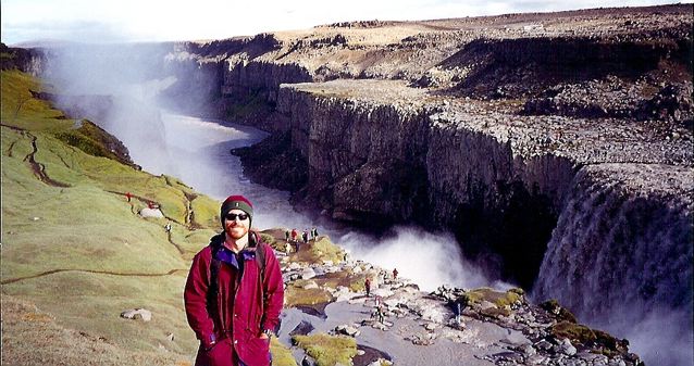
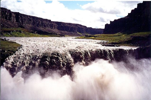
Yours truly at Dettifoss, the northern terminus of the Jokulsargljufur Canyon hike.

Random photographer lady taking in the wonder of Dettifoss, which is reputed to be the second most powerful waterfall in Europe after the Rhine Falls.
Route / Conditions:
- Navigation is straightforward – simply a matter of following the canyon north from Dettifoss. Look for the easily recognizable yellow trail markers.
- Near hike’s end, definitely choose the fixed rope descent into Asbyrgi, rather than the more mundane option down to the petrol station.
- Bring all supplies from Akureyri.

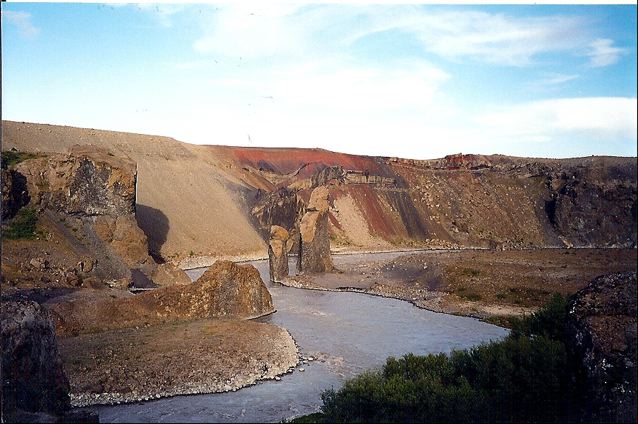
Heading north along Jökulsárgljúfur Canyon.

Jökulsárgljúfur Canyon
The 27 m high Hafragilsfoss is located approximately 2 km north of Dettifoss.
Sleeping:
- Bring your own shelter. Officially speaking, camping is only permitted at Vesturdalur where toilets and potable water are available.
Overview:
- Highlights include spectacular waterfalls (Dettifoss and Hafragilsfoss), surreal basalt rock formations and the climactic final views into Asbyrgi canyon.
- I did this walk with an Englishman by the name of Phil. A top bloke, Phil walked with a pronounced limp due to a recent parachuting accident. Born and bred in Yorkshire, he was a tough bastard who loved his Yoeman’s Potatoes, a beer or six and most of all his long-distance cycling.

Yours truly and Jökulsárgljúfur Canyon.

The basalt columns of Jökulsárgljúfur Canyon.

Hljodaklettar (The Whispering Cliffs)
Hljodaklettar (The Whispering Cliffs)

Looking over Asbyrgi canyon – the northern terminus of the hike.

Asbyrgi Canyon.
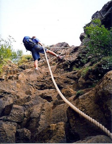
“Yoeman’s” Phil descending into Asbyrgi Canyon.
Discover more from The Hiking Life
Subscribe to get the latest posts sent to your email.