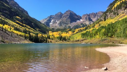
Distance : 12 miles round trip Avg.Time : 5 – 6 hours Start / Finish : Eagle Creek Trailhead. About 45 minutes drive from Portland. Only two miles walk from the cool little town of Cascade Locks, situated on the Columbia river. See the Portland Hikers website for details on getting to and from the [...]
Distance : 16.5 miles (26.5 km) Avg.Time : 10 – 12 hours Start / Finish : Happy Isles Trailhead, Yosemite Valley. The Park’s shuttle bus system provides regular services to many of Yosemite’s more popular areas. Happy Isles is stop #16. Yosemite National Park is about 3-4 hours drive from San Francisco. Public transport is [...]
Distance : 10.8 miles (17.4 km) Avg.Time : 6 – 7 hours Start / Finish : Mendenhall Lake Campground Juneau city buses will drop you at the junction of Mendenhall Loop and Montana Creek Rds. From this point it is one mile walk to the trailhead. Season : June to September Maps / Info : [...]
Distance : 44 miles approx. ( to Anderson Pass return) Avg. Time : 4 – 5 days Start / Finish : I started my hike at Toklat River Ranger Station (mile 53 on the Park Road) and finished at the Eielson Visitor Centre (mile 66). The hike included four backcountry units – # 10, 12, [...]
Distance : 211 miles (340km) Avg. Time : 12 days Start / Finish : Yosemite Valley – Mt. Whitney summit For transport details to the trailheads, try Backpack45.com. From the Whitney summit, you will need to walk a further 11 miles (17.5km) to the trailhead at Whitney Portal. If you haven’t already organised transport from there, [...]
Distance : 2650miles (4265km) Avg.Time : 5 months Start / Finish : Campo – Manning Park Campo can be accessed by bus from San Diego. See the following link for details: http://www.pcta.org/about_trail/faqs.asp#mapdata Alternatively you may be able to organise a ride with a “Trail Angel”: http://www.pcta.org/planning/during_trip/services.asp From the Canadian Border marker, you need to walk [...]
Distance : 33 miles (53km) Avg. Time : 2 or 3 days Start / Finish : Crow Pass trailhead – Lake Bennett trailhead See the Parks Canada website for details on getting to and from the trailheads. Season : May to September. Maps / Info : Alaskas most famous trail, the Chilkoot is one hike that [...]
Distance : 44km Avg.Time : 2 days Start / Finish : Eagle Summit trailhead – Twelve mile summit trailhead. No public transport, but hitching isn’t too difficult. Not many cars on this section of the Steese Highway, but those that do come by will generally give you a lift. Another possibility is contacting the Fairbanks [...]
Distance : 273 miles (439km) Avg. Time : 18 days Start / Finish : Williamstown – Canadian Border (5.25 miles from the town of North Troy). The Long Trail End-To-Ender’s Guide is your best source of information in regards to transportation to and from the trailheads. For transport information online, try Squidoo.com Quick Guide to [...]
Distance : 150km (93miles) Avg.Time : 7 days Start / Finish : Longmire Season : July to early October. I recommend doing the hike around mid-September in order to avoid the crowds. Maps / Info : Logistics: See the US National Parks Website for details on permits, trail conditions, trail access and a basic downloadable [...]