
Western Arthurs | Day 20, SW Tasmania Traverse.
I’ve always been drawn to remote corners. If it’s out in the wilderness and off the beaten track, chances are you’ve got my attention. Throw in some ecological diversity, lots of solitude and the promise of a pretty vista or three………..ya basta.…….where do I sign up?
Which brings me to the traverse of Southwest Tasmania. In a backcountry nutshell, a combination of rugged, trail-less coastline and spectacular mountains. Specifically, the west coast south of Strahan and the Arthur Range.
To my way of thinking, together they encapsulate much of what makes Tasmania’s southwest one of the world’s premier wilderness areas. And what better way to experience this natural diversity, than a continuous hiking journey linking together the best of both coastal and alpine environments?
Here’s the trip report from the second and final stage of the Southwest Tasmania Traverse:
Stage 2 Details

SW Tasmania Traverse Overview Map
Distance: 48 miles (77 km)
- Total – 185 miles (298 km)
Time: 6 days (i.e. Days 19 to 24).
Start: Scotts Peak Dam
Finish: Farmhouse Creek Trailhead
Maps / Info:
- TASMAP Topographic Maps 1:25,000 (6 maps) – Crossing, Razorback, Glovers, Federation, Bobs, Burgess.
- Note: As of May, 2015, TASMAP have made it’s topographic maps available for digital download (A$2 each)
- Trekking notes from John Chapman’s South West Tasmania. Now in its 5th edition (2008).

Descending to Lake Oberon | Day 19.

Rays of Light | Day 24.
Notes & Musings
The Maydena Blues
After finishing the first stage (17 days), I was hoping to have a full rest day in the nearby town of Maydena. The plan was to hitch in from Scotts Peak Dam, pick up my resupply boxes, find accommodation, take a shower, and then return to the trail clean and rested the following morning. It didn’t quite work out like that.
I made it into Maydena without too many issues, however, upon arrival, I received a weather forecast courtesy of my brother-in-law (Jonno). According to the report, fine conditions were on the cards for the next two days, followed by a big storm front. A rethink was in order.

In 2015, Jonno and I traversed the Arthurs in some of the harshest conditions I have experienced.
As someone who has spent time in the Arthurs when the elements are raging, I knew what was coming. And it wasn’t going to be pretty. Indeed, not only does this part of Tasmania receive an average of 250 days of rain a year, it’s the manner in which Mother Nature delivers the precipitation that makes traversing the Arthur Range such a challenging proposition. The rain is often accompanied by driving wind (see Roaring Forties) and temps that hover around freezing. When coupled with the exposed nature of the terrain, suffice to say if you are fortunate enough to receive a window of fine weather, it behooves you to make the most of it.
So that’s what I did. I left Maydena that same afternoon. No rest, no big dinner, no beers to celebrate finishing the west coast. After 17 days, I didn’t even have the opportunity to take a shower.

This is what I wanted to avoid…….or at least minimize | A wet and wild day in the Eastern Arthurs, 2015.
Note: It wasn’t an easy hitch back. I waited for 2.5 hrs on the outskirts of Maydena before I was finally picked up by a combi-driving, dreadlocked couple from France. As a wise Scotsman once told me, “van driving hippies are a hitchhiker’s best friend.” Truer words have rarely been spoken.
Western Arthurs
On day 19, I started off from Scotts Peak Dam at around 7.30 am.
The first few hours were relatively flat and easy, as the sometimes muddy trail meandered across plains and through pockets of forest. Not long after passing the popular Junction Creek campsite, I began the climb towards what would be my home for the next five to six days, the Arthur Range. The views looking back towards Scotts Peak Dam were impressive.

Geographically speaking, a traverse of the Arthurs is a high-level route chock full of jagged quartzite peaks, hanging valleys and glacier-carved lakes. The vast majority of the trekking is either steeply up or precipitously down. If you’re looking for a hike in which you can stretch out and cover big miles, it’s best to look elsewhere. In the Arthurs 0.5 to 1 mile per hour is very good going.

Lake Cygnus | Day 19.

Square Lake | Day 19.
Of the range’s many lakes, one of my favourites is Oberon. In 2015, I barely saw it thanks to the torrential weather. This time around the conditions were perfect. So ideal in fact, that once I arrived in the early afternoon of Day 19, I spent the next 1.5 hours swimming, eating and soaking in the sunshine.

Lake Oberon as seen from my lunch-time perch.
When I’d eventually eaten my and six other people’s fill, I packed up and waddled onwards.
The next section to High Moor is quite well known amongst Arthurs enthusiasts. It involves some steep gullies that transform into watercourses when it starts raining. And a wiggle-through gap that almost makes you wish that you hadn’t stopped for such a big lunch at Lake Oberon (Note: The photo immediately below is from my first hike in the Western Arthurs in 2002)

And, of course, more lakes. The main body of water pictured immediately below is Lake Uranus, and I’d be willing to bet that over the years quite a few jokes have been made by hikers in regards to the bum-kicking they’ve received while negotiating the challenging terrain around & above its shoreline.

Lake Uranus – Fine Conditions – March, 2016

Lake Uranus – Not fine conditions – March, 2015
I’d originally planned to camp at High Moor at the end of Day 19. However, a relatively late start combined with a southern Italian length lunch break, meant that I wasn’t going to make it before it got dark. As a result, I was forced to improvise, in the form of a conveniently situated cave/overhang, which lay just over a mile NW of High Moor.

Blurry Gorillapod shot of yours truly bunking down at the end of Day 19.
After a good night’s sleep in the cave, the next two days played out exactly as the meteorological forecast had predicted.
On Day 20 it was mostly fine weather. Clouds began to gather late afternoon, and around 9 pm the heavens opened and it started to rain.

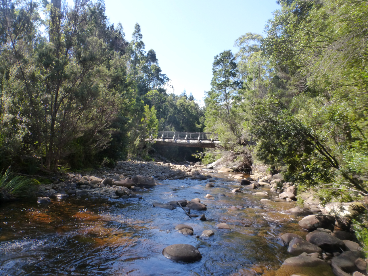
Ridge views from the Western Arthurs | Day 20.

Promontory Lake | Day 20.

Calm before the storm | Day 20.
The following day, the inclement conditions continued, which translated to short breaks, little in the way of views and 100% concentration on the job at hand. Nonetheless, I kept a steady pace, made better time than expected and by day’s end had reached Strike Creek and the end of the Western Arthurs.
Eastern Arthurs & Federation Peak
I was now on the home stretch. Even with inclement weather, I was looking at a maximum of three days to the Farmhouse Creek trailhead. There was just one last micro-challenge that I hoped to meet before the finish. A summiting of Federation Peak; arguably Tasmania’s most striking mountain and a holy grail of sorts for some in the Australian bushwalking community.

That’s it……..the tall one.
My brother-in-law and I had hoped to climb it during last year’s Arthur Traverse. Unfortunately the weather Gods didn’t oblige. In 2016, time was on my side, and I was prepared to sit out a day or two if need be to wait for reasonable conditions.

“Please let this good weather hold.”
I reached the base of Federation Peak by way of “The Southern Traverse” just after midday on Day 22. It was cloudy, but precipitation-free. The direct ascent route is a Grade 5-ish scramble, not technically difficult, but extremely exposed.

Federation Peak (photo jasonmacqueen.com)
I’m talking six hundred metres pretty much straight down to Lake Geeves. There’s definitely a pucker factor involved.

The climb up Fed Peak with Lake Geeves below (Photo jasonmacqueen.com)
(Note: The two photos immediately above appear courtesy of Jason Macqueen, who along with some friends climbed Fed Peak in January 2015. They help give some perspective of what the ascent was like.)
Thankfully the route to the summit is cairned, as there are a couple of times when the way is anything but clear. Indeed, on two separate occasions I distinctly recall thinking to myself, “Nah, that can’t be it………can it?” Sure enough, after investigating what at first (at least in my mind) seemed like easier alternatives, I returned to the cairned route.

The final third of the ascent was the easiest. Basically a steep hike.
When I eventually reached the top, four things happened. Firstly, I broke out into a huge smile and let out an ebullient exclamation.

Yours truly on the summit of Federation Peak.
Secondly, I thought to myself, “hmm, the summit is much bigger than I anticipated.” Looking at Fed Peak from a distance, you’d never guess how spacious the top is until you’re actually standing on it. It really is quite big.
Thirdly, I surveyed the incredible 360º panorama, ate some Cadbury’s Chocolate, drank half of my water and signed the summit register.
And finally, after spending about an hour taking it all in, I acknowledged what had been increasingly obvious with each passing minute: “Hmm, those clouds are coming in pretty fast. I better get my skates on and descent this puppy sooner rather than later.”
So that’s what I did.
Note: The following video contains some colourful (though completely in context) language. For those easily offended, you may want to skip directly to the conclusion below.
The End
The final day and a half was relatively uneventful. I descended Moss Ridge from the Bechervaise plateau; the trail (if you can call it that) was steep and more of a hand over foot scramble than a hike. Ducking and weaving my through fallen trees and overgrown vegetation, I eventually bottomed out at Cherry Creek.
From that point on, the terrain was relatively flat and not-so-relatively muddy for the rest of the way. The highlight was some early morning sun rays piercing through the forest canopy just a few short kilometres from the end.

Rays of Light 2.
At 11 am on the 24th day of my journey, I reached the Farmhouse Creek Trailhead. The finishing point of the Southwest Tasmania Traverse. The sun was shining and I broke out into a wee jig. What can I tell you; I’m half Irish. I then put down my pack and went for a ten-minute swim in the creek.
Farmhouse Creek
Soaking in the pleasantly warm water, I floated on my back and looked up at the blue sky. I thought about the last three and a half weeks. There was no way around it; there had been some very sketchy moments. The close call with the Tiger Snake, scrambling in and out of some of those wave smashed gulches, the malfunctioning Personal Locator Beacon (PLB). I chuckled.
If truth be told, I’ve never been one for dwelling or second-guessing. Stuff happens out in the wilderness, and my preferred method of dealing with it has always been to shrug my shoulders, learn from the experience and get on with things. I think that’s one of the most important lessons I’ve derived from spending so much time in the woods over the years. Not to over-analyze.
There are no “what ifs” in the natural world. Everything just is what it is. And that very simplicity is a big part of what keeps drawing me back.

Leaving Farmhouse Creek Trailhead – The End.
Discover more from The Hiking Life
Subscribe to get the latest posts to your email.
Those lakes look awesome, great trip report
What a journey. Glad to see you made it through with mainly favourable conditions. Hope to meet you on the trail again one day.
Thanks, Beth & Jimmy! And thanks again for the curry, breakfast and ride out to the Highway from Scotts Peak! You guys are awesome!
Cheers,
Cam
Nicely worded, easily read trip report mate, appreciate your humility & ability to ‘get on with it’. Cheers for providing me with a much needed kick up the bum to get out there & explore Southwest Tassie again!
Cam that trip epitomises the heights of rapture that ONLY can be had from such places as they are in their raw pure form.
A fantastic achievement and thanks for sharing.
It’s to be hoped theses places survive human meddling.
Keep up the trips and enlightening others.
Hello!
Your trip sounds awesome!
I was just wondering if you could possibly send me a map of the trip you took of Stage 2, I myself would be very interested in completing the hike very much like you did!
Thank you so much 🙂
Hi Alice,
All the maps I used are referenced in the article. For more information on the Arthur Range Traverse, see the following link: https://www.thehikinglife.com/2018/02/arthur-range-traverse-planning-guide/
Cheers,
Cam