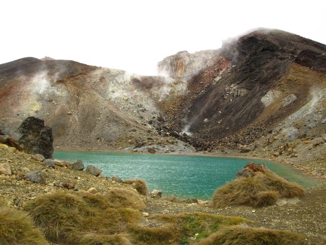
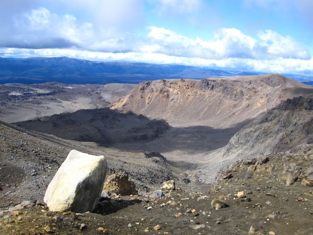
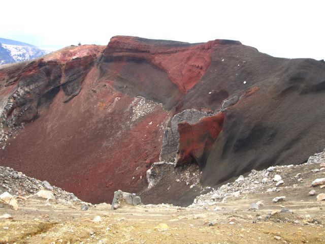
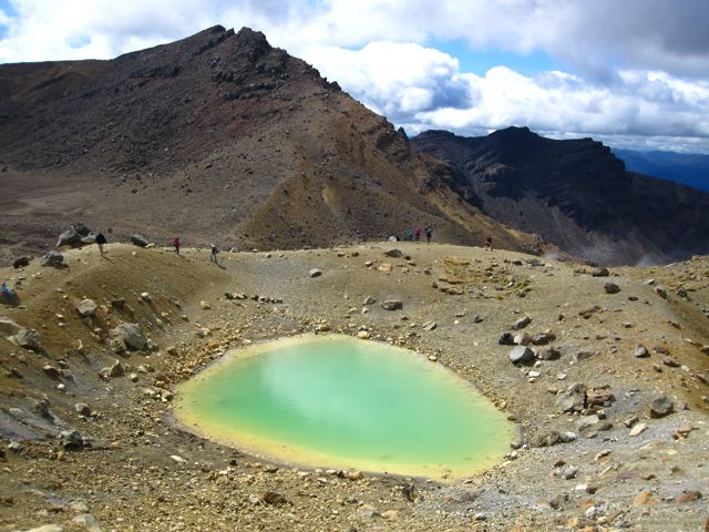
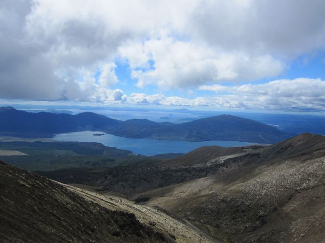
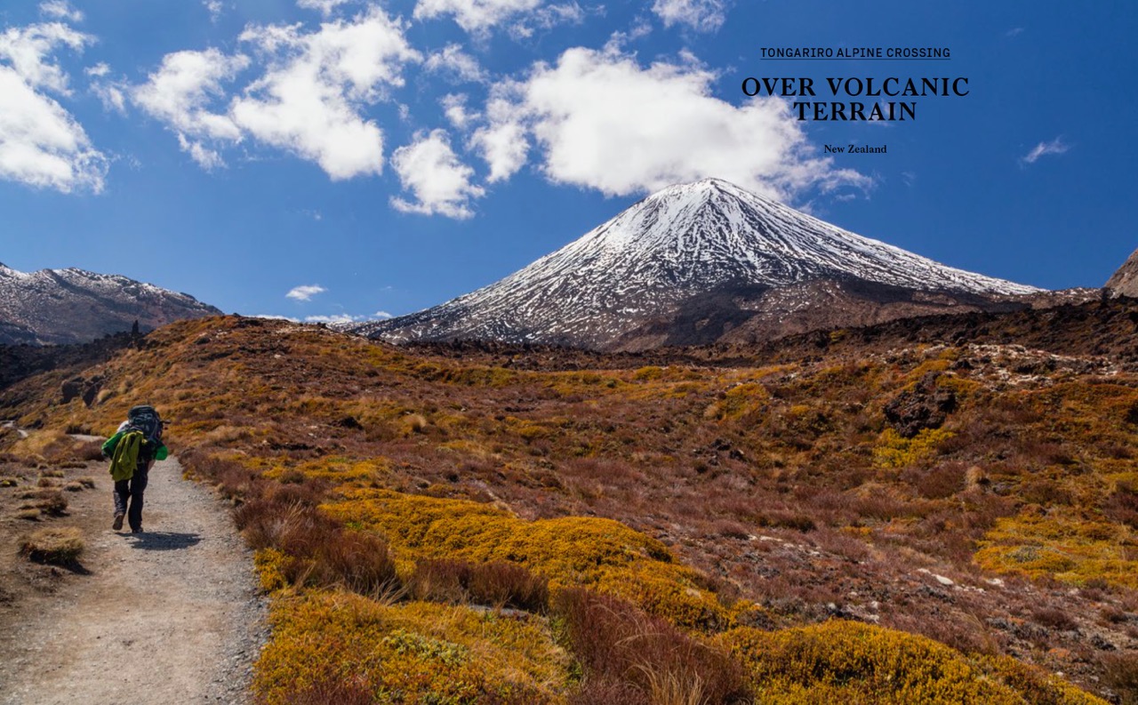
The Tongariro Alpine Crossing is commonly referred to as “New Zealand’s best day hike.” That’s a big call, considering the country has countless beautiful trails in a diverse range of landscapes, ranging from lush rainforests to snow-capped mountains to golden beaches. However, it’s a statement that is wholly justified. During its course, the Crossing traverses a dynamic environment of old lava flows, whistling fumaroles, active volcanos, and multi-hued lakes. It also passes through alpine tundra before finishing in the shady confines of lush native forest. All that in the space of just 19.4 jaw-dropping kilometres.
I hiked the Tongariro Alpine Crossing in 1994 and 2010. All planning information has been updated as of March 2020.
Distance: 12.1 miles (19.4 km)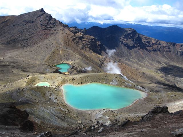
Avg.Time: 6 hours
Start / Finish:
- Mangatepopo Car park – Ketetahi Car park
- Both trailheads are serviced by regular shuttle buses from National Park and Whakapapa villages.
Season:
- October to May.
- In addition to warmer clothing, a winter traverse fo the Tongariro Alpine Crossing usually requires an ice axe and crampons. Check on current conditions with the Tongariro National Park Visitors Centre before setting out. As the trail may not be discernible due to snow cover, a topographic map and GPS and/or compass will be necessary. Click here for the Tongariro Alpine Crossing Winter Brochure.
Maps / Info:
- Outside of winter, the basic trail map and trekking notes contained in the Tongariro Alpine Crossing Brochure is all you need for navigation purposes.
Four Facts about Tongariro National Park:
- It is New Zealand’s oldest national park and the fourth oldest in the world.
- It holds both cultural and natural World Heritage status.
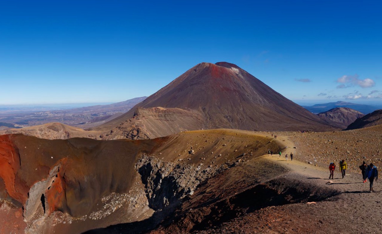
- It is home to three active volcanos, namely Ngauruhoe, Tongariro and Ruapehu.
- For all you Lord of the Rings fans, Ngauruhoe doubled as Mt. Doom in Peter Jackson’s famous movie trilogy. Channel your inner Frodo and Sam and make the ascent!
Route / Conditions:
- The Tongariro Alpine Crossing is well marked from start to finish with poles and directional signs.
- Wet, cold and windy conditions are possible at any time of year. Bring appropriate clothing and equipment. Double-check the forecast before departure; weather in this area is notoriously unpredictable.
- There is no water available between Mangatepopo and Ketetahi huts. Start early, wear a hat and bring enough water to last you through to Ketatahi hut (i.e. at least 2 litres; if you are doing side trips and it’s the middle of summer, you may want to double that).
- Conditions permitting, side trips to Mt.Ngauruhoe and Mt. Tongariro (particularly the former) are well worth the effort. In addition to the incredible 360° panorama, hikers can also walk around the rim and peer into the steaming crater. Don’t dally for too long………..Ngauruhoe has erupted more than forty times over the past century!
Accommodation:
- Plenty of accommodation options available in nearby National Park village and Whakapapa village.
Tip: How to Beat the Crowds:
- The Tongariro Alpine Crossing is a very popular hike. So popular in fact, that during clear days in summer, the trail can sometimes resemble a long conga-line of hikers stretching into the distance. That being the case, if you want to avoid the crowds either trek out of season or make the effort to start from Mangatepopo at dawn. The latter strategy is made considerably easier if you camp near the trailhead the night before (Note: There is both a hut and a campsite less than 20 minutes walk away).
From barren volcanic landscape to lush native forest. The descent toward Ketetahi Car Park and the finish of the Tongariro Alpine Crossing.
The Tongariro Alpine Crossing is one of 32 hikes from around the world featured in my book, “Wanderlust: Hiking on Legendary Trails.” (Photo by Marta Kulesza / inafarawayland.com)
Another image from the Tongariro chapter of “Wanderlust: Hiking on Legendary Trails.” (Photo by David Bressler).
Discover more from The Hiking Life
Subscribe to get the latest posts sent to your email.