As another decade draws to a close, I look back with an appreciative smile. Over the past ten years my journeys taken me from the snow-capped peaks of Peru to the Aurora Borealis of Arctic Norway, and from the pristine wilderness of Southwest Tasmania to the longest journey of my hiking life, an 18 month, 14,342 mile (23,081 km) peregrination through the backcountry of North America. At the end of the 2010’s my beard is greyer and my step a wee bit slower, but the unconditional love I have for experiencing the natural world on foot remains undiminished. Indeed, I look forward to the next decade with the same sense of curiosity, wonder and enthusiasm I had when I embarked on my first backpacking trips more than thirty years ago. Without further ado, here are some of my hiking highlights from 2010 to 2019 (in no particular order):
1. Southwest Tasmania Traverse (Australia, 2016)
Between February 27 and March 22, 2016, I completed a traverse of Tasmania’s southwestern wilderness. One of the wildest, most pristine backcountry areas on the planet, the route combined the island’s rugged west coast south of Strahan, with the Arthur Range, arguably Australia’s most spectacular mountain chain. I connected these two areas by way of the De Witt Range, Davey River, Lost World Plateau and Port Davey Track. During the first two weeks of the journey the only person I saw was a lone cray fisherman moored off the coast on the fifth day, and such was the unrelenting nature of the terrain, that there were days when I’d hike for 12 hours plus, only to cover around four miles (7 km) in total.
For detailed trip reports for both the coastal and alpine stages, click on the following links: Stage 1: West Coast, and; Stage 2: Arthur Range.
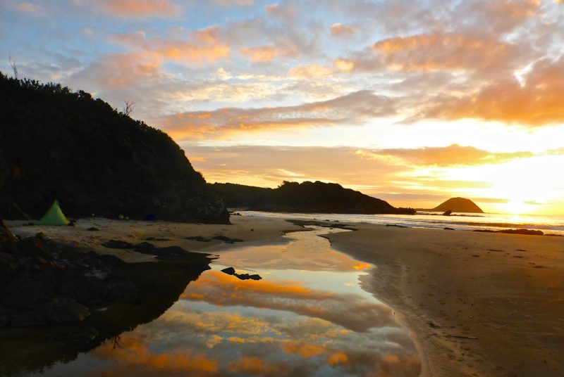
Sunset at Evans Creek on Tassie’s pristine western coastline.

Overlooking Lake Oberon in the Arthur Range.
2. Cordillera Blanca Traverse (Peru, 2014)
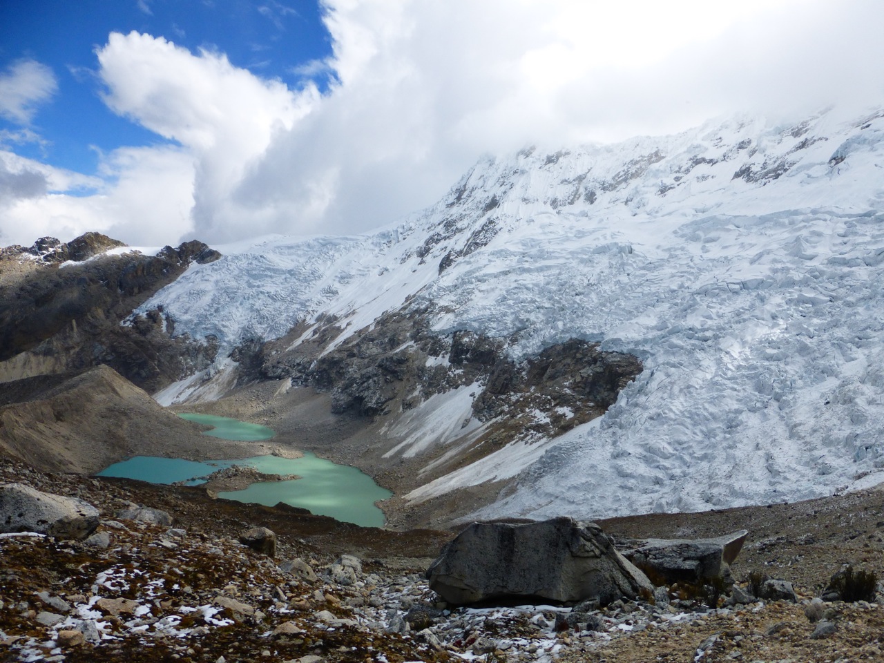
Between August 21 and September 6, 2014, I completed a traverse of Peru’s Cordillera Blanca, one of the world’s highest and most beautiful mountain ranges. Beginning north of Nevado Alpamayo and finishing at Pastoruri Glacier, the route was approximately 252 miles (406 km) in length, and included 23 passes ranging between 14,000 and 17,109 ft above sea level (4,267m – 5,215m). To the best of my knowledge it was the first time that such a trip had been undertaken. Click here for photos galleries and journal entries from the trip.
Approaching Ishinca Pass, at 17,109 ft (5,215 m) the highest point on the CBT.
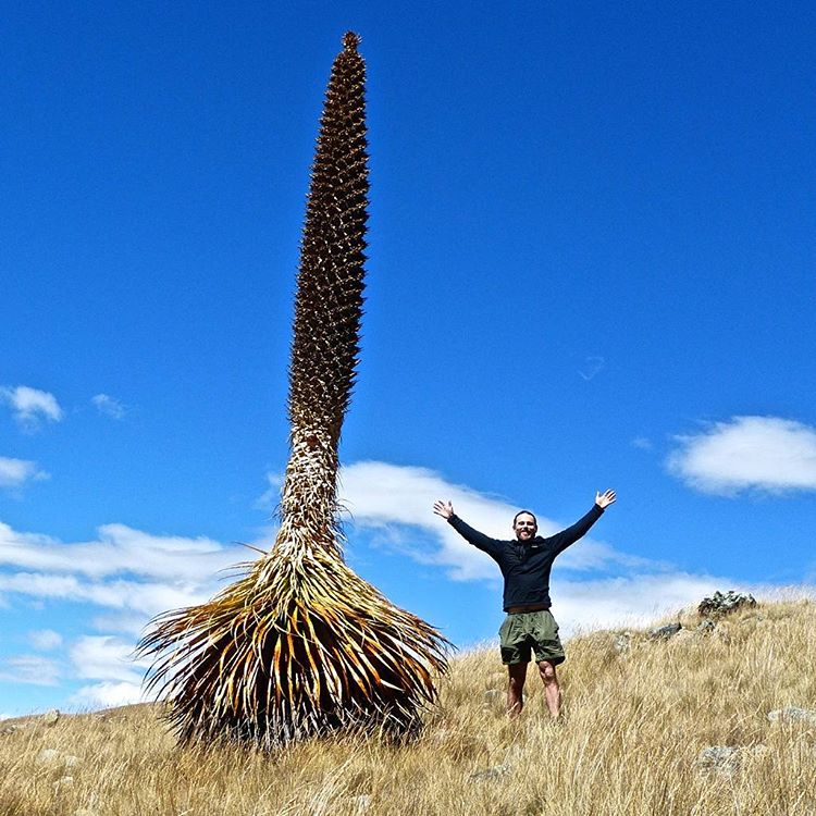
Growing up to 33 ft (10 m) high, Puya Raimondii plants are endemic to the Peruvian and Bolivian Andes. Found at altitudes ranging between 10,000 and 16,000 ft, they are the world’s largest Bromeliad and are commonly referred to as the “Queen of the Andes.”
3. Copper Canyon Traverse (Mexico, 2013)
On December 12, 2013, Justin “Trauma” Lichter and I finished a pioneering traverse of Mexico’s Copper Canyon region. The 22 day, 380 mile (612 km) route was a combination of hiking, scrambling, packrafting, bushwhacking and weaving our way through and around clandestine drug fields. The hike linked together the six major canyons that constitute the Copper Canyon region, and took us from the area’s northwest corner (Candameña Canyon) to its southeastern limits (Sinforosa Canyon). Click here for more details.
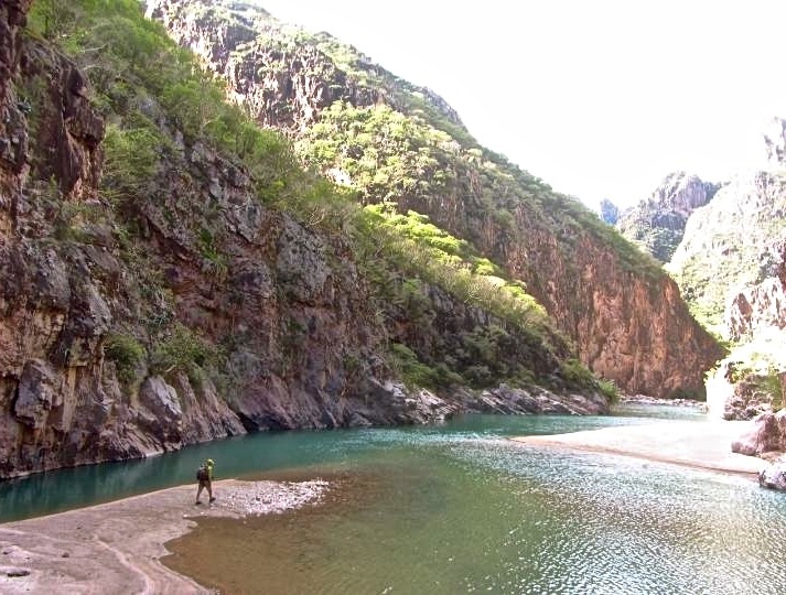
One of many crossings of the Urique River in the canyon of the same name.
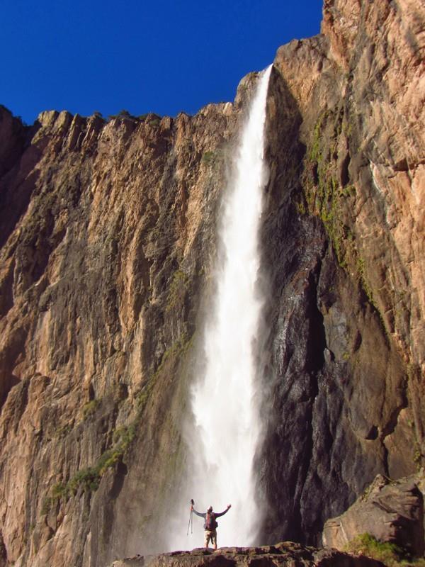
Basaseachi Falls in Candameña Canyon – The memorable starting point of the Copper Canyon Traverse.
4. Long Crossing of the Lofoten Islands (Norway, 2018)
I was joined on this hike by my old mate, Greg “Malto” Gressel, who I’ve teamed up with in previous years on the Lowest to Highest Route, Wind River High Route and Northville Placid Trail. This time around Malto and I tackled an approximately 124 mile (200 km) route that spanned much of Norway’s legendary archipelago. The idea for the trek came about from an excellent website called Rando-Lofoten, the go-to source for all things hiking in the islands. All told this challenging route took us a week to complete (we added on an extra section and some side trips), and we were blessed with a window of uncommonly fine weather for six of the seven days (Note: Trip report still to come).
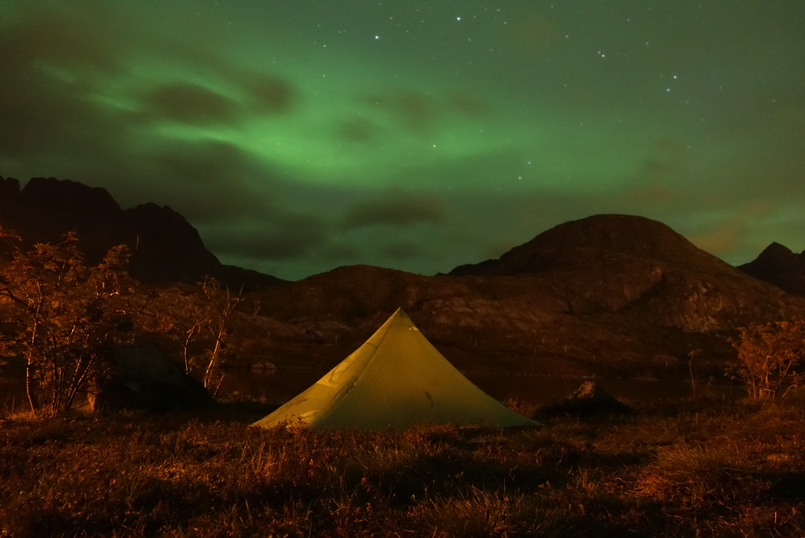
Mother Nature’s light shown on the final night of the Crossing.
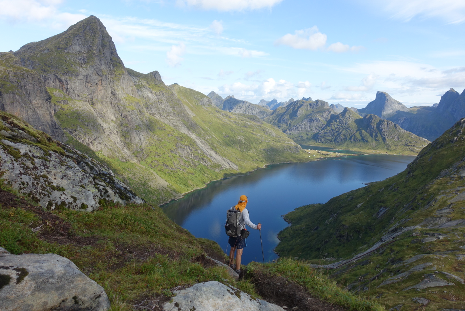
Greg “Malto” Gressel during the Long Crossing of the Lofotens.
5. Sangre de Cristo Traverse (USA, 2016)
On the afternoon of September 5, 2016, I completed an eight day traverse of the Colorado section of the Sangre De Cristo (i.e. “Blood of Christ”) mountains. My route began in the town of Salida and finished at the informal trailhead for Blanca Peak, just off CO HWY 150. It was a largely cross country affair, approximately 120 miles (200 km) in length, and had a cumulative elevation gain of more than 40,000 ft (12,192 m). Click here for images and details from the trip.

One of the highlights of the Sangres hike came in the form of a detour. Specifically traversing the length of Great Sand Dunes National Park from its northern border to southern tip.
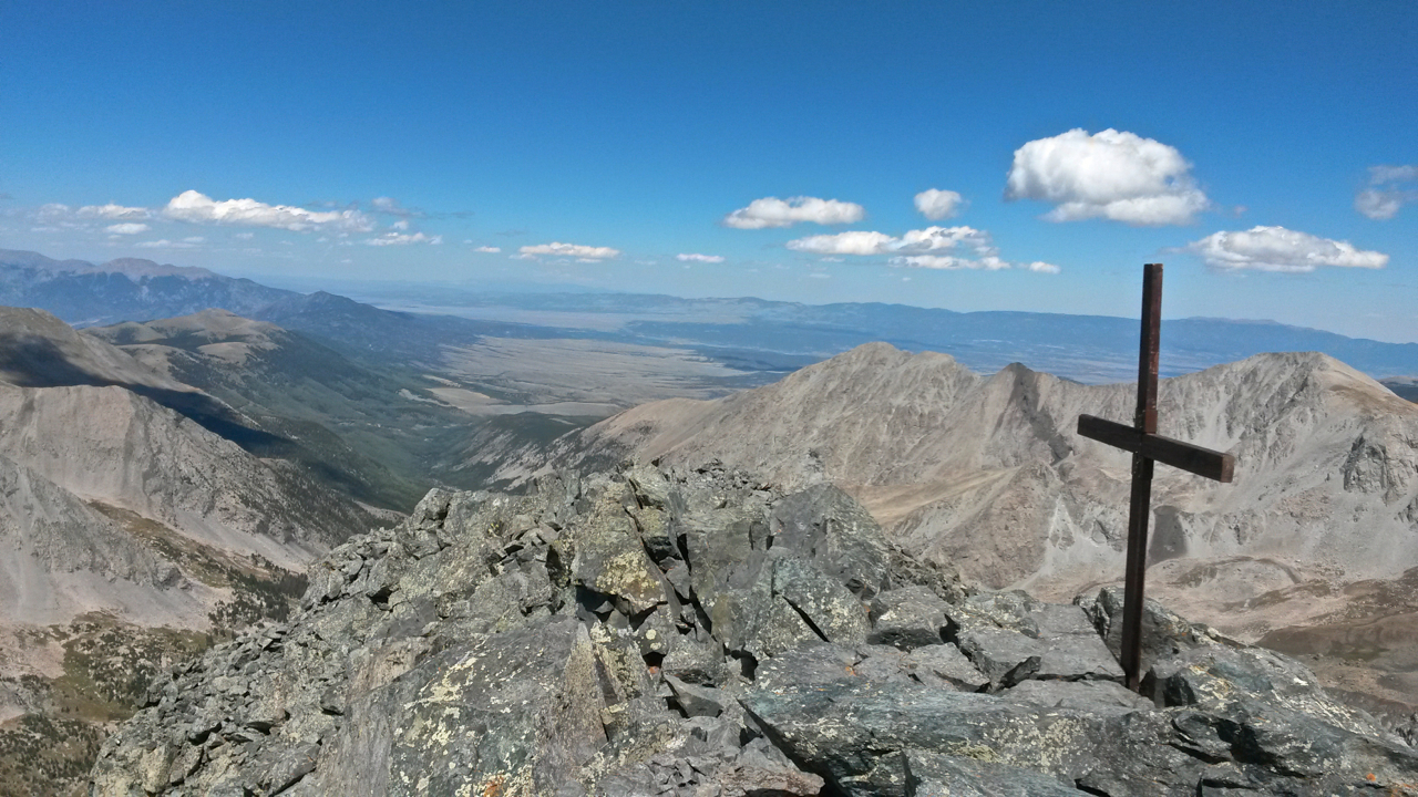
Although I finished walking at HWY 150, personally speaking the summit of Blanca Peak (14,344 ft / 4,372 m) marked the end of the traverse of the Colorado section of the Sangre de Cristo Range.
6. Cocuy Circuit (Colombia, 2015)
In August, 2015, I had the opportunity to hike in a place I’d dreamed of visiting since the early 90’s; Colombia’s Sierra Nevada del Cocuy. Located close to the Venezuelan border, this little frequented gem of the northern Andes is home to the second largest concentration of glaciers in Colombia, and sports a collection of towering peaks rising up to 5,330 m (17,487 ft). Click here for images and journal entries from the trip.

Laguna de la Plaza

Hiking near Laguna Hoja Larga on the eastern side of the Sierra Nevada del Cocuy.
7. Altiplano Traverse (Bolivia, 2017)
In August, 2017, I hiked an approximately 600 km (372 mi) route across Bolivia’s Altiplano region. An otherworldly landscape of salt flats, volcanoes, fantastical rock formations and coloured lakes, it was a trip that had been bouncing around my noggin for twenty years, ever since my first visit to the area in February, 1997. Click here for details from the first stage of the journey, which included crossing the world’s largest salt flat, and finishing on the summit of the incredible Volcan Licancabur (5,920m / 19,423ft).
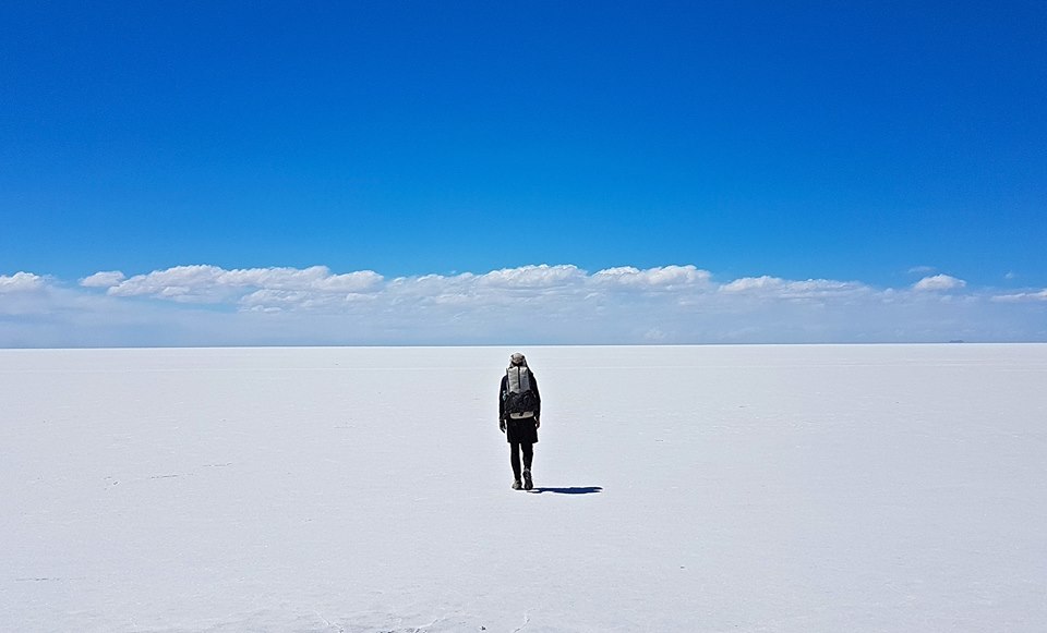
Yours truly crossing the Salar de Uyuni.
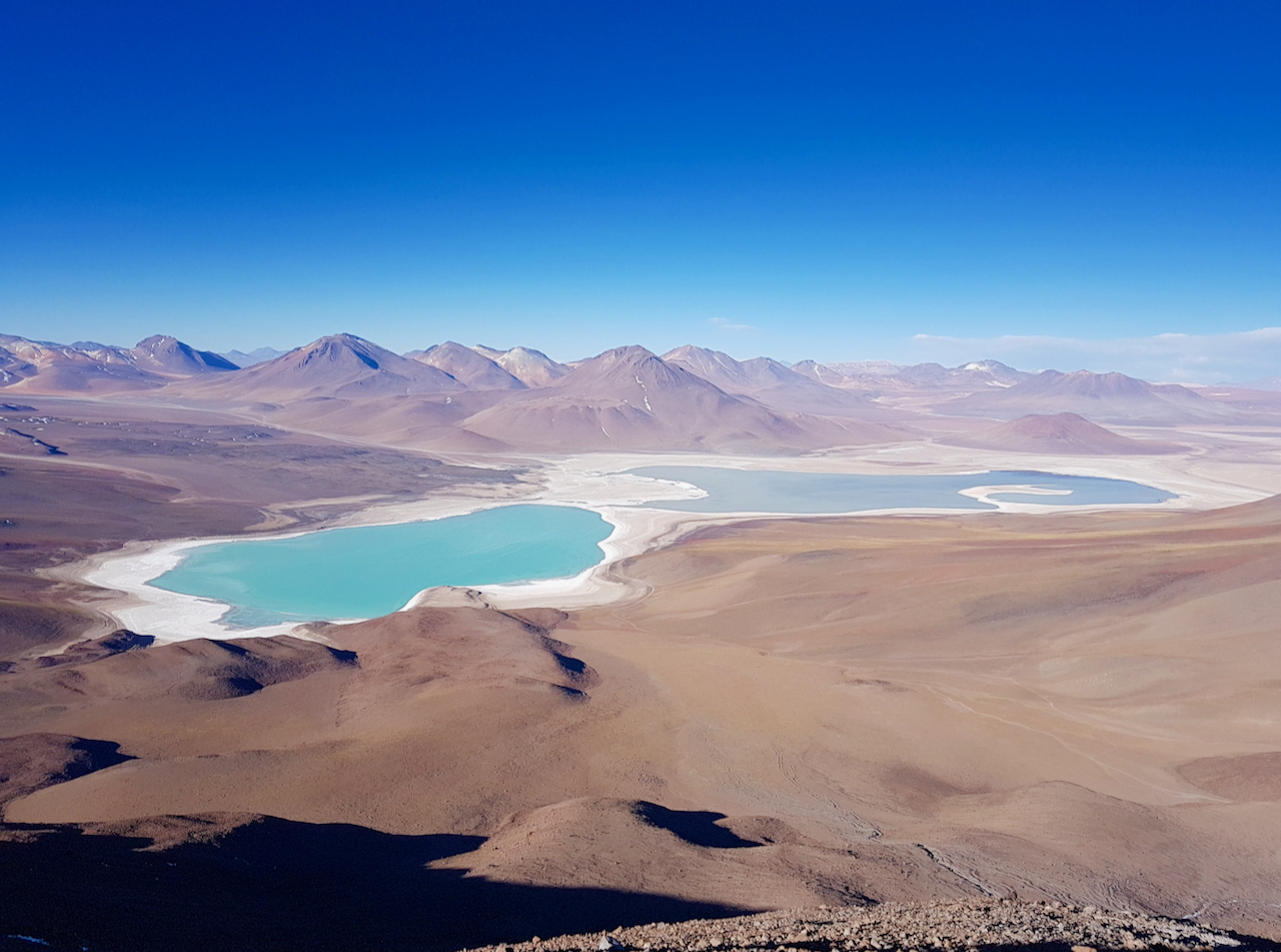
The summit views from Volcan Licancabur (5,920m / 19,423ft)
8. Badlands Traverse (USA, 2016)
The Badlands of South Dakota combines a fauna-abundant prairie land with a moonscape of other-worldly rock formations, to form one of the America’s most unique natural environments. In mid-September, 2016, I completed an approximately 90 mile (160 km) traverse of Badlands National Park from Ben Reifel Visitor Center to White River Visitor Center. To the best of my knowledge, it was the first time that such a hike had been completed. Click here for a trip report from the journey.
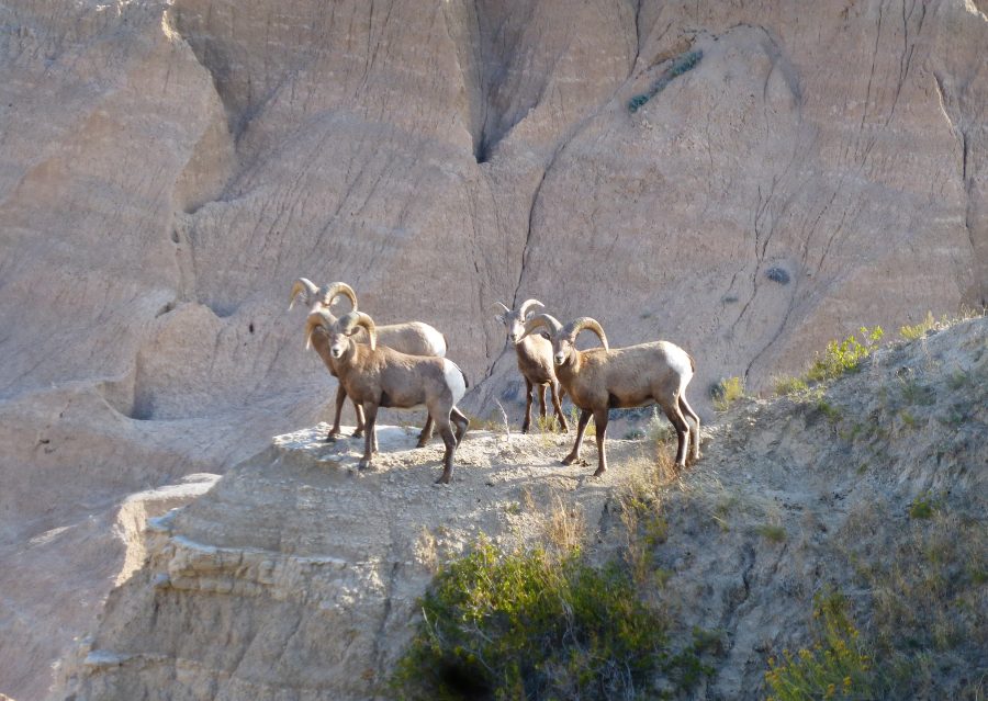
Curious Bighorn sheep near Stronghold Table.

The final stretch of the Badlands Traverse.
9. Cordillera Real Traverse (Bolivia, 2017)
In August, 2017, Ryan “Dirtmonger” Sylva and I completed a full length traverse of Bolivia’s Cordillera Real. Our route began at the southern end of the range in the village of Cohoni, and finished some 150 miles (241 km) NW of there in the mountain town of Sorata. The trek took nine days to complete, and along the way we crossed 23 passes, ranging in altitude from 4450m (14,600 ft) to 5300 m (17,400 ft). Click here for details.

Ryan “Dirtmonger” Sylva on the Cordillera Real Traverse.
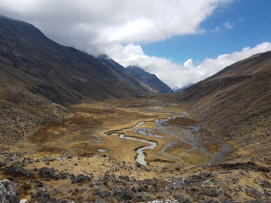
Valle Chajolpaya | Day 8, Cordillera Real Traverse.
10. 12 Long Walks (USA & Canada, 2011/12)
Ok, ok, I’m fudging a bit here. The final instalment in this list is actually 12 hikes instead of one, but what the hey, they were all done in a consecutive fashion, and at least in my mind, they collectively constituted a single hiking journey.
As the name suggests, the 12 Long Walks consisted of a dozen long distance or thru-hikes ranging in length between 200 and 2700 miles.The series began with the Pacific Northwest Trail (PNT) on July 2, 2011, and finished some 545 days and 14,342 mi (23,081 km) later on the summit of Springer mountain, the southern terminus of the Appalachian Trail. During the peregrination I passed through 29 US states and 4 Canadian provinces. For the full rundown on the trip see the 12 Long Walks – Maps, Stats and Journals. To finish up, here are some random factoids from the journey:
- Total Nights Cowboy Camping: Approximately 360 nights under the stars, and 184 nights under a human-made roof.
- Average Calories Consumed Per Day: 6000 plus (45-55% carbs, 35-40% fats, 10-15% protein)
- Food Trivia: Total weight of dehydrated beans consumed: 123.7 lbs (56.1 kg). Total number of Snickers bars – 620.
- Total Pairs of Trail-Running Shoes: 28
- Solo Vs Accompanied: Total Distance walked by myself -13,380 miles (21,533 km). Total Distance walked with others – 962 miles (1548 km).
- Average Base Weight of Pack: Between 6 and 7 lbs (2.7 kg – 3.2 kg), when temperatures were consistently below 20°F (-6.7°C). Between 8 and 10 lbs (4.1 kg – 4.5 kg) when temps were regularly lower than that.
- My Weight: I started the trip weighing 181 lb (82 kg), and at the finish tipped the scales at 176 lb (80 kg).
- Favourite Pieces of Gear: Katabatic Gear quilts (Sawatch & Palisade), Patagonia R1 Hoody, Mountain Laurel Designs Burn Backpack, Suunto M-2 Compass (I didn’t use a GPS during any part of the trip), Mountain Laurel Designs ProPoncho, Montbell UL Down Jacket, and Brooks Cascadia trail-running shoes.
- Calendar Triple Crown – The last three trails of the 12 were the PCT, CDT and AT, collectively known as the Calendar Triple Crown, or as my mate Greg “Malto” Gressel irreverently calls them, “the warm down hikes.“
- Blood Mountain: Upon reaching Springer Mountain on December 28, I decided to hike back some 30 miles (48 km) to Neels Gap the following day. It turned out to be the most important decision of the entire 545 day trek. Click here for the full account.
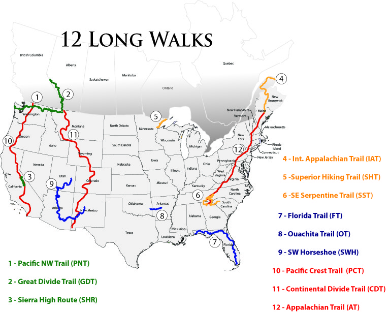
12 Long Walks Overview Map
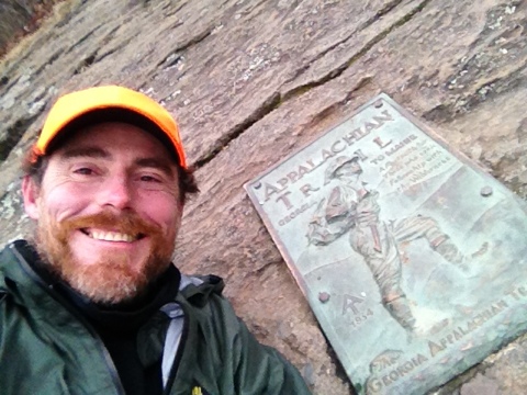
The Finish of the 12 Long Walks | Springer Mountain, GA, December 28, 2012
Honorable Mentions
Here are some of my other favourite rambles from the past decade:
- Five Passes Route (New Zealand, 2010).
- Larapinta Trail (Australia, 2010)
- Lowest To Highest Route (USA, 2014)
- Beartooth Mountains Route (USA, 2016)
- Wind River High Route (USA, 2016)
- Cape Wrath Trail (Scotland, 2017)
- Alta Via 2 (Italy, 2019)
- Stubai Horseshoe (Austria, 2019 – trip report still to come)
- Triglav High Route (Slovenia, 2019 – trip report still to come)