Note: Unfortunately all of my photos from this hike, which I did over seven days in May 2009, were accidentally deleted.

Coast-to-Coast Walk Overview Map (Cicerone Press)
Distance: 192 miles (309 km) approx.
Avg.Time: 10 – 13 days.
Start / Finish:
- St. Bees – Robin Hood’s bay.
- For transport details to and from the trailheads, see the excellent Coast to Coast Guides website.
Difficulty: Easy
Season:
- April – October.
- Best outside of July and August if you want to avoid the crowds.
Maps / Info:
- Maps: I recommend Harvey Maps, Coast to Coast West & Coast to Coast East. These two ‘strip maps’ are all that you need for navigation purposes. In addition, they display facilities and points of interest along the way. Excellent for pre-hike planning.
- GPX: See Traildino.com and Walkingclub.org.uk for Coast to Coast GPS data.
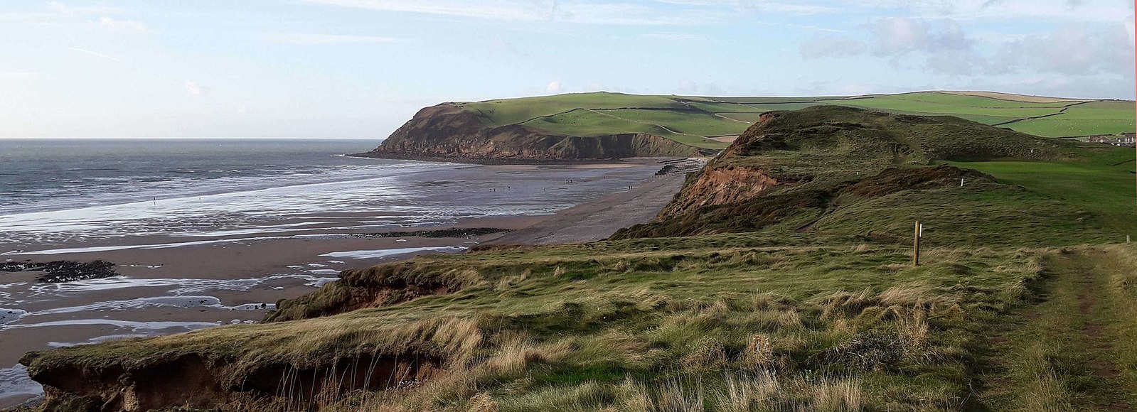
St Bees Head and Bay (Wikimedia Commons)
- Online Planning Guide: See Ramblingman.org.uk for an informative overview of the trail including trip itineraries, as well as accommodation and transport beta.
- Guidebooks: There are numerous guidebooks available for the Coast to Coast Walk. Those by Cicerone Press (2017 – Kindle Version available) and Trailblazer publications (2020) are two of the most popular.
- The “Granddaddy” of all Coast-to-Coast guidebooks is Alfred Wainwright’s A Coast to Coast walk. Written by the man who devised the trail – amazing attention to detail; occasionally witty narrative; highly recommended.
- Luggage Transfer: The ‘Coast to Coast’ attracts hikers of all ages, abilities and experience levels. A by-product of this popularity is the existence of companies such as Coast to Coast Packhorse and Sherpa Van, which organise accommodation and/or provide luggage transfer services for walkers.
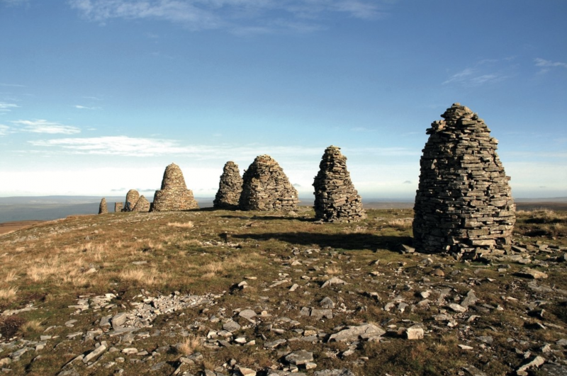
The Nine Standards (Cicerone Press)
Route / Conditions :
- The path is relatively well-marked and easy to follow start to finish. The guidebooks mentioned above describe the route in minute detail. When used in conjunction with the Harvey Maps, it would be difficult to get yourself too lost on this trail.
- Despite the mellow nature of the walk, hikers should still be adequately equipped for inclement conditions; this is England after all.
- If you are fortunate enough to enjoy fine weather whilst traversing the Lakes region, consider some of the high-level alternatives between Ennerdale Bridge and Shap. Note that the terrain on these alternatives is generally more challenging, and a reasonable level of fitness and decent navigation skills are required.
- If the weather isn’t looking great, make for the nearest pub and wait it out. Note that this could significantly extend the duration of your hike. As a wise man once told me, “it never rains in the pub.”
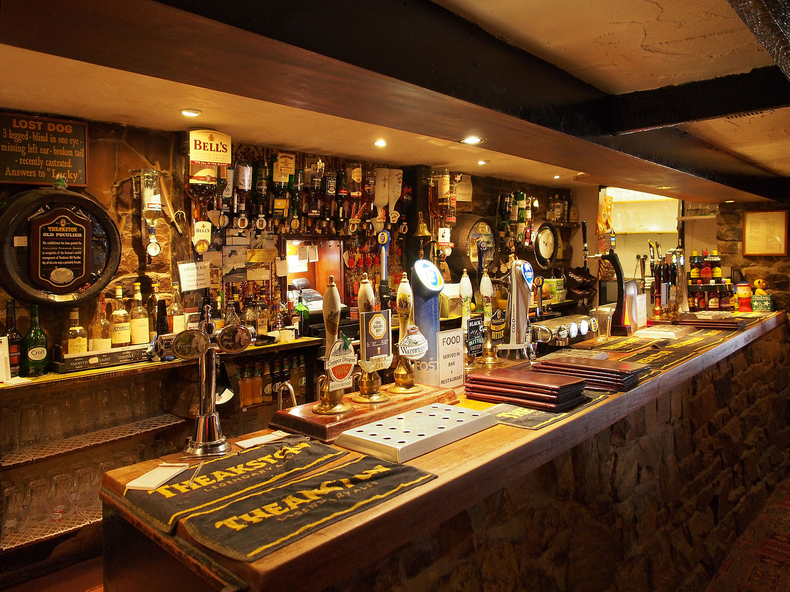
The Lion Inn – My favourite pub on the Coast-to-Coast Walk (photo Wikimedia Commons).
Sleeping :
- Every option imaginable. Hostels, hotels, pubs, camping and the most popular of all, B&B’s. The website, www.coasttocoastguides.co.uk, is an excellent source for all accommodation information.
- In regards to wild camping, the Lakes area is your best bet. Generally speaking, no one seems to worry too much about individuals camping for a single night and then moving on. That being said, discretion and no trace principles should be practised at all times.
Highlights:
- Favourite Section: The Lakes District
- Favourite Villages: Rosthwaite, Grasmere (touristy, but worth the short detour) and Reeth.
- Favourite Pubs: Lion Inn and King’s Head pub (Gunnerside). The former is featured in one of 2016’s most popular posts: My Five Favourite Hiking Pubs.
Discover more from The Hiking Life
Subscribe to get the latest posts sent to your email.