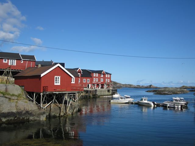
Fishing village of Å
Distance : 13.7 miles (22 km) approx.
Averag Time : 10 hours
Start / Finish :
- Vindstad to the Fishing village of “A“ (the last letter in the Norwegian alphabet) via Hermannsdalstinden peak.
- Getting to Vindstad involves taking the daily (during summer months) Fjordskyss boat from Reine.
- There are regular buses to Reine from Å.
Season : June to September.
Maps / Info:
- This hike takes place on the island of Moskenesoy, generally regarded as being the most spectacular of the Lofoten archipelago.
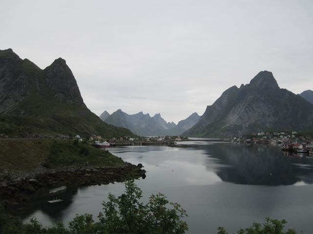
View from Reine
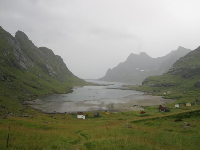
Leaving Bunesstranda beach in the rain
- Turkart Maps, 1:100,000 Lofoten. Widely available in bookshops and outdoor stores throughout Norway.
- Visit Norway.com and Lonely Planet’s Norway guidebook are both good sources of general information on the Lofoten Islands.
Route / Conditions:
- Temperatures in the Lofoten Islands are relatively mild by Arctic standards. That being said, if you are looking for some seriously wet and windy conditions, you have come to the right place. Pack accordingly.
- Upon arrival in Vindstad, make the short walk over to the spectacularly set Bunesstranda beach. It was absolutely bucketing down when I was there, however, I imagine during less inclement weather it would be a fantastic place to relax for a few hours. Alternatively, spend the day exploring the surrounding hills and camp overnight.
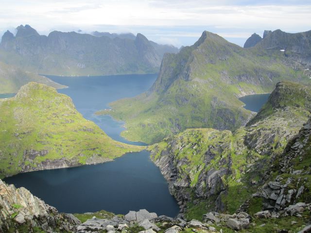
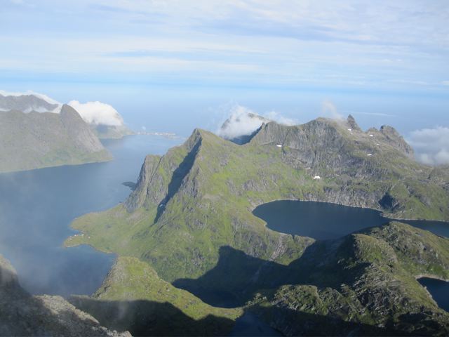
- Return the same way to Vindstad and then head south along the inlet, never straying too much from the shore. The way is overgrown in parts and can be quite slow going.
- After a couple of hours, you will reach a jetty at the southernmost point of the inlet. From here you follow a sporadically marked route straight up, eventually leveling out at Temnesvatnet (lake). The name of the lake is not mentioned on the Turkat Topo map.
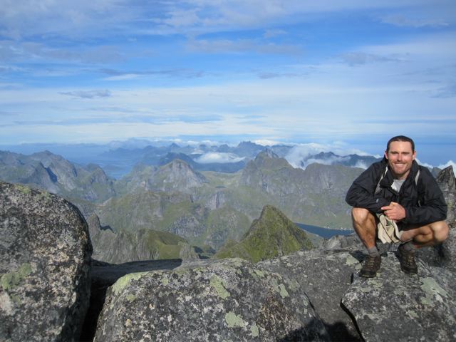
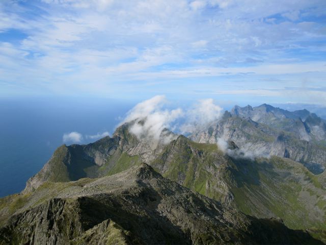
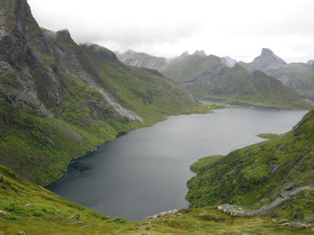
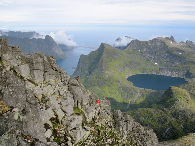
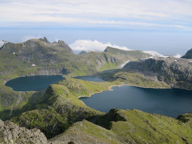
- From Temnesvatnet, follow the cairned trail toward the NW tip of Krokvatnet (lake), from where you climb steeply for another 1-1.5 hours to the summit of Hermannsdalstinden. This is Moskenes’ highest peak and in clear weather the views are unbelievable.
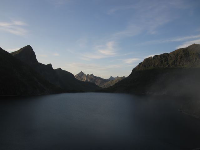
- From the summit, retrace your footsteps until you are once again on the hill overlooking Krokvatnet. From here head due south for 500 metres, at which point descend west to the saddle, and then make a steep climb up to the locked Munkebu Hut.
- From the hut, head south to eventually reach the village of Sorvagen. From here it is a short road walk back to A (the village).
Sleeping :
- Great camping possibilities on the hill west of Krokvatnet and nearby Munkebu hut.
- If you want to overnight in Munkebu Hut, you will need to organise a key in advance. See datadesigns.ws for details.
Overview:
- Picture postcard fishing villages, glacier-sculpted fjords and peaks, gorgeous mountain lakes; the Lofoten Islands is one of the most beautiful places I have ever been.
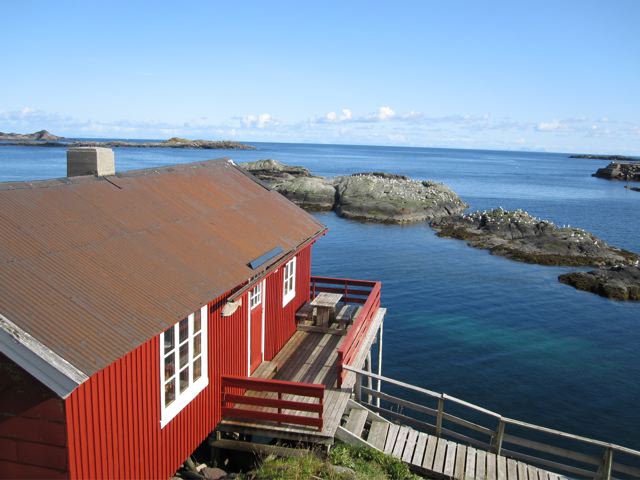
Village of Å
Related Posts
Discover more from The Hiking Life
Subscribe to get the latest posts sent to your email.