Distance: 18.6 miles (30 km) approx.
Average Time: 1 or 2 days
Difficulty: Moderate
Start / Finish:
- Tres Cruces to the Cuenca Guayaquil road.
- Buses leave regularly from Cuenca to the Tres Cruces trailhead. From the finish, it will be a question of hitching or flagging down a Cuenca-bound bus.
Season:
- Possible all year round. The dry season (which is still pretty wet) runs from August to January.

Maps / Info:
- Lonely Planet Trekking in the Central Andes has a sketch map and useful trekking notes. I followed the route described on pages 85-90.
- If you would like more detail, three IGM 1:50,000 maps cover the route: Cuenca [sheet 3785-2]; San Felipe de Molleturo [sheet 3785-4]; Chiquintad [3785-1]. These maps can be purchased at either the IGM office or South American Explorers Club, both of which are in Quito. Click here to purchase online.
- The Cuenca tourist information office sells a basic trail map: Parque Nacional El Cajas–Mapa Turistca / Guia de Senderos. I found this map, combined with the information in the Lonely Planet guide, to be sufficient for navigation purposes.
- Bring all supplies from Cuenca.
Route / Conditions:
- With terrain and weather conditions reminiscent of the Scottish highlands (at more than twice the altitude), Cajas is not the place to be if you don’t have a decent wet weather gear and solid route-finding skills.
- If you are overnighting, be sure to bring warm clothes and a good tent.
- Definitely no problem finding water. Avoiding it is another matter.
Sleeping: There are no indoor accommodation options available in Cajas. Bring your own shelter.
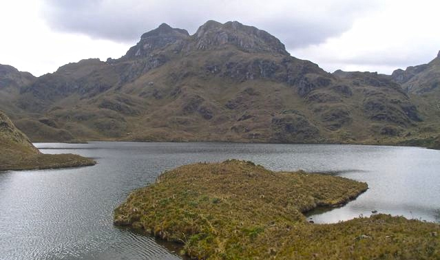
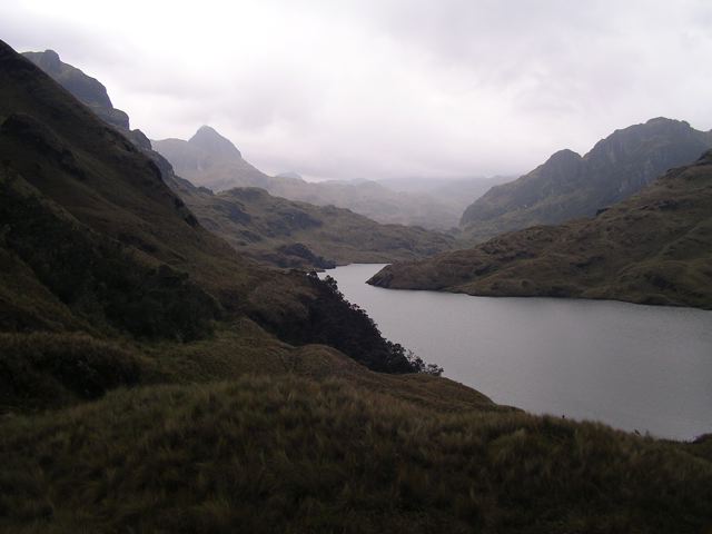
Overview:
- Think Scotland without the pubs/villages.
- Scores of lakes, jagged peaks, gnarled red Quenua trees, and cloud forest make this a wonderfully scenic hike. Good luck with the weather.
- If you have newly arrived from the coast, it is worth basing yourself in Cuenca (2530m) for a few days in order to acclimatize.

Discover more from The Hiking Life
Subscribe to get the latest posts sent to your email.