Located in northeastern Italy, the Dolomites are one of Europe’s most dramatic mountain ranges. A combination of serrated limestone peaks, sheer cliffs, shimmering alpine lakes and deep, narrow valleys, they have long been a magnet for geologists, travellers and outdoor enthusiasts alike. From a hiker’s perspective, this legendary sub-range of the Alps boasts an extensive system of pathways (i.e. “Vias”), and of the many trails that crisscross its rugged topography, arguably the most spectacular of them all is the 160 km (99 mi) long Alta Via 2 (AV2).
I hiked the AV2 in late September 2019. Please note that the information below is largely directed towards independent hikers, rather than folks going as part of organised trekking groups.

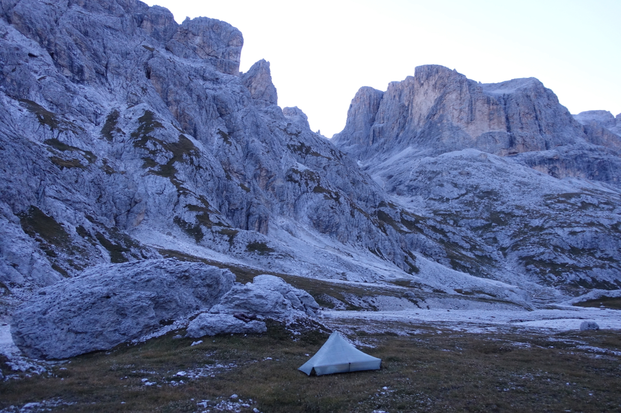
Sunset on the Alta Via 2 (Tarptent Aeon Li)
At a Glance
Distance: 160 km (99.4 mi)
Duration (average): 11 to 14 days (including a rest or weather day)
Difficulty Level: Moderate to challenging
Start / Finish:
- Bressanone (Brixen)
- Croce d’Aune
Which Direction?: I don’t think it makes much of a difference, though the majority of people seem to hike north to south; which is the way the route is described in the Cicerone guidebook listed below.
Elevation Gain: 11,884 m (38,990 ft)
Elevation Loss: 11,423 m (37,477 ft)

Alta Via 2 Overview Map (“Trekking in the Dolomites”, Cicerone Guides)
Getting There & Away:
- Bressanone (Brixen) is accessible by regular train and bus services all year round. It has a fascinating historical centre, multiple supermarkets to stock up on supplies, and plenty of accommodation options where you can store extra luggage during your hike if needed.
- Croce d’Aune is serviced by regular Dolomiti buses to and from Feltre during the summer months, but after mid-September buses come much less frequently. See Rome2Rio or the Dolomiti website for the current schedule. From Feltre, regular train and bus services are available all year round (Note: If you are looking for a place to enjoy a post-AV2 celebration, Venice is less than an hour away from Feltre by bus).
- Tip: To return from the southern terminus back to Bressanone: 1. Bus from Croce d’Aune to Feltre; 2. Connect to bus from Feltre to Trento; 3. Train from Trento to Bressanone.
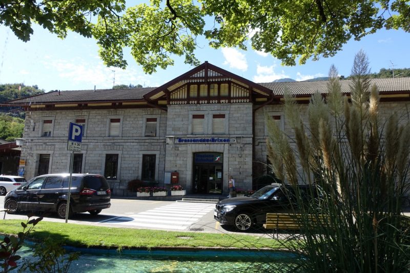
Bressanone Train Station – starting point of the Alta Via 2.
Season:
- Mid-June to late September. In an average weather year, September is ideal. The school holiday crowds are gone, the summer thunderstorms (generally short) have subsided, temperatures are cooler, and the mountain huts are less crowded.
- Depending on the snow levels and experience of the aspirant, the AV2 can also be done in the late spring or early to mid fall. When hiking at these times, you may require an ice axe and traction devices. Also note that most, if not all of the huts will be closed, so you will need to carry all of your own food and a tent/tarp (Note: Bivouac Huts remain open during the off-season / See Accommodation section below for details),

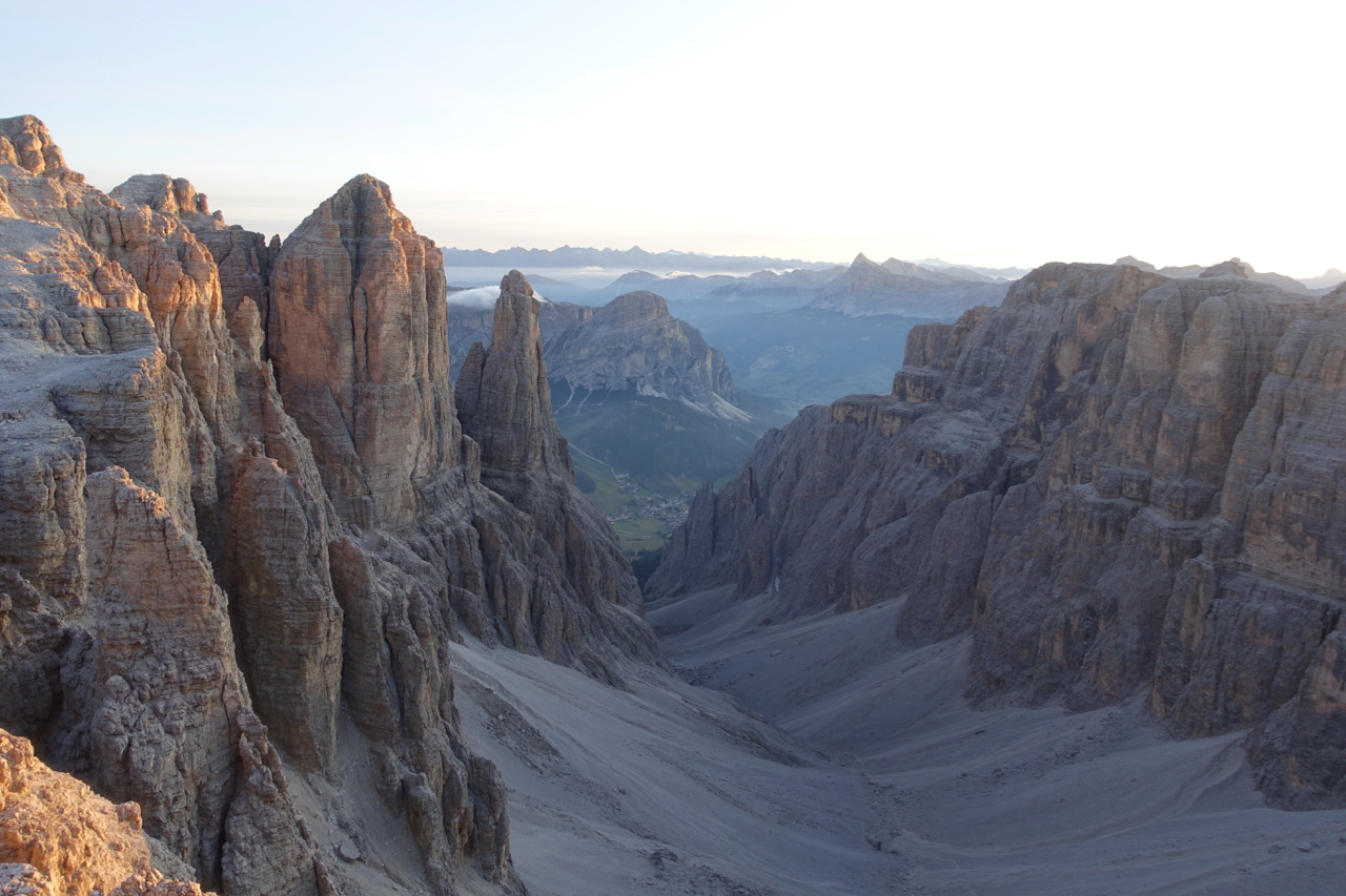
Stage 8 – Approaching the Passo delle Farangole (2814m), the deep (and steep) notch in the center of the photo.
Planning Information
- Guidebook: Gillian Price, Trekking in the Dolomites (Cicerone Guides) | Kindle version available | The book includes logistical beta, trekking notes, elevation profiles, basic maps (not detailed enough for navigation), town information, and time and distance estimates for each of the 13 stages.
- Maps: 1. Tabacco produces the most detailed hiking maps for the Dolomites. Five 1:25,000 topo maps cover the the entire AV2 (i.e. Sheets – 030, 07, 015, 022, 023). Also available online from Amazon and Omnimap.com. Note that it is possible to pick them up once you arrive, but there are no guarantees all five sheets will be available; 2. Alternatively, Kompass produce a 1:50,000 ‘Wanderkarte’ series that cover the route (3 maps total – Sheets 56, 59, 76).
- GPS Data: GPSies – Alta Via 2 (Brixen to Feltre) and Traildino.com (Alta Via Dolomiti 2)

Yours truly on a foggy Stage 12 between Rifugio Boz and Rifugio Dal Piaz.
- Permits: No permits are required to hike the AV2.
- Language: German and Italian. A basic knowledge of either definitely comes in handy, however, most of the locals along the route know at least a little English.
- Cell/Mobile Phone Coverage: I tend to keep my phone in flight mode 99% of the time while hike, but from what I can tell service in the Dolomites is spotty once you leave the villages/towns. That said, an increasing number of huts now offer Wifi for guests, and it is usually possible to charge your phone and/or battery pack whether you are overnighting, or just stopping in for breakfast or lunch.

Stage 4 – Puez-Odle Nature Park
- Cash or Card: Some, though not all huts along the AV2 accept credit cards. Be sure to bring along enough cash just in case you are staying in one or two that don’t.
- AV2 Planning Summary: I’d recommend the following course: 1. Read through this article; 2. Purchase the informative Cicerone guide; 3. Download a GPX file (see above) to your phone (I use the Gaia GPS app), and; 4. Pick up the Tabacco maps.
View from outside Rifugio Roe just after sunrise (Stage 5).
Resupply & Water:
- Resupply: The AV2 passes through just the one village – Malga Ciapela in Stage 6 – where groceries can be purchased. That said, procuring food along the way is simple if you are hiking during the summer season. Simply eat your main meals at the regularly-spaced Rifugi (mountain huts), at which you can also purchase snacks and sandwiches to go. Note that if you are interested in hiking out of season, you either have to carry all your own food from start to finish, or undertake some detours off route along the way. Note that the shops and most of the accommodation in Malga Ciapela also close down in mid-September.
- Water: Unlike in many other parts of the Alps, H20 is relatively scarce in the upper regions of the Dolomites. According to Gillian Price in the Cicerone Guide, this is due to the “dolomite-limestone rock (most surface water disappears underground) as well as the dearth of glaciers and permanent snowfields.” In practical terms, this means that hikers should always be aware of where their next chance to fill up will be before setting out on each stage. Note that bottled water is always available for purchase in the huts – generally at very expensive prices (e.g. €3 for a 1.5 lt bottle – September 2019).

A wet and windy Stage 10 from Rifugio Treviso to Passo Cerada.
Route / Conditions:
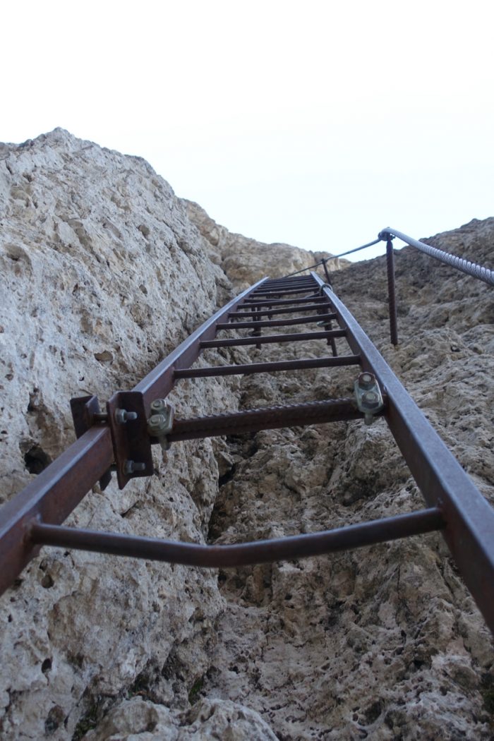
- Overview: The AV2 is a physically demanding trail, which includes more than 23,000 metres (75,459 ft) of combined altitude gain and loss. During its course, hikers will negotiate high altitude passes, exposed traverses, steep scree slopes and narrow rocky gullies, some of which are denoted by lengthy sections of Via Ferrata (i.e. “Iron Roads” – protected climbing paths with cables, ladders and iron rungs that are attached to rock walls).
- History: The Via Ferrata are much more than an exhilarating way to experience the Dolomites breathtaking landscapes. They also represent a visual reminder of the area’s bloody history. During WW1, the Dolomites were the scene of fierce battles between the Italian and Austro Hungarian forces. The Via Ferrata were installed during these years as a means of enabling troops quicker access to the front line.
- Do I need a helmet and harness?: It depends. Most of the people I saw tackling the Via Ferrata sections on the AV2 seemed to be using them. However, I think if you’re comfortable negotiating Class 3 and occasional Class 4 type terrain chances are you’ll be fine without them. If heights make you nervous and you’re not particularly sure-footed, than you are most likely better off bringing via ferrata gear. Note that if you are hiking out of season in May/early June or October, chances are you might need traction devices as well (i.e. microspikes or even crampons).
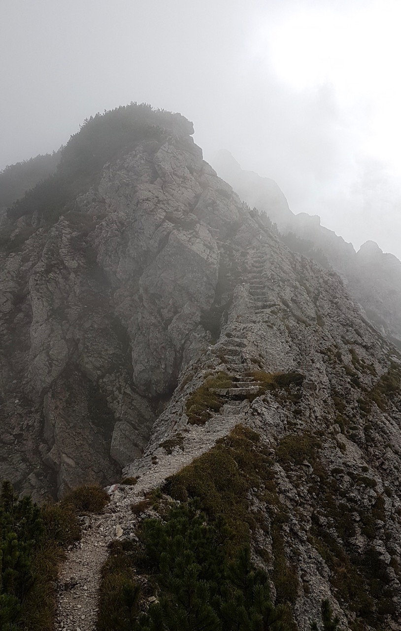
- Navigation: The trail is well marked from start to finish. The route is marked with red and whites paint splashes, cairns, and the occasional triangle symbol with a “2” inside it.

Stage 4 – The steep climb up the Val Setus ravine (note the cables and iron rungs)
Going up on Stage 8.

Stage 4 – Topping out at 2610m, after the steep climb up Val Setus. Note the red/white painted flags which mark much of the trail.
- How Long will it take?: In the opening “At a Glance” section I mention that the average AV2 hiker will take 11 to 14 days. Chances are this will include a rest and/or “rain” day (maybe two). That said, the amount of time it takes to finish the AV2 can vary greatly depending on a number of factors. Fit and experienced hikers carrying a light pack and who have a good head for heights, can comfortably do the AV2 in six or seven days. On the other end of the spectrum, slower folks who get the short end of the meteorological stick and who feel like doing multiple side trips, may take two weeks or more to complete the trail.
- Favourite Sections: My favourite stages on the AV2 were as follows:
- Stage 5 – Rifugio Pisciadu to Rifugio Castiglioni;
- Stage 8 – Rifugio Mulaz to Rifugio Rosetta;
- Stage 11 – Passo Cereda to Rifugio Boz;
- Stage 12 – Rifugio Boz to Rifugio Dal Piaz
Stage 12 – Rifugio Boz to Rifugio Dal Piaz
Sleeping
Options on the AV2 include staffed mountain huts, bivouac huts, and wild camping:
- Mountain Huts: The majority of backpackers in the Dolomites stay in the rifugi (mountain huts). These staffed refuges can be found throughout the range, and often boast incredible high altitude locations, along with spectacular vistas. Most are open from mid-June to late September, and along with overnight accommodation (dormitory and sometimes private rooms), they also offer breakfast, lunch and dinner. The best value can usually be found in the half-board offer (mezza pensione), which consists of a three-course dinner, a bed, and breakfast. As of 2019, half-board costs around 45 to 55 Euros. Note that members of the Club Alpino Italiano usually pay around 20% less than non-members, and folks that are affiliated with certain other European Alpine or Mountain clubs (e.g. UK, Austria, German, French), enjoy reciprocal rights. During the peak season months of July and August, accommodation should ideally be booked in advance (especially if you are hiking in a group).
- Bivouac Huts: Unmanned, simple refuges that are usually open all year round. They are often converted shepherd’s huts or metal cabins, and the facilities can vary greatly (i.e. Unlike the Rifugi mentioned above, you should plan on bringing your own sleeping bag, mat, and supplies). They are free to use, and can be a godsend when the elements are raging. Some are located next to or attached to the main Rifugi, while other examples (such as the Bivacco Minazio on Stage 9 and the Bivacco Feltre Bodo on Stage 11 – See photo below) are situated in more isolated locales.
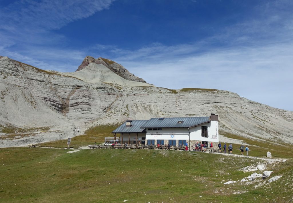
Stage 4 – Rifugio Puez – Popular with day hikers making the short walk in for lunch from Passo Gardena.
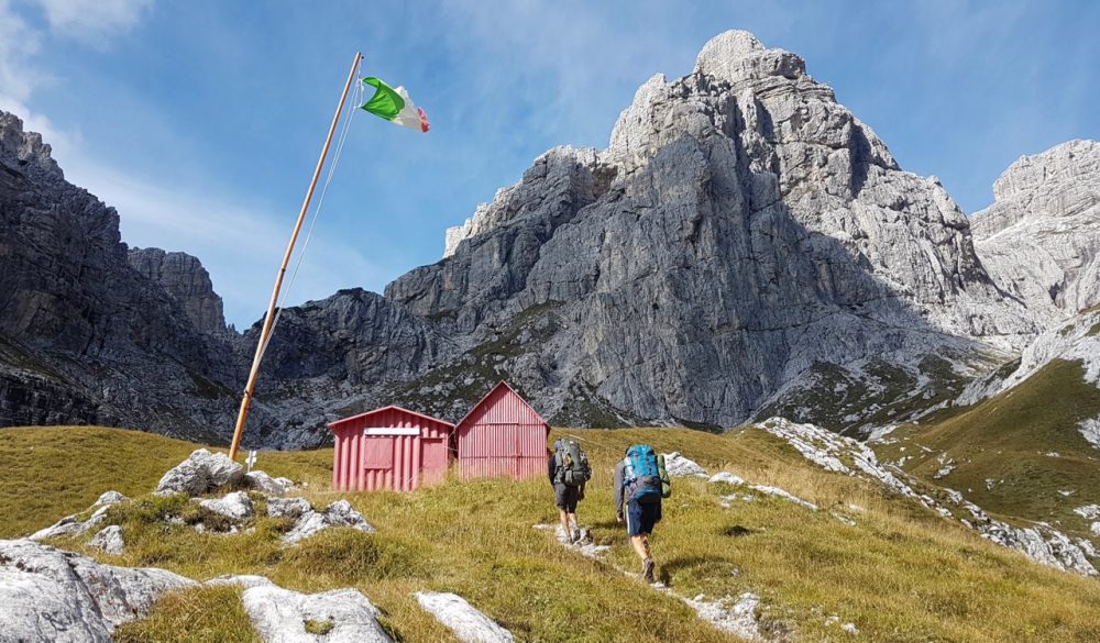
Stage 11 – Bivacco Feltre-Bodo
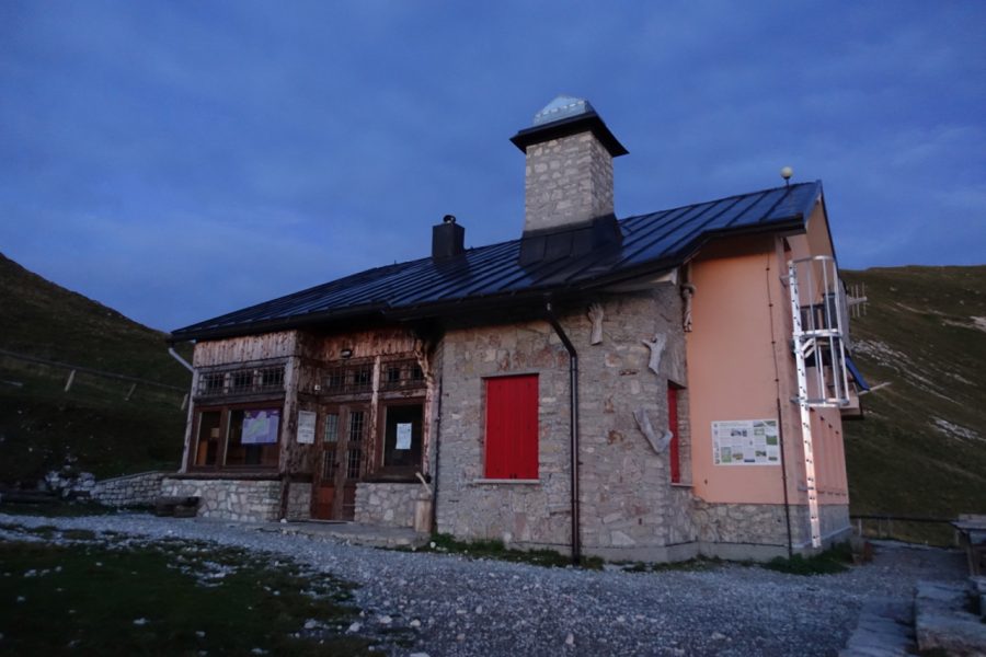
Stage 13 – The final hut of the AV2 – Rifugio Dal Piaz
- Wild Camping: Regular readers of ‘The Hiking Life’ knew this bit was coming. While I enjoyed eating breakfasts and lunches in the huts during my time on the AV2 (and AV1), I avoided overnight stays in the huts. The main reasons for this is were that: A. I don’t sleep well in dormitories, and; B. If I’m hiking in the mountains I prefer to sleep outside whenever possible. That being the case, I did what I almost always do – set up camp at sunset and left the following morning before sunrise.
- Is Wild Camping Legal in the Dolomites?: Officially speaking, “camping” – which is apparently defined in Italy as staying in the same tent site for more than 48 hours – is strictly prohibited. On the other hand, the “overnight bivouac” – setting up late and leaving early the following morning is allowed (or at least tolerated) as long as you practice LNT principles. See the following article on the hikedolomites.com website for a more detailed breakdown.
- Practically speaking, I found wild camping in the Dolomites to be similar to other Alpine regions I have hiked through over the years – that is, as long as you set up late in a stealthy spot, leave at dawn the next day, and practice LNT principles at all times, there are no issues. During my trip I met a handful of other campers who like myself encountered no problems following this strategy. Indeed, a German couple I met at Passo Cerada, actually said that they’d regularly received advice from the rifugi staff as to where they could set up nearby, in order so that they could eat both dinner and breakfast at the huts.

Campsite near Val Lasties (according to legend, the dwelling place of witches (and wayfaring middle-aged Australians)) on Stage 5.
Camp spot on Stage 8, about 40 min hike from Rifugio Rosetta.
Final Tips for the AV2
1. Carry a light pack – There aren’t a lot of flat sections on the AV2, and the lighter your pack is, the easier the long and steep descents will be. Additionally, a light pack allows for greater freedom of movement and enhances your balance while negotiating the exposed Via Ferrata sections. Note that this is actually one of the primary benefits of staying exclusively in the huts – you can hike without a tent, sleeping bag and cooking/soaking gear.
2. Timing Your Days: As is the case pretty much all over the Alps, most of the hikers you will encounter seem to begin their hiking day around 8 – 9 am, and finish sometime between 2 and 4 pm, when they arrive at their pre-reserved hut. This means that the trails are often hiker-free during what I consider to be the best times of the day (i.e. early morning and late afternoon). From my perspective, herein lies the greatest benefit of carrying your own shelter – freedom. The freedom to arise at dawn when the birds are singing, and walk in solitude under an infinite ceiling of emerging blue. The same applies to sunset, when the temps are cooler, wildlife reemerging and the sky is turning fifty shades of crimson. These are the times when I most want to be out on the trail. Not necessarily to cover more miles, but instead because it makes me feel like I’m more a part of the daily miracle that is unfolding all around me.
3. My AV2 Strategy: FWIW, here’s a rough breakdown of my daily schedule during my six days on the AV2:
- Start my hiking day at dawn.
- Usually I’d be camped 30 min to an hour from the next hut, which I’d aim at reaching by 8am at the latest for a morning meal.
- Breakfasts – In general, brekky at the huts was a mixed bag. The good ones included a buffet of cereals, bread, cheeses, meats, multiple cups of coffee, and cost around €9 or €10. The not-so-great ones were of the continental variety consisting of bread, butter, jam, a coffee, and that’s about it. These cost €7 or €8 and I invariably left hungry………not really, as in these cases I’d buy something extra to go.
- Lunches – Upon leaving after breakfast I knew more or less how long it would take me to get to the next hut, where I would stop for a midday/mid-afternoon meal. As long as I got there by 2 to 230 pm, I always knew they’d still be serving. Lunches at the Rifugi were sometimes pricey, but always good, with hot meals setting you back anywhere between €10 and €16. I usually added a dessert and a couple of beers, after which I waddled out €20 to €30 lighter in pocket (but content of stomach).
- Dinner – I’d often leave my lunch stop with one or two sandwiches (and an overpriced chocolate) to tide me over for the rest of the day. Looking at my maps, I’d have in my mind the areas where I could most likely find a nice camping spot, at which point I’d generally arrive around sunset. The next day I’d wake up and do it all over again………..

Cairns and crimson sunrises – Stage 9, AV2.
Related Posts
Disclosure: This post contains some affiliate links, which means ‘The Hiking Life’ receives a small commission if you purchase an item after clicking on one of the links. This comes at no additional cost to the reader and helps to support the website in its continuing goal to create quality content for backpackers and hikers.
Discover more from The Hiking Life
Subscribe to get the latest posts sent to your email.
Great post!!
Hello,
I’m planning on doing part of this route this summer. Is it possible to avoid via Ferrata route and take alternatives paths? Or are they unavoidable in Alta via 2?
Thanks!
Great post. Did both AV 1 and 2 myself a few years ago……thoroughly recommended!
Did AV1 two years ago, fun and I did have to work a bit…thinking about doing the AV2, was it a million times harder than the AV1? Did you use ferrata gear?
Hi Judy, My wife and I have done the AV2 twice! It’s brilliant, we have also done the AV4 and the Haute route.
My advice in Hut-to-hut hiking in the Alps is to travel really, really light. We carry about 4kgs all up without water – then wife 1.5L and me 2.5L of water in bladders. We carry Via Ferrata gear (light Pod Harness and the lightest leash you can afford) but no helmet. You don’t actually need the gear though. Having been caught out a few times we also carry very light micro spikes.
Hiking the European Alps using the Refugio/Hut system is fantastic, they become very addictive. By using them and spending the bit more money you can walk extremely light, fast and fun! The people we see labouring under full loads don’t look like they are enjoying it nearly as much. Cheers, Glenn
“We carry Via Ferrata gear (light Pod Harness and the lightest leash you can afford) but no helmet”
I’m in the US and I’m struggling to find such kit, everything I found so far seems to be heavy complete sets. I’m planning on doing the AV2 in September next year without the kit, but also wanted to do some side trips that may require via Ferrrata kit. My backpack is weighted about 8KG anyway I can keep it light would be helpful.
Hello Glen,
Thanks: that is useful! I am planning to hike it early/mid-June: do you happen to know it the huts are open, and what time breakfast usually is? I’d love to be able to get out at dawn:) Do you pre-book or wing it giving you more freedom?
Cheers, Erika
Dear Cam,
You’re a fantastic inspiration and i’m enjoying your quick and dirty guides a lot! Did the HRP this summer as my first hike longer than two days and it wouldn’t have been possible without all the information about UL hiking, gear etc. you’ve posted. So, thank you!
I’m considering combining three high routes in to a longer trip this summer:
Stubaier Höhenweg
Pfunderer Höhenweg
Alta Via 2
I’ve already ordered the AV 2 cicerone guide and maps and i’ve started planning.
I would really like to hear your thoughts on the Pfunderer Höhenweg though. As there is not so much information around. Did you enjoy it? How long did it take, etc.
Hope to hear from you.
All the best from Denmark
Hey Mads,
Thanks for the kind words. Glad you had a great time on the HRP. Even after all these years, it remains one of my favourite hikes in Europe.
Sounds like you also have an excellent hiking summer planned for next year. In regard to the Pfunderer Hohenweg, I did enjoy it quite a lot. It took me about two and a half days, and I had a mixed bag with the weather. One of my favourite parts was reaching the characterful Walter Brenninger Bivouac in thick fog during a big storm. I cooked up a big pot of hot chocolate, and remember just sitting there for a couple of hours listening to the elements raging outside.
All the best with your upcoming hikes!
Cheers,
Cam
Hi Cam
I am a fan of your blog living in Mesa AZ. In your Alta via article you mentioned re: quilt selection you took the warmer one because you had another month of hiking. I’m curious where you went and what you did?
I am heading to Spain to do one of the more remote caminos and a variant which should take about 50 days. Because Spain getthot early will do the hike in April/ May. Thinking about via altas afterwords but need to do something interesting to do until mid June when refugis open. Ideas?
Thx Rick
Hi Rick,
Thanks for the kind words.
During October the main hikes I did were a trip through the Julian Alps in Slovenia, and a few different multi-day treks in Austria (e.g. Stubai Hohenweg). I’ll go into more detail over the next month or two when I post the trip reports.
In regards to your other question, there are a lot of different options in Europe you could look at for that time of year. One would be the Scottish Highlands.
All the best for your trip.
Cheers,
Cam
Is that Mt Whitney? He He
Quick and Dirty Guide? Mags is a gettin’ to ya Smiley
Is that Mt Whitney?
There are definitely some similarities (as well as many differences) between the two ranges.
Quick and Dirty Guide? Mags is a gettin’ to ya Smiley
Mags and I have been good mates for quite a long time. Four or five years ago I asked him if he’d mind if I used the “Q&D” name on some of my hike overviews, as I felt like it was a fun title that summed up the style of those particular posts. He agreed, and we subsequently went on to publish a couple of “Q&D” eBooks together.
Hi, we are looking to trek the AV2 in June (10-20). We are fit and capable, having completed the GR20 in 13 days and with significant weight (25kg). My concern/question is – should we take crampons or microspikes on the AV2? Are there areas where these will let us get through whereas otherwise we would have to turn back? and if this is a good idea, would you recommend microspikes or crampons?
Also, from reading your blog, can I assume that taking a tent at this time might be advisable? Given that many of the refugis may be closed, how often are bivouac huts located?
Thanks
Ben
Hi Ben,
In regard to your points/questions:
1. Thirteen days is quite a long time to hike the GR20. I would suggest you look at lowering your pack weight significantly before attempting the AV20. In potentially icy conditions, the Via Ferrata sections will be more difficult than they should be carrying such a heavy load.
2. Whether or not traction devices (and possibly an ice axe) will be useful on the AV2 for those dates really depends on the snow conditions, which can vary significantly from year to year. In an average year, there might still be quite a bit of snow around at the higher elevations (particularly on the north faces). Your best bet would be to keep an eye on snow levels as your departure date draws closer, and then pack accordingly.
3. I didn’t sleep indoors on the AV2 so I’m not sure which of the rifugi have bivouac huts and which don’t. Yes, I would advise taking your own shelter.
All the best with your trip,
Cam
Thanks – most of the people we spoke to on the GR20 were taking longer than 13 days, but yes, I do aim to lower my pack weight. Thanks, will be taking my own shelter and have just purchased crampons to be safe – did I say I was trying to lower my pack weight lol
Does anyone hiked in covid conditions the AV2? Are there specific things to be aware off?
Thanks and keep safe.
As far as I can tell: make sure to carry a mask as I’m sure you’ll be required to wear one on the huts and on public transport, be mindful of staying distanced from others, and be extra good at washing your hands. Beyond that I’m unaware of any specific requirements for hiking/hikers.
I suppose also be aware of your country’s and Italy’s entry requirements.
The British government is changing it’s list of quarantine countries regularly. So if your government is doing the same then there maybe a chance that you will need to self isolate when you return. Assuming you’re coming from outside Italy.
Did you walk up from Bressanone or get the cable car 😉 ?
So far Italy seems like one of the countries left on the ever shortening list of places I could easily hike this September. Fingers crossed I can get to try out the AV2!
Thank you for the write up!
I walked up, though if I was to do it again, I’d probably take the cable car.
I will ponder the choice. The never ending internal struggle of wanting to be a ‘purist’ vs taking the easy (smart?) option. 😛
Whichever way you go, Bressanone is worth spending some time in before starting your hike. It’s a cool town with lots to see. As for the hike up the mountain, despite the elevation gain, it’s not too difficult, and you are afforded some nice views along the way – though I suspect the vistas are also pretty good from the cable car!
Awesome post. Super-helpful. I especially appreciate the structured info about sleeping outside on this trail (or in the Dolomites in general). Just like you I prefer night skies above my head to a roof over it :-). Thanks for sharing!
Looking forward to hit the trail.
K.
Hi Cam
I enjoyed your post. Every year i try and go on a solo multi day hike in the mountains and the AV2 looks perfect. The only problem is i cant start until the 27th of September. I will be wild camping like you but am used to picking up supplies on the way. I was wondering if you did that at all? Or saw places where you can. For example do the huts sell instant noodles that you can take with you? Also a problem is that a lot of the huts close around the 25th of September so my ability to collect supplies becomes further complicated. I see a few are open so maybe its possible. What dates did you do your hike? Also how was it finding water? As i am concerned about my packweight having to carry camping gear and days of food… Any info along these lines would be very appreciated.
Luke
Hi Luke,
Thanks for the message. In regard to your questions:
1. I bought all my food along the way until I reached Passo Cereda. I stayed at the lodge there and picked up what I needed for the rest of the hike. South of Passo Cereda the final couple of huts – Boz and Dal Piaz – were closed when I went through. As I mentioned in the article, the shops and accommodation in the village of Malga Ciapela were also closed.
2. If memory serves I hiked it between the 19th and 24th of September.
3. Water – There were a few dryish sections, so I’d definitely be double-checking at the huts (at least the ones that are open), before heading off on the next stage. If in doubt, err on the side of caution and fill up when you can.
Best of luck on your trip.
Cheers,
Cam
Thanks alot for your helpful and quick reply Cam.
After continuing research it seems i can pick up supplies for first part of hike at Plosehutte, refugio Genova, Pisciadu… After that it gets a little difficult. At Passeo San pellegrino I think the hotels are shut. The albergo Miralgo is closed on the 27th september. So i may have to get a bus or hitch a lift off the mountian to a place with a supermarket.
And that would leave me with a similar situation once i get to passeo Cereda but you said you able to stock up there for the last couple of days? Was that from a hotel?
I think if i know i can pick up supplies at these two points its do able, as i cant see myself enjoying hiking carrying 7 days of food on my back…
And onto water… are there many springs outside the huts? And if the huts are closed do they have external springs outside that i would still be able to fill up from?
And how was the weather for you?
Thanks so much
Luke
Hi Luke,
I stayed at the Rifugio Passo Cereda mentioned in the Cicerone Guide. I had a big breakfast, packed out some sandwiches and chocolates, and it only took me a day to reach Rifugio Del Piaz. From there it’s less than 2 hours downhill to Croce d’Aune.
In regard to water, some of the huts have water sources outside, others not. For that final stretch from Passo Cerada, I recall that Biv Feltre Bodo and Rifugio Boz both had accessible pumps outside the huts.
Overall I had a good run with the weather. One rainy day. Temps at night were relatively mild; at a couple of the higher campsites it dropped a little below freezing but not by much. Here’s a link to my gear list: https://www.thehikinglife.com/2019/11/gear-list-alta-via-1-and-2-dolomites-italy/
Cheers,
Cam
Thanks you ve been a big help.
No worries. All the best on your trip.
I am interested in how cold it got at night, in order to work out a clothes packing list… as i will be hiking at a similar time of year…
thanks
When you heading out? I’m about to pull the trigger on tickets to start hiking on the 26th of Sept.
Think I will start on 27th or 28th! I ll keep an eye out for you! I’m 37 yr old British guy on own from berlin. Grey gossamer rucksack.
Brilliant, I’m going to be in the Lowenhof in Brixen campsite 24-25th if you’re about and bored then I’d be more than happy to grab a beer! I won’t drop any contact details here unless you’re interested 🙂
Hey rob.
Email me on cplmont@hotmail.com
I ll give you my number on there.
Not sure I ll be there that date but be good to keep in touch and we can keep each other updated about trail or whatever.
Hi Cam
I recently got back from AV2 hike and thought id add a few thoughts on here to potentially help future hikers.. I did it end of sept/into october and there was a lot of snow to navigate. the first fall happened before i left but slowly melted over the days and the second fall happened half way through so i holed up in Passo Valles (an excellent cheap place to stay with amazing food) half way through for two days… I bought spikes with me after chatting with Rob who i met on here and i am so glad i bought them. They made hiking a lot more comfortable at quite a few moments. Also i got bad snow blisters on my lips that were very painful so would recommend taking lip protection if hiking in snow.
Also i think this year they released a ‘Geomarketing’ alta via 2 dolomites high route map. that covers the whole route super well 1:25000 I would highly recommend.
Walking at the end of season over half the huts were shut but its worth noting that many have ‘winter rooms’ that you can stay in. Also a few key ones are still open until around the 12th of October (Genova, Pisciadu, Trevisio, Passo Valles, Castiglioni) but after second week of October even these ones are shut…. .. water was a bit more of a challenge to manage than usual but it is possible, important to bring electrolyte supplements. A few times i melted snow on my cooker and then filtered it as well…. The temps at night for camping were on the lower end of comfortable for me, particularily up at 3000meters. But it is possible if you have decent gear. 2000meters and below were fine.
Anyway thanks for such a great resource as this site.
Best
Luke
Did you notice any positive or negative attitudes about wild camping? I’ve noted a couple places in my travels that used to be more tolerant than they are now
Ah yes…
Also a very useful piece of information… There is a supermarket in Mis open most days (but not thursday/sunday) 9-12 and 4-7 which is only a small diversion off the trail around passo cereda… I took a different route from Trevisio to get there more directly… Its a fully stocked good shop. And i stocked up on supplies for the last couple of sections where there are no huts open, (but both feltre bodo and boz have winter rooms and water).
Hello! Great post!
We’re looking for 7 or 8 day trek. I’m very interested in the AV2 trek, but we only have 8 days to spend. Is there a possibility to walk just a part of the AV 2, and if there is, which part would you recommend?
Or do you have other recommondations for this amount of days?
Thank you in advance
Hi Yvonne,
Thanks for the kind words. Depending on your fitness/experience/pack weight it’s possible to do the whole trek in 8 days. However, if you’re group is looking at something shorter, your best bet is to pick up the excellent Cicerone Guide book I mention in the article. That will give you a better idea than I could in regard to the shorter possibilities on either the AV2 or other nearby hikes in the Dolomites.
All the best,
Cam
Hi Cam,
As always, love the write-up! Your page has become our hiking bible so thank you very much 😉
Just a couple of quick Q’s.. my partner and I are hoping to spend some time hiking/road tripping Europe this July – Sep before heading back to Aus after living in the UK for 5 years. I’ve only just remembered one of the (many!) evils of Brexit means we now only have 90 days we can be in the EU before we need to get out so will be rushing a bit (lots to do and plenty of folks to see!).
How long do you think we would need to complete AV2 (on the faster end of the scale)? We’re both pretty fit and experienced. Did TMB last year in 5 & 1/2 days carrying everything (including food – we avoided the need to resupply) and the days could probably have been longer if we’d needed (& we ‘managed’ to do an extra 15km). We haven’t nailed light packing yet though. I know you’ve written above that it takes 11-14 days – is it possible to shave a few days off that if hiking quickly? Maybe 5-6 days? I do realise it is somewhat more technical than AV1 & TMB so mightn’t be as simple to reduce the length!
We’re actually contemplating doing a multi day in the Picos de Europa, then the HRP before AV2 so should have a really good level of fitness by the time we get to Italy!
Also – I noticed you include Montbell gear in a lot of your gear lists. Safe to say you’d suggest they’re worth the spend? I’m after a really good quality rain jacket and have my eye on their Storm Cruiser – it seems to be a bit of a mission to buy their stuff from here, but its the jacket with the best specs I’ve been able to find! And I’m probably really pushing the limits of what’s reasonable to ask here (sorry!) but did you find they’re true to size or fit up or down? If I manage to get one I think exchanging it for a different size would be tough!
Finally, just out of pure curiosity (and I won’t hold my breath for an answer as I know this is getting a bit long!) but I just can’t help but wonder what/where you’re going to tackle this year (presuming, like the rest of us, your options are more limited atm!)? And what you do for a living that allows you to routinely dedicate large swathes of time to the trail? I ask that as I’m considering a career change and am racking my brains for viable options to allow me similar grace!
Thanks again for all the amazing information you’ve kindly shared!!
Cheers & take care,
Nathaniel
Hi Nathaniel,
Thanks for the message and the kind words. Regarding your questions:
1. Re: Time Needed for AV2 – The 11-14 day reference is the average time needed. As I mentioned further down the article, experienced/fit hikers carrying a lightish load can comfortably do the hike in six or seven days. I tend to avoid using myself as a barometer in most of the website’s articles, but I comfortably did it in six, which included breakfasts and lunches in the huts. The latter of which were usually drawn-out affairs involving multiple courses and alcoholic beverages. It was a very relaxed trip and I wasn’t exactly on the clock!
2. Re: Montbell – Over the years I’ve found the US sizing to run fairly standard. Here’s a handy sizing chart which may help.
3. Re: 2021 – TBD. Like many folks, this past year I’ve stayed local because of Covid. That said, I’m fortunate to live in the mountains, so I still go hiking most days.
4. Re: Career – I touched on the career subject in a Reddit AMA I did a few years back. These days I spend a lot of my working life writing about hiking and the outdoors (though not so much on the website in recent months).
All the best for your upcoming trip and your next chapter back in Australia!
Cheers,
Cam
Cam! This is the reply I mentioned in my comment on your recent update/blog. So sorry for not expressing my gratitude before now!! Thank you so much 🥰
We didn’t make the AV2 in the end- we hiked the Picos de Europa (one of the hardest hikes I’ve done yet – 7000m elevation gain in 3 days 🤯 – then some wonderful hikes in the Pyrenees followed by Triglav. As always, I used your site for info and it came in incredibly cam-dy (sorry I couldn’t resist 😅).
Thanks again and looking forward to hearing about your future adventures!!!
Cheers,
Nathaniel
I’m looking for a trail to hike for next summer, it leads to your post, it is really great and useful. I think AV2 will be the first candidate now. Many thanks!
I hope to do the AV2 in 2022, but im not interested in speed, will take a couple of weeks, probably with diversions to pick up food in villages.
Hello to all. I am a hiker with no mountaineering experience. I am signed up to do a guided trek for Alta via1&2 but not the entire distance. I am starting to get concerned that my lack of experience may be an issue. My toughest climb is south sister in Oregon. This is 15 miles and 5000 gain. I don’t struggle on this hike as I am very fit however there are no narrow sections or via Ferrata. Should I try to book another trek?
Thank you all for your words of wisdom. I am beyond excited to start my trekking just want to make sure I’m not holding a group back
Hi Erin,
It’s natural to feel a little trepidation, but chances are you’ll be fine. The guides in the Dolomites know their stuff, and both the AV1 and AV2 are incredible treks. Have a wonderful time!
Cheers,
Cam
I did the Alta Via1 two years ago, no ferratas….just hiking! I hear the AV2 is totally different, more exposure and assisted areas/ferratas. I am thinking of doing the AV2. The AV1 was magnificent and the numbers of people got less and less as you progressed on the trail.
Hey Judy,
The AV2 is harder than the AV1, but perhaps not as difficult as some folks make out. Whether or not you need Ferrata gear really depends on your experience and the type of conditions you encounter. If you’re unsure, then chances are you should bring a harness and helmet. Best of luck!
Cheers,
Cam
If anyone is looking for an AV2 hiking buddy, hit me up. Aiming for around 4 to 16 July 2022. Have done AV1, Haute Route and a bunch of multi day hikes in Australia. I live in Sydney, Australia.
Hi Cam,
My wife & I are planning to hike roughly 70 miles of the AV2 this July and are trying to decide on which sections to hike. I see that you listed your favorite sections above? Why were these your favorites? Most scenic? Less crowded? Nicest rifs? Best food? or maybe most challenging terrain? 🙂
Thank you! This article is sooo helpful.
Hi Mattias,
Thanks for the kind words. Regarding those sections, it was probably the scenery and terrain that most made them stand out for me.
All the best for your upcoming trip!
Cam
Hi Cam
Thank you for taking your time to write an informative and well written post. Its really helpful and appreciated.
It only leaves me with one question 🙂
How cold does it get at night Wild camping and do you have a recommendation for how many degrees a sleeping bag should go down to?
Best
Kristoffer
Hi Kristoffer,
Thanks for the message. During the height of summer, you’d probably be fine with a bag that was accurately rated to 0°C. If you’re hiking early or late in the season, you may want to go with something a little bit warmer (e.g. -5° or even -10° if you’re a cold sleeper).
Cheers,
Cam
Hi Cam
I followed your sleeping bag advice and it was spot on.
I just got back from an amazing trip which was made so much easier from your through guide. Thanks for sharing it with all of us.
Kristoffer
Hi Kristoffer,
Glad the sleeping bag info worked out for you, and great to hear you had an awesome trip!
All the best,
Cam
Hey Cam,
I have only 9 days to hike in the Dolomites, I really want to do the Alta Via 2. I was thinking of shorting it on either the front end or back end. But I was curious what are you thoughts on ending it a day or two early?
Or do you have any other suggestions for a 8-9 dolomite trek? I plan on wild camping
Thanks!
Hi Sophia,
I think if you’re in good shape and carrying a lightish pack, you might be able to finish the whole trek in 9 days. As for other suggestions, you could try one of the other Alta Vias or alternatively the Pfunderer Höhenweg, which is located just a short train ride away to the north.
All the best,
Cam
Hi Sophia, 2 weeks ago I completed a shortened AV2, north to south, ending at Rifugio Rosetta and taking the cable car down to San Martino for onward buses. That was a comfortable pace, allowing me to do some of the more epic via ferratas as side trips. I reckon 9 days for the whole AV2 would be a serious challenge for most people. If you enjoy that sort of challenge then go for it but expect to be exhausted and sore. I met a few sad souls who had bitten off more than they can chew with compressed itineraries.
Hi Cam,
Great post, contains a lot of useful information ! Together with 5 friends, I am planning on doing the hike late August. I was still wondering where to park our car. Any recommendations for parking spots in Brixen/Bressanone.
Thanks !
Hi Larry,
Thanks for the message. Sorry, I can’t help – I based myself out of Brunico/Bruneck during my time in the Dolomites. Your best bet might be to email or call the folks at the Brixen/Bressanone Tourist Office.
Good luck with the trip!
Cheers,
Cam
Hi Cam,
Thanks for writing this all out. Feel like you’ve got a good no-nonsense attitude to hiking. I’m currently very last minute re-planning my hiking trip and have possibly landed on the AV2. I’m planning on wild camping most days, but it’ll make my pack considerably heavier. You mentioned a light-ish pack a few times. Last time I weighted in I was at about 14.5kg, which I know is a lot for that distance. That included quite some food, which I’ll take out as this hikes allows for buying more stuff along the way. Just how heavy were you packed when you did it? And did you literally bring no food at all? I’m a competitive runner who exercises 6-7 days a week, so I’m pretty confident I can do it in 8 days with even a slightly heavier pack.
Thanks!
Hi Erik
Thanks for the message. Here’s a link to the gear list (https://www.thehikinglife.com/2019/11/gear-list-alta-via-1-and-2-dolomites-italy/) for my AV1 & 2 hikes.
As I mentioned in the AV2 guide post (under the heading “My AV2 strategy”), after having a big lunch at a Refugio, most days I’d pack out some sandwiches and some dessert which I’d eat for dinner in my tent at the end of the day.
All the best on your hike!
Cheers,
Cam
Hey Cam
I used this resource to hike the alta via 2 a couple of years ago. Now i am looking to go back and do the AV3 and AV6 combined but cannot find any information online. Do you have any good tips for forums or places on the interenet to research these lesser known trails.
Best
Luke
Hey cam,
I know you mentioned that the av2 is possible late spring, but I was wondering if you had any first hand experience doing so? I have a lot of experience hiking for work, low base weight and experience with snowshoes and crampons, but I can’t seem to find any trip reports or more detailed information. Any help would be greatly appreciated!
Hey Ethan,
Thanks for your message. As mentioned in the post, I did the AV2 in late September, so I can’t speak from first-hand experience regarding the late spring. That said, the huts are open from the third week of June and in most years, the snow melts out not long after that. All the best with your trip!
Cheers,
Cam
Great post – We dont want to do a full AV2 but roughly 6-7 days worth. What would be a good itinerary for that? Should we focus on a particular section and exit out OR should we take a bus to skip over a few sections?
Hi Waseem,
Thanks for your message. I think your best option is to pick up the Cicerone guide mentioned in the post and correlate that trail information with up-to-date transport and accommodation options that suit your specific needs.
All the best,
Cam
Hi Cam, I just got back from a solo 6 day AV2 ( mainly camping with a couple of recuperative nights in rifugios…). It was my first solo multi day trip and just wanted to say that this post was a massive encouragement and amazing resource. Thanks for the inspiration and taking the time to write these things for all of us.
Hi,
I wish to wild camp on the AV2. Did you always find decent places to pitch a tent? My understanding is that the terrain is quite rocky so could you always get the stakes into the ground? Not sure if the big stone, little stone will work on my groundsheet.
Thanks,
James
Was there lots of snow? Needed micro spikes?
Thanks for the great article!
I’m looking to do this hike In July and am wondering about wild camping. Would it be reasonable to expect to camp close enough to the mountain huts that I can have both dinner and breakfast at the same hut? Don’t need a soft bed at night, but I am happy to shed the food weight and get a beer at the end of each day!
Hey Evan,
Thanks for the kind words.
I didn’t have dinner at any of the huts – opting instead for long/late lunches – but if your amber-fluid motivation was strong enough and you didn’t mind doing a bit of backtracking to and from your campsite, then yes, I think it would be possible.
All the best!
Cam
Hey there, thanks for the helpful post! We are trying to figure out logistics and feeling confused on the best way to get back to the start (where our vehicle and belongings will be stored). Is a bus the best option? Are there any companies you know of that offer shuttle service?
Hi Cam –
Thanks so much for your helpful write-up. My husband and I are planning on doing the entirety of the AV2 this summer sand staying in rifugios, so we’ll be able to keep our packs light. I’m a competitive runner and we have a good bit of experience hiking, so we feel confident about completing the hike in 7-8 days. In the comments you mentioned that experienced/fit hikers carrying a lightish load can comfortably do the hike in six or seven days, so it seems you agree!
I’ve read through the Cicerone guide as well, but was wondering if you have any suggestions as to what a reasonable 7-day itinerary would look like? I know you camped, which lends itself to more flexibility, but if you’d be able to share where you stopped and/or rifugios you’d recommend we stop at that would be great! I don’t want to end up with overly ambitious days as I know some sections are rather slow going.
Thanks so much!
Elizabeth
Hi Elizabeth,
Thanks for your message.
I’m not sure I can tell you much that you couldn’t pick up from the Cicerone Guide. On the itinerary front, I did the hike in six days, and started each day fairly early and finished around sunset.
As I alluded to in the post, I ate almost all of my breakfasts and lunches at the huts. Some of the former were hit and miss, but if memory serves, all of the midday meals were filling and reasonably well-priced. On average, I guess I took about 1-2 hours for breakfast each day, and maybe 2 hours plus for lunch – I definitely didn’t rush any meals!
Not sure if this helps, but when it comes to itinerary questions on hikes such as the AV2, there are so many variables involved (e.g., hiking fitness, pack size, preferred starting/finishing times, length of breaks, comfort level on the technical sections, weather encountered, etc.), that it’s difficult to give specific recommendations.
All the best on your trip.
Cheers,
Cam
Thanks a lot for this post!!! Says everything that you can’t find out easy!!!!
Hello,
This info is great! We have one more question though. We are 4 girls with good condition but not a lot of hiking/mountain experience. We have 8 days for hiking (10 dat travel). We will be staying in tents. Do you think we can do the whole route or is it better to leave out a few stages? Would you skip the beginning or the end if you had to make the choice?
Thanks in advance!
Hey Luka,
Thanks for the kind words.
Eight days is definitely possible, but as I mention in the article, most folks take more than 10 to complete the whole trail. Regarding possible ways to shorten it, your best bet on the logistical front is to look through the Alta Via Cicerone Guide and coordinate that info with up-to-date transport information. Best of luck!
Cheers,
Cam
G’day Cam!
Thanks for this write up! As always I’ve been using your website for both info and inspo a lot recently!
My partner and I completed AV2 a month back- we skipped the first “stage” as I have a couple of slipped discs and it seemed less scenic with lots of elevation gain (still, it hurt to leave it out 😂) and otherwise completed it in 6 days.
FYI for those unsure about via Ferrata gear- My partner doesn’t have a head for heights and very seriously considered carrying gear, and in the end opted not to. She was grateful for this as even though some sections left her pretty nervous she decided it would have been an unnecessary weight/mass addition which wasn’t necessary.
I found that everyone who did carry gear ended up spending lots of time putting it on and off, sometimes for about 3m of use!
Thanks again,
Nathaniel
Hello! This information has been SO helpful. We have a tight schedule this summer but are hoping to complete AV2 in 10 days. As this is not typical, we have had trouble finding a reasonable itinerary to book our huts as we will be doing hut-to-hut trekking. We are fit and have trekked before, but have never made an itinerary for ourselves and were looking for guidance! Any thoughts as to what our 10 day itinerary may be/look like?
Thank you so much!
Hi Tegan,
Thank you for your message. Your best bet regarding potential itineraries is to pick up the Cicerone Guide I mention in the post. That will give you a good idea of the average time most folks take on the respective stages. Best of luck!
Cheers,
Cam