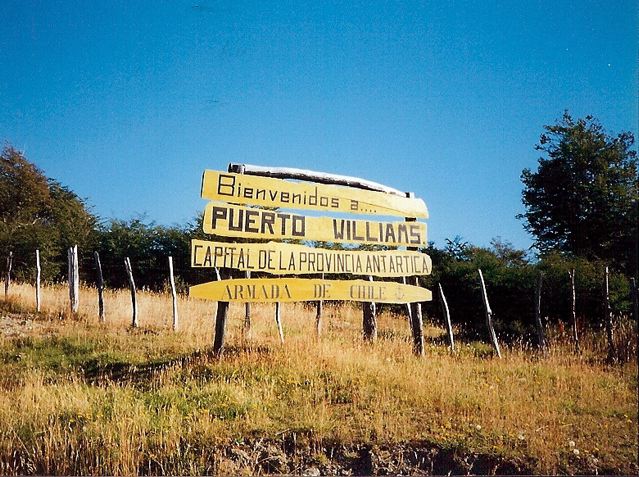
Puerto Williams – the most southerly located town in the world.
Distance: 33 miles (53 km)
Avg.Time: 3 or 4 days
Start / Finish:
- Puerto Williams
- Isla Navarino can be reached by both regular plane and boat services from Ushuaia (Argentina) or Punta Arenas (Chile).
- In 1997 I flew down from Punta Arenas and hitched a ride back to Ushuaia on a yacht. To this day (November 2013), it remains the only time I have ever hitched a lift with a yacht. Have to say, it was pretty cool.
Difficulty: Moderate
Season: December to March
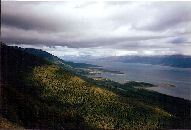
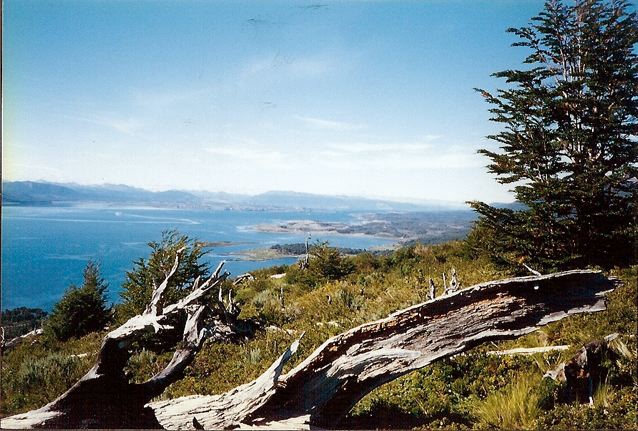
Gazing west over the Beagle Channel.
Dientes Circuit, Isla Navarino
Maps / Info:
- I used the map and trekking notes contained in Lonely Planet Trekking in the Patagonian Andes (1992). The most recent edition of this excellent guidebook came out in November 2009.
- If you are looking for greater detail, try the following two Chilean IGM 1:100,000 maps: Puerto Williams – L #190 and Lago Windhond – L #203. You can purchase these maps in Santiago at the IGM Sales office. Alternatively, click here to purchase online from the IGM website (in Spanish).
- It is possible to buy supplies in Puerto Williams, but you will find a wider range and cheaper prices in Ushuaia or Punta Arenas.
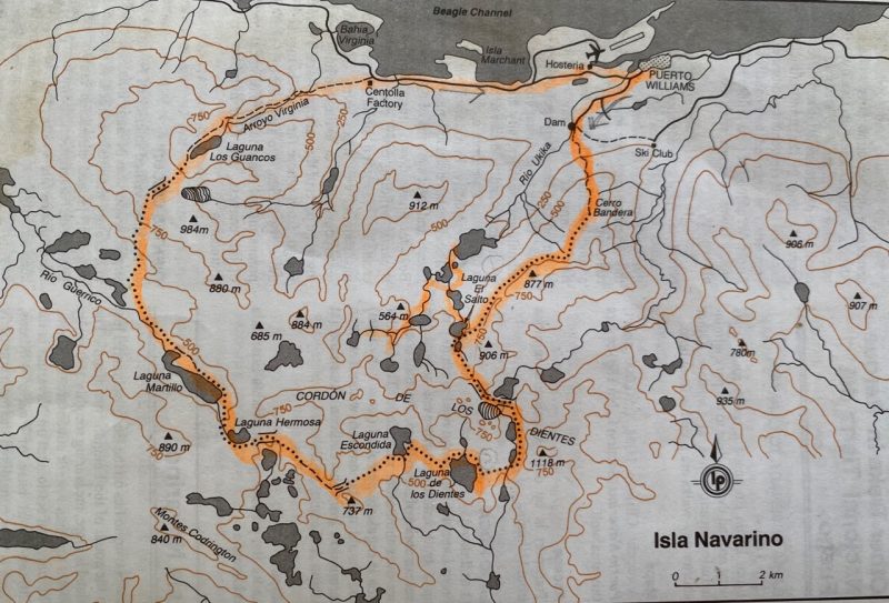
Dientes Circuit Overview Map / From my battered old copy of “Trekking in the Patagonian Andes” (1992).
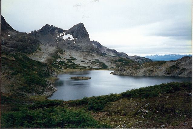
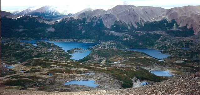
Laguna de los Dientes
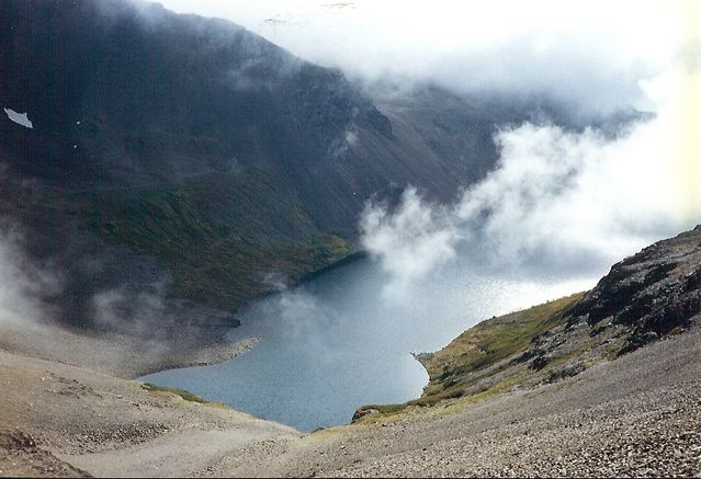
Laguna Los Guanacos
Route / Conditions:
- The route is reasonably well marked throughout. A combination of cairns, paint splashes and the occasional bit of tape/ribbon shows the way.
- Much of the trek is above treeline. Navigating is not difficult in fine conditions, however, due to the notoriously unpredictable nature of weather patterns in this part of the world, careful attention should be paid to route finding at all times. Proficiency with map and compass is a must.
- The one negative of this hike is the prevalence of beaver ponds and dams throughout the island’s valleys. It is estimated that there are 20,000 of the furry little buggers on the island, and with no predators, both their numbers and negative influence are bound to grow exponentially in the coming decades.
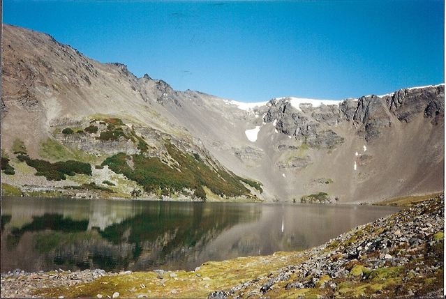
Laguna Los Guanacos
The final stretch east back to Puerto Williams.
- From a hiking perspective, this means some of the circuit’s low-lying areas are often waterlogged and very muddy.
- Any water taken from such low-lying sources should be purified or treated.
Sleeping:
- No huts. Bring your own shelter. Be sure that it will hold up in the harshest of conditions.
Overview:
- Jagged rock pinnacles, hundreds of lakes and gorgeous views throughout. Outside of Antarctica, the world’s most southerly hike.
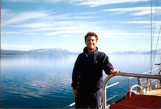
Hitching back to Ushuaia on a private yacht.
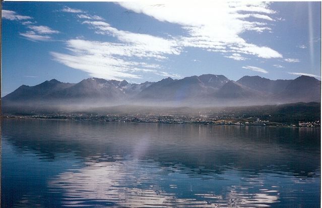
The Beagle Channel was uncommonly tranquil the day I returned to Ushuaia.