Scotland’s Isle of Skye is a place steeped in myth, legend and natural beauty. Tales of giants and shape-shifting water horses are woven together with stories of dramatic mountain ranges and coastlines. It is an island that engages and inspires all that visit, and for those possessed of a wayfaring disposition, there is a 128 km (80 mi) trail which spans its length that encapsulates all of the diverse wonders for which it is renowned.
I hiked the Skye Trail in the summer of 2018. The post below includes impressions from the trip, logistical and background information, route recommendations, and a gear list.

Skye Trail Overview Map (Cicerone Guides) | Note: I added the place names in bold red font.
At a Glance
Distance : 128 km (80 miles) approx.
Duration : 6 or 7 days
Difficulty: Moderate
Start / Finish :
- Broadford (South) – Rubha Hunish (North).
- Which direction should I go?: I hiked from south to north. The directional choice seemed like a no-brainer, as theoretically the prevailing winds are at your back (assuming they are prevailing), and the combination of the Trotternish Ridge and Rubha Hunish makes for a more dramatic finale than the village of Broadford. In its defence, Broadford does have a pretty good chipper on the waterfront.
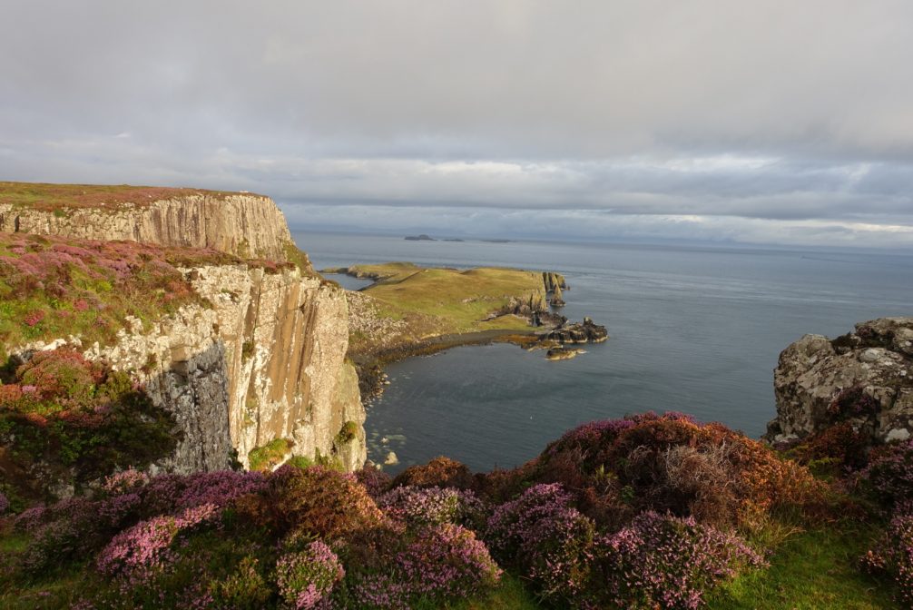
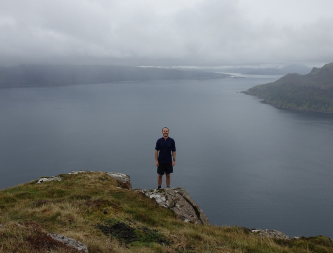
Looking towards Rubha Hunish, the northernmost point of the Isle of Skye.
Getting There & Away:
- Both trailheads are accessible via public transport (buses). Regular Citylink buses travel to the Isle of Skye from Glasgow and Inverness, stopping in Broadford. The northern terminus can be accessed via the local bus service operated by Stage Coach. .
Season / Weather :
- April to September. Even by Scottish standards, – which are very high – the Isle of Skye is a wet place. Indeed, its name is said to derive from the Norse word Skuyö or “Isle of Clouds”; an etymological heads-up if ever there was one.

Camped below the Trotternish Ridge.
Maps, Guidebooks & GPS
Although unmarked, the Skye Trail is generally not too difficult to follow. The notable exception being when it is absolutely belting down with rain and foggier than a Swiss banker’s memory post-1945:
- Guidebooks: 1. Helen & Paul Webster, The Skye Trail (Cicerone Guides) – Trekking notes, history, maps, resupply and accommodation information. Available in Kindle or paperback. I used the electronic version along with the Harvey Map (see below) during my hike; 2. Cameron McNeish & Richard Ilse, The Skye Trail: A Journey through the Isle of Skye – McNeish is the Skye Trail’s founder and one of Britain’s most respected backpacking authorities. I haven’t personally seen this hardcover book, but going by the online reviews, it looks like it would make for a great post-hike memento.
- Maps: Harvey Maps, The Skye Trail. Lightweight, waterproof, lots of details; along with a compass and/or GPS, all you need for navigation purposes.
- GPS Data: Walk Highlands has GPS data for all seven stages of the Skye Trail.
- Online Resources: 1. The Walk Highlands website is an excellent resource for all things Skye Trail and the Scottish Highlands. Trip reports, photos, logistical information, etc. In fact, if I was you, I’d forget about the rest of this article and go there without further ado; 2. Alex Roddie, Backpacking the Skye Trail – Informative trip report from the online editor of TGO magazine.
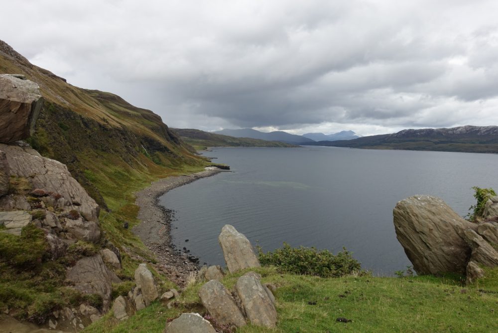
Day 1 – Overlooking Loch Eishort.
General Information
- How long will it take?: The time needed to complete the Skye Trail can vary depending on the weather and route choices, as well as the fitness, pack weight and goals of the said hiker. Speedy ramblers carrying a light load can do it in four to five days. Slower, more heavily laden hikers and/or those that are simply interested in doing as many side trips as possible, may take up to seven or eight days. I ended up taking five, which included the Bad Step / Loch Coruisk alternate, along with a couple of out-and-back side trips to the summit of Sgurr na Stri and Bonnie Prince Charlie’s Cave.
- Accommodation: Most Skye Trail hikers take a hybrid approach, combining wild camping with overnight stays in villages or bothies (free mountain huts) along the way. Indoor accommodation can be procured at Torrin, Elgol, Sligachan, Portree and Floodigarry. See the Cicerone Guide or the Walking Highlands for accommodation details. Note that during the Isle of Skye high season of July and August, you will likely need to book all village/town accommodation in advance (Note: Portree has an affordable campground situated 15 minutes walk from the town centre. It has washing machines, wifi, but no on-site shop or indoor cooking facilities).
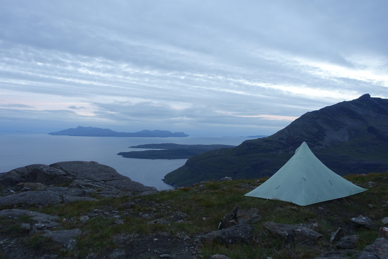
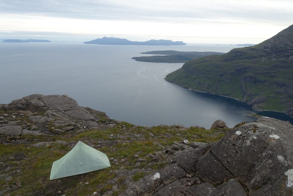
Looking out towards the Isle of Rum from my campsite on Sgurr na Stri.
- Skye Weather: Irrespective of when you hike, strong winds, precipitation and foggy conditions are likely. A decent rain jacket and a storm-worthy tent are essential. A good dose of stoicism and an ironic sense of humour will also come in handy. On that note, one of my favourite moments from the hike came while I was resupplying in the Co-op supermarket in Portree. After purchasing food for the final 1.5 days of the hike, I realised that I should probably pick up an extra plastic bag in which I could temporarily store some of my wet items. I searched my pockets for a 5 or 10 pence coin to pay for the bag without success. Just as I was getting ready to say “don’t worry about it”, an elderly local lady that had been waiting patiently behind me in the queue, produced the needed cash along with the following gem (spoken in a thick Scottish brogue): “The weather may be crap, but you really can’t beat the hospitality.”
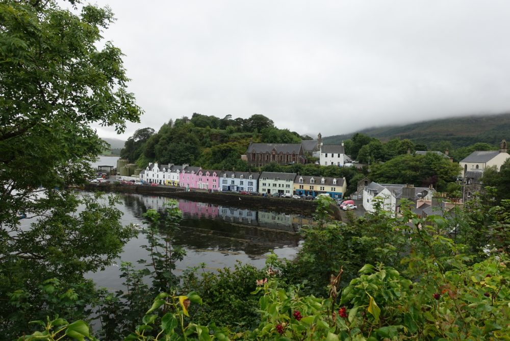
Day 4 – The picturesque harbour of Portree. Love that pink house.
A brief respite from the rain during the section between Portree and the Old Man of Storr on Day 4 of the Skye Trail.
- Resupply: Unless you choose otherwise, you shouldn’t have to carry more than a day or two’s food during the Skye Trail. Both Broadford and Portree have supermarkets, and you can also buy food at Torrin (Blue Shed Cafe), Elgol (small shop), Sligachan (hotel / pub food) and Flodigarry (hostel). See the Cicerone Guide and Walking Highlands website for details.
- Water: I didn’t treat any of my water while in Scotland and had no issues. That said, there are parts of the Skye Trail that pass by human settlement and grazing animals. In such areas it is generally recommended to treat all water taken from streams and rivers (see Intestinal Disorders in the HEALTH & SAFETY section of the website).
- Costs: Scotland isn’t cheap. However, wild (and free) camping is possible along most of the Skye Trail, and groceries aren’t too expensive when purchased in supermarkets. For those on a very tight budget, I’d suggest the following (going in a Northbound direction): 1. Bring provisions for the first few days from the mainland; 2. Stock up at the Co-op in Portree for the final two or three days; 3. Stay at the Torvaig Caravan and Campsite in Portree, which has hot showers, as well as washing and drying machines.
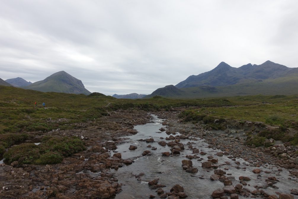
Glen Sligachan.
Fauna
- Sea Eagle: The Isle of Skye is the best place to spot Britain’s largest bird of prey, the Sea Eagle (also known as White tailed eagle). Measuring up to 0.95 cm (3.1 ft) in length and with a wingspan of 2.4 m (8 ft), the Sea Eagle was hunted into extinction in the UK by the early 1900’s, but has been reintroduced to Scotland since 1975 from Norway. Since that time, the bird – which is the fourth largest eagle in the world – has staged a successful recovery, and as of 2016 there were 106 pairs with experts predicting a rise to 221 pairs by 2025.
- Midges: Off the top of my head, I can’t think of another creature whose name is more commonly preceded by the terms “bloody” or “f……ing” than the Highland Midge. These maddening flying insects are the bane of Highland hikers every year from late spring to late summer. During this period, an ultra-fine mesh head net – the little blighters can get through regular mosquito head nets – is worth its weight in gold.
- Highland Cattle: It’s hard not to smile when you think of these shaggy, Cousin It-like quadrupeds. While hiking the Skye Trail I discovered that a group of Highland cattle are known as a “fold” instead of a “herd.” This is because during the winter months in centuries past, they were brought together at night in open stone shelters called folds. This afforded them protection from wolves and severe weather.
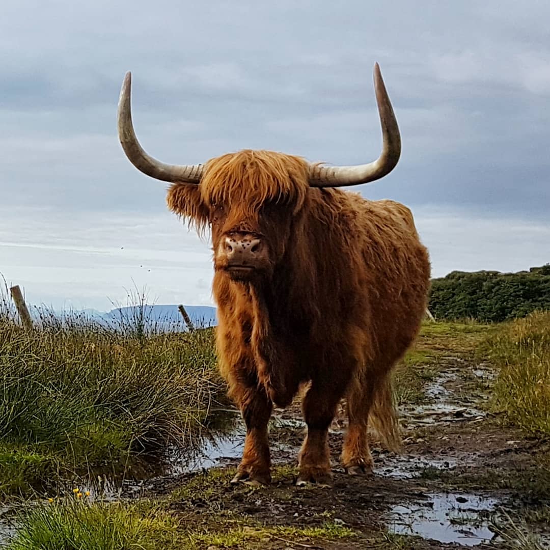
Highland Standoff with shaggy local.
Route – Character, Alternates & Highlights
The Skye Trail is unmarked, sometimes remote, and best suited to fit and experienced ramblers. The route follows a diverse course along rugged coasts and exposed mountain ridges, passing through storied glens and deserted villages with tragic histories.
- Route Choices: In the summer of 2018 I followed the standard route described in the Cicerone Guide, with the exception of taking the Bad Step / Loch Coruisk alternate, which departs the main trail at Camasubary. This variation isn’t described in the book, however, it is marked on the Harvey Map. If the weather is halfway decent, I would highly recommend it as a more scenic alternative to the standard Skye Trail route via Loch na Creitheach.
- If I was to do the Skye Trail again, would I do anything differently?: The only thing would be to take the Bla Bheinn alternate (which is described in the guide book), rather than the coastal route via Elgol. As a history buff, this time around I wanted to check out Prince Charlie’s cave (see below), however, in clear conditions the route over Bla Bheinn would make for a more challenging and scenic option.
- Boreraig and the Highland Clearances: Not long after departing the southern terminus of Broadford, the Skye Trail passes through the haunting village of Boreraig. One of the most well-preserved relics of the Highland Clearances, Boreraig was abandoned in 1852, when landowners forcibly removed their tenants in favour of more profitable sheep farming. Walking among the ruins, makes for a somber reminder of one of the darkest periods in Scottish history when during the 18th and 19th centuries thousands of evicted Highlanders were relocated to places as far off as Australia and New Zealand.
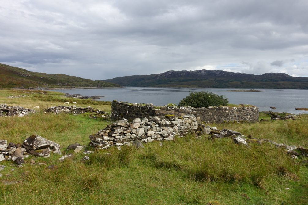
Day 1 – The abandoned village of Boreraig overlooking Loch Eishort.
- Bonnie Prince Charlie’s Cave: From the seaside village of Elgol, history buffs can make a four kilometre (2.5 miles) out-and-back side trip to Bonnie Prince Charlie’s cave, where in 1746 the elusive Prince took refuge on his final night in Skye before escaping the following day. The cave is accessible a couple of hours either side of low tide.
- The Bad Step / Loch Coruisk Alternate: The Bad Step is a deep crack in a sloped rock face, situated some five or six meters above Loch na Leachd. “How bad is it?” If you have a decent head for heights and your balance is ok you will likely skip across (assuming it’s not blowing a gale and pouring with rain). On the other hand, if your knees wobble and cheeks pucker at the thought of a bit of exposure, then you may want to consider going with the standard Skye Trail route via Loch na Creitheach.
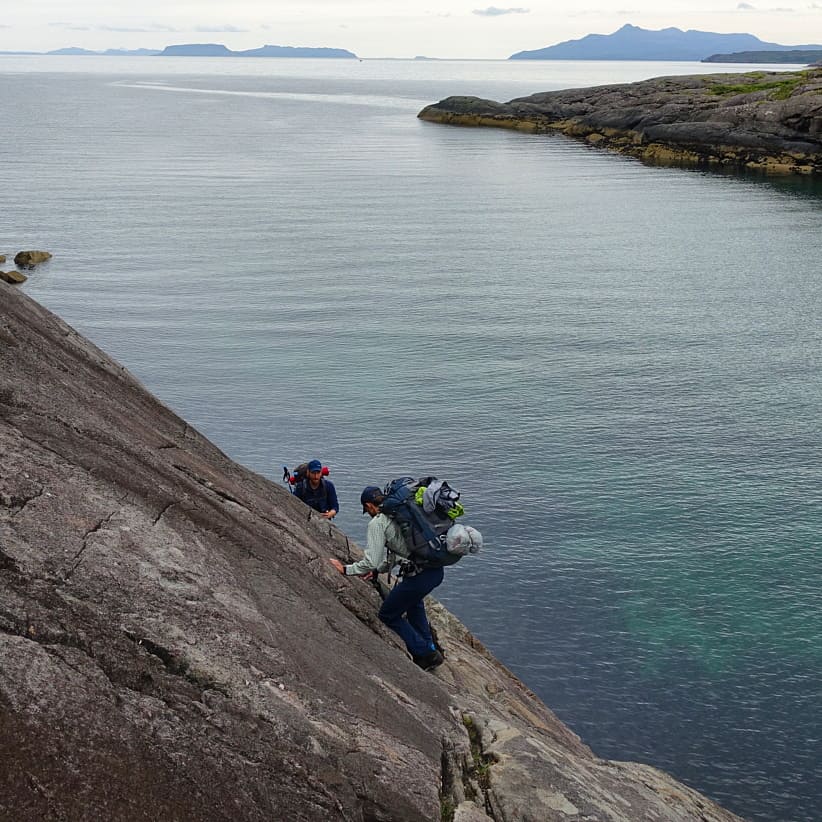
The Bad Step.
- Loch Coruisk For centuries this beautiful Scottish lake has inspired writers (Walter Scott), landscape painters (Sidney Richard Percy) and wayfarers alike. According to legend, Loch Coruisk is also home to a shape-shifting water horse known as the “Kelpie”, who when not in equine form, sometimes assumes the guise of a grey and wizened old man. Almost every large body of water in Scotland has a Kelpie story associated with it. The most famous of them all relates to “Nessie”, the elusive and beloved monster of Loch Ness, situated some 106 km (66 miles) west as the crow flies from Coruisk.
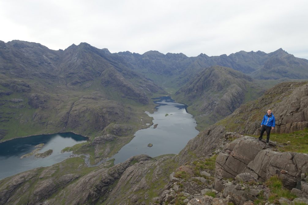
End of Day 2 – Overlooking Loch Coruisk.
- Sgurr na Stri: After negotiating the Bad Step and skirting the shores of Loch Coruisk, I made my way to the summit of Sgurr na Stri (494 m / 1621 ft). With a relatively clear forecast on the cards, I decided to camp on this scenic high point. It ended up being a great choice, and I was rewarded with spectacular views over not only Coruisk, but also the Isle of Rum and the coastline stretching back towards Elgol. This turned out to be my last night of fine weather on the Skye Trail, and I couldn’t have asked for a better spot from which to enjoy it.
Day 2 campsite on the summit of Sgurr na Stri.
- The Old Man of Storr: The most famous landmark on the Isle of Skye is the Old Man of Storr. Located about 10 km (six miles) north of Portree, these spiky rock pinnacles are set amid rolling green hills and look out upon the beautiful Sound of Raasay. Featured in postcards, guidebooks and Ridley Scott’s 2012 sci-fi thriller, Prometheus, the Old Man of Storr was formed from an ancient landslide and was so named because the rock outline and the protruding basalt pinnacle resembles that of the face of an elderly man with a very big nose. Unfortunately, the weather wasn’t great when I arrived, and after waiting/shivering patiently in the rain, wind, and thick fog for about an hour, I finally moved on. The Wikimedia photo below shows what the Old Man looks like in somewhat clearer conditions:

The Old Man of Storr – That’s the nose on the far left (Photo – Wikimedia Commons – David Ilff / License: CC-BY-SA 3.0)
- The Tempest on Trotternish Ridge: In clear weather, this 28.5 km (17.8 mi) section of the Skye Trail affords jaw-dropping vistas, and the chance to observe sea eagles winging their way around the skies above. At least that’s what I’ve been told. My Trotternish experience was a little different (but by no means uncommon). For about 75 percent of this exposed ridge walk, I hiked through thick fog and was buffeted by constant driving wind and rain. In short, I saw bugger all. In such conditions, when setting up your shelter is not an option and there are no practical bailout points, there is nothing for it but to keep a steady pace, a positive attitude, and make sure you stay on course. So that’s what I did.
Camped at the base of the Trotternish Ridge.

Day 5 – Looking south along the Trotternish Ridge during a brief respite from the weather.
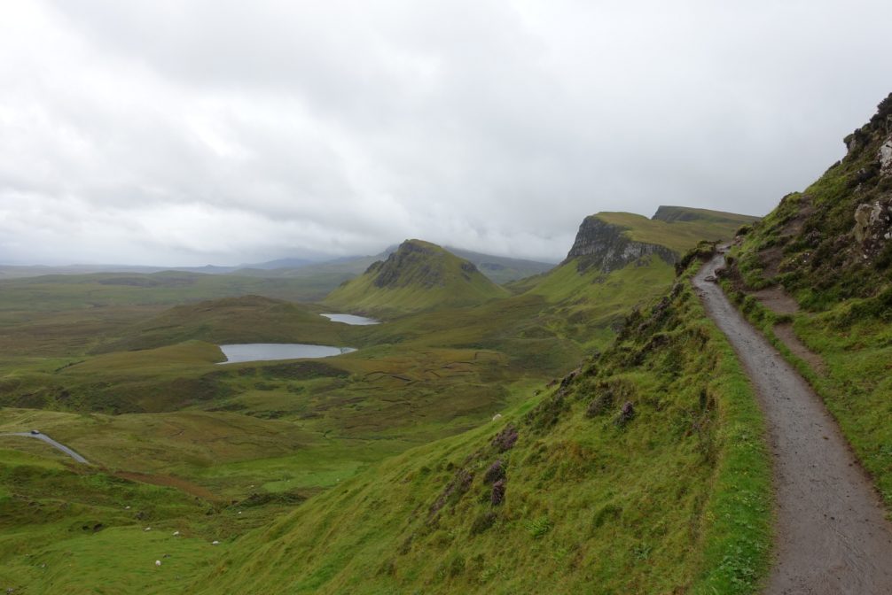
Day 5 – Clear section of trail along The Quiraing | Day 5.
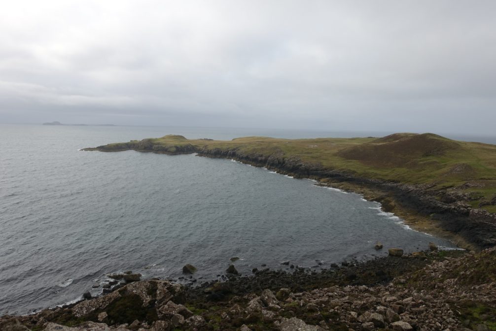
- The End: Rubha Hunish represents a wonderful finale to the Skye Trail; a dramatic headland from which hikers are afforded beautiful views over the chilly waters of the North Sea. If your timing is just right, it is said that you may even spot dolphins swimming off the coast, or even a passing pod of killer whales. I saw neither one of those things, but that was ok. The rain had momentarily stopped, I had the northernmost tip of the island all to myself, and I’d just finished a memorable five days of hiking on the Isle of Skye.
- The End – Part 2: Immediately after finishing the trail, I enjoyed a fun night at the Rubha Hunish Lookout bothy with an entertaining couple from Poland. Not surprisingly they had packed in a bottle of vodka; which they generously offered to share with yours truly. As I sat there drinking and joking with these two strangers that soon became friends, three things came to mind: 1. The deep sense of appreciation that I feel after every hike; 2. In all my years of travelling – including a few weeks in Poland itself back in 2002 – I’d never met a Pole that didn’t enjoy a vodka or four, and; 3. With the wind howling and the rain pouring down outside, I was very glad to be dry and warm inside the cozy, if somewhat cramped, confines of the bothy.

The lookout bothy at Rubha Hunish.
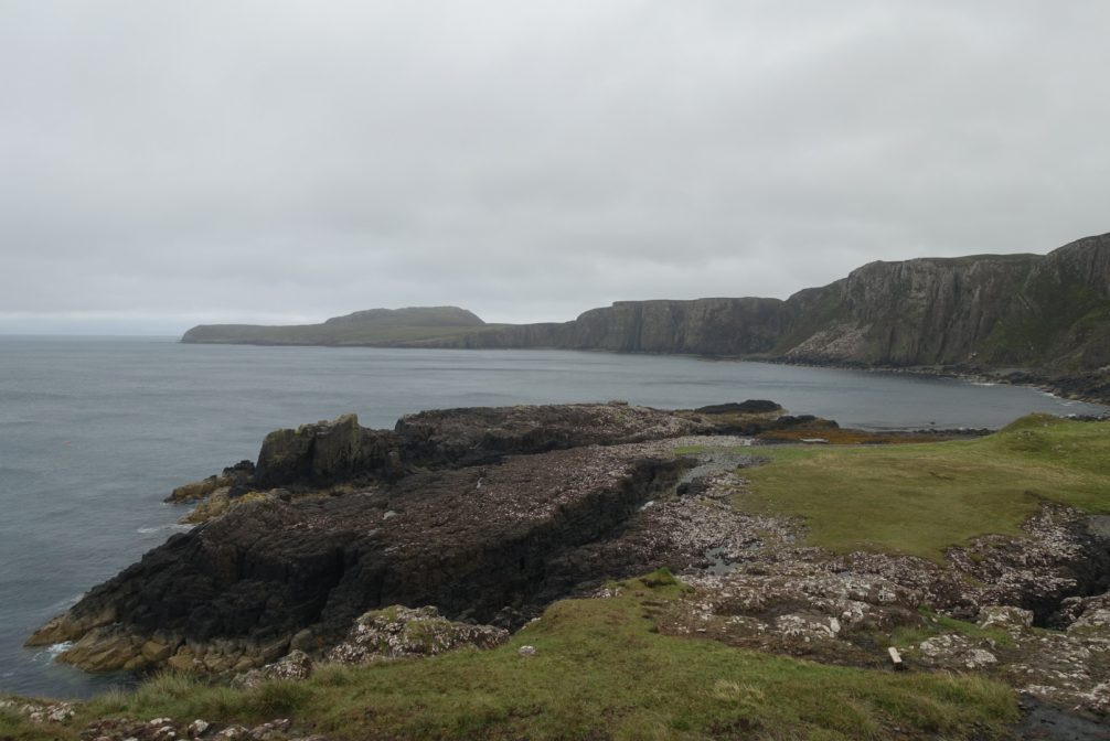
Looking back along the cliffed coast from Rubha Hunish.
The northernmost tip of the Isle of Skye.
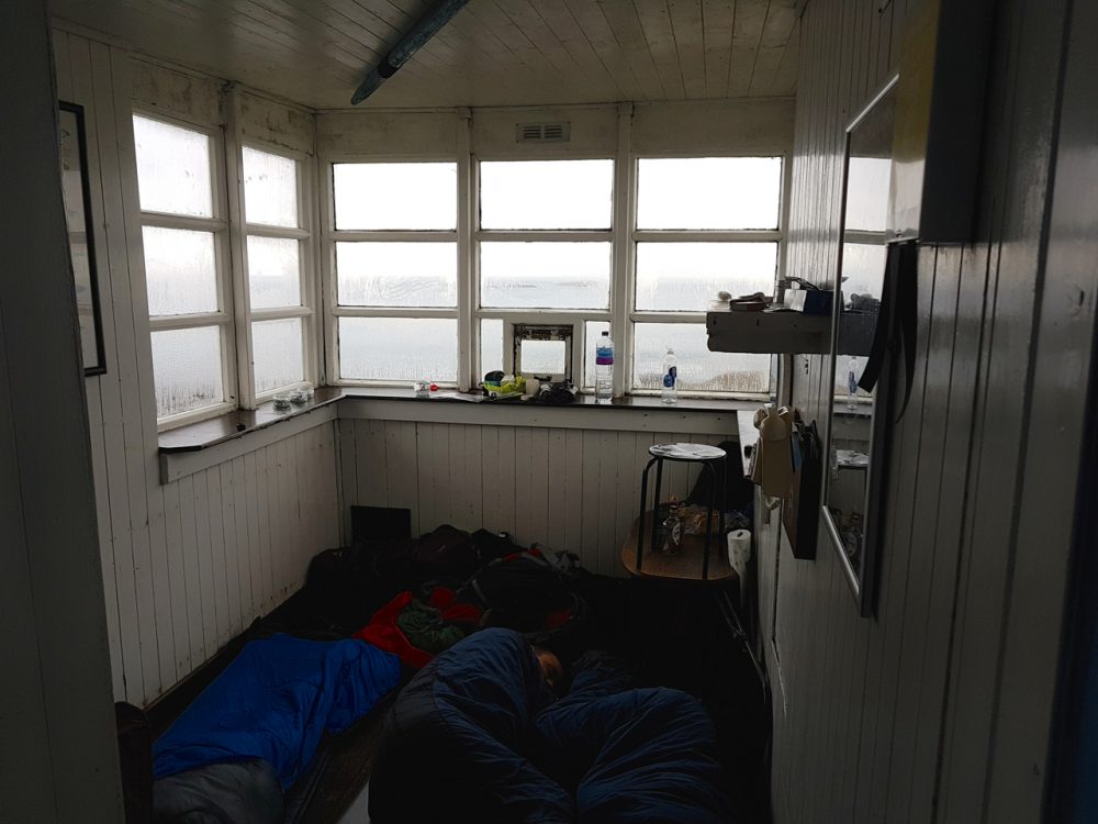
Sleeping Poles | Rubha Hunish bothy.
Skye Trail Gear List
Overall I was happy with my gear selections. I was never uncomfortable during the hike, and felt prepared for any meteorological scenario that may have occurred. My base weight for the Skye Trail was 8.7 lbs (3.93 kg), and the total weight came in at 11.8 lb (5.34 kg).
| ITEM | WT. (OZ) | SUB (oz) | SUB (kg) | COMMENTS |
| BACKPACK | ||||
| MLD Burn | 14 | |||
| Pack Liner (Trash Compactor Bag) | 2 | Cheap & effective | ||
| 16 | 0.4 | |||
| SHELTER | ||||
| MLD Duomid (0.75 DCF) with Solomid Silnylon Innernet. | 24 | Upsized from the Solomid XL for a little more space on what promised to be a cold and wet trip / Very quick set up / Holds up well in a storm. | ||
| Guylines – Kelty Triptease | 1 | Guyline of choice for many years. | ||
| Stakes – Mix of sizes & styles (8) / Mostly MSR Groundhogs | 2.8 | Groundhogs are great; in addition to their durability, the red colour makes me less likely to lose them than the generic silver. | ||
| 27.8 | 0.79 | |||
| SLEEPING SYSTEM | ||||
| Pad – Thermarest NeoAir XLite (Regular) | 8 | Very comfy / Doubles as makeshift framesheet for pack / Put feet on backpack when sleeping. | ||
| Quilt – Katabatic Palisade 30 | 18.4 | Conservatively rated 30°F. Quilt of choice for three season conditions since 2011. | ||
| 26.4 | 0.75 | |||
| KITCHEN | ||||
| LokSak 20×12 (Food Bag) | 1.2 | Food storage bag of choice for hundreds of nights / Seals usually start to go after about six weeks of regular use. | ||
| Gatorade Powder Container | 1.8 | For many years my rehydrating vessel of choice when going stoveless. | ||
| Toaks Titanium Spork | 0.3 | Top end wrapped in orange tape so I won’t lose it. | ||
| Bic Lighter | 0.2 | |||
| Reconstituted sports drink bottles (2) | 2.4 | |||
| 5.9 | 0.17 | |||
| FIRST AID / HYGIENE | ||||
| Sunscreen (repackaged in tiny btle.) | ||||
| Hand Sanitizer (repackaged in dropper btle.) | I haven’t had a case of the backcountry trots since 1999…….I think a big reason is diligent use of hand sanitizer. | |||
| Aquamira (repackaged in dropper btles.) | ||||
| Mini Toothbrush | ||||
| Toothpaste (mini tube) | ||||
| Dental Floss | Doubles as sewing thread | |||
| Antiseptic Wipes (2) | Clean cuts / wounds | |||
| Gauze | ||||
| Triple Antibiotic Cream (tiny tube) | ||||
| 3M Micropore Medical Tape | Breathable, paper tape / Adheres well. | |||
| Ibuprofun (8) | Vitamin “I” | |||
| Toilet Paper | ||||
| Sewing Needle | One armed blind folks can sew better than me. | |||
| Duct Tape, Mini Tube Super Glue (repairs) | To compensate for lack of sewing skills | |||
| Nivea Lip Balm SPF 30 | Kept with sunscreen & hand sanitizer in shoulder pocket. | |||
| 5 | 0.14 | |||
| CLOTHES | ||||
| Rain Pants – Montbell Versalites | 3.6 | Lightweight, quick drying, and a surprising amount of warmth for something that weighs less than 4oz / Not super durable. | ||
| Rain Jacket – Montbell Torrent Flier | 8.6 | |||
| Insulation – Montbell Chameece Inner Jacket | 8.8 | I’ve owned this fleece for the last four years / Ideal insulation layer for Scotland in summer – warm enough, not too heavy and performs well when damp. | ||
| Wind Shirt – Montbell Tachyon Anorak (old model) | 1.9 | After more than a decade of using Montbell wind shirts, the warmth to weigh ratio of these items never ceases to amaze me. | ||
| Extra Socks – Darn Tough Hiker Micro Crew | 2.6 | Three years old and still going strong. | ||
| Dirty Girl Gaiters | 1.3 | Helped keep mud out of my trail runners. | ||
| Bandana (1) | 0.5 | Towel, neck/face protection, condensation wipe, convenience store holdups when low on cash. | ||
| MLD eVent Rain Mitts | 1.2 | Outer Layer for hands. | ||
| Montbell Chameece Inner Gloves | 0.9 | All-time favorite liner gloves. Unlike pretty much every other pair I have used, they are fairly durable. | ||
| Warm Hat – Montbell Chameece Beanie | 1.1 | Excellent beanie / Not too thick / Stretchy enough to fit my noggin / Doesn’t seem to be available in the US at the moment. | ||
| Head Net | 1 | |||
| 31.5 | 0.89 | |||
| MISCELLANEOUS | ||||
| Phone – Samsung Galaxy S7 (Unlocked) | 5.4 | Good photos & Video / Have used an unlocked phone in recent years, to avoid heavy roaming charges when overseas. Just pick up a different SIM in each country and pay local rates. | ||
| Camera – Sony RX100 3 | 10.2 | After a couple of years of using my phone, I bit the photography bullet and upgraded. Happy with the results so far. | ||
| Stuff sacks – HMG Cuben Fiber (3) | 2.5 | |||
| Montbell Power Head Lamp | 2 | This headlamp has grown on me | Lightweight, double-click, four settings, good battery life, 160 Lumens max | No longer miss my old Black Diamond Spot. | ||
| Wallet/Credit Cards/Passport | 0.7 | Used thin plastic card holder as Wallet | ||
| Swiss Army Classic | 1.3 | |||
| Suunto M-2D | 1.2 | Lightweight, adjustable declination; compass of choice for years | (Note: No longer made. Will upgrade to Suunto M3 Global in near future). | ||
| Wall charger, cover, cord | 3 | |||
| Small LokSaks for Valuables (2) | 1 | Protection for phone, charger, wallet | ||
| 27.3 | 0.77 | |||
| BASE WEIGHT | TOTAL | 8.7 lb | 3.93kg | |
| ITEMS WORN | ||||
| Shorts – Patagonia Baggies 7″ | 6.7 | Cut out the liners. | ||
| Base layer – Montbell Merino Long Sleeve Zip Neck | 5.9 | Great baselayer / Not too thin, not too thick / Spot on for shoulder season conditions. | ||
| REI Merino Wool Liner socks | 1.6 | Still my favourite Merino liners after more than a decade / Cheaper and more durable than the big sock companies. | ||
| Hat – Adapt-a-cap | 2.5 | Back from the dead. Had it repaired and sewed up. Not as good as new, but still functional / From what I’ve seen, the latest models have a different design, and aren’t in the same league as the old ones. | ||
| Shoes – Brooks Cascadia 12 | 24 | 500 miles per pair / The Cascadias have returned to form since the 11th incarnation. | ||
| Fizan Compact – Hiking Pole (1) | 5.6 | Tent setup / Fencing practice during breaks……Tokyo 2020 here I come. | ||
| Timex Ironman Watch | 1.5 | Light, cheap, durable, reliable. | ||
| Sunglasses | 2 | Polarized lenses / 100% UV Protection. | ||
| 49.7 | 1.41 | |||
| TOTAL WEIGHT | 11.8lb | 5.34 kg | ||
Disclosure: This post contains some affiliate links, which means The Hiking Life receives a small commission if you purchase an item after clicking on one of the links. This comes at no additional cost to the reader and helps to support the website in its continuing goal to create quality content for backpackers and hikers. Cheers.
Discover more from The Hiking Life
Subscribe to get the latest posts to your email.
This is excellent, thank you! So well written. We did the Eastern Dolomites this summer and I feel inspired to write my own blog! I did a short one – Me and My Pozze Smeraldine, but it only talks about one day!
That Bad Step looks like a truly AWFUL step. Yikes. But the photos are lovely and bring music to mind. I would freeze to death in the clothing you had, in that damp chill. Did you ever actually need the sunscreen? And I wonder about bug dope for those midges, or you just tucked in all the edges of things. Were they constant or localized?
I found the clothing I took to be appropriate for the conditions. I did use the sunscreen on the first couple of days. I had some bug spray with me, but the combo of rain pants, long sleeve shirt and head net sufficed. Throughout the Skye Trail, whenever the wind stopped blowing, the midges tended to swarm.
Looks beautiful ?
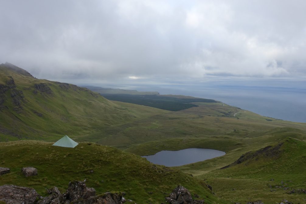
Thanks for the report Cam, brings back great memories of Skye this summer. I went north bound on the Skye Trail on 19 August and the weather was great for the first 2 days. Weather was pretty unrelenting whilst on the Trotternish ridge with driving wind and rain and I decided to go back to Portree the next morning after a sleepless night to dry my stuff and repair a leaky tent. Glad I did because going back to the ridge after a couple of days in town the weather was a complete contrast and the views along the ridge were stunning. Joint highlight with the ridge was Bla Bheinn on a clear but eerily still Monday morning looking across to the Cuillin hills. Is that tent pitched on the ridge near The Old Man of Storr?
Yes, the tent photo was taken just over the ridge from the Old Man of Storr. I dropped down off the trail for about 150 yards or so until I found a flat area.
I hear you in regards to Trotternish ridge. It’s extremely exposed up there and sheltered spots to set up a tent are few and far between. Glad you got to see some great views upon your return!
Cheers,
Cam
I remember stopping near the spot where you pitched the tent because it was the first place I could get a phone signal to check for available hostel accommodation the morning after! My original plan was Skye Trail/Alder Trail (Alex Roddie’s route)/Cairngorms but just ended up staying on Skye due to weather and falling in love with the place. Will there be a trip report for the Cairngorms?
Skye definitely has a magical quality to it. I think the inclement weather just makes you appreciate the moments when the sun comes out even more.
In regards to the Cairngorms, I put together a four day loop around the park. Very much a mixed bag on the weather front. On two of the days it was fairly calm and drizzly and the midges were out in force. On the other days, the weather was similar to what I experienced on Trotternish Ridge. I’ll eventually put together a trip report, but I think first up will be the Cape Wrath Trail.
Very good essay!
Thanks again for another excellent write-up and feeding the stoke. Too windy for an umbrella on this one? Cheers.
Hey Jeremy,
Thanks for the kind words. I took an umbrella on the longer Cape Wrath Trail (which I ended up using on seven of the ten days), but not on the Skye Trail or Cairngorms hike. The latter two are definitely prone to some very windy conditions.
Cheers,
Cam
Great trip report and gear list. Thanks! How crowded is the Skye Trail, and any suggestions for remote, i.e. relatively isolated backpacking trips in the Highlands?
Thanks for the kind words.
“How crowded is the Skye Trail?” I’m not sure of the numbers, but I hiked in August (peak season) and apart from the Old Man of Storr stretch, I never felt there was a lot of other hikers around. Definitely a lot less than the West Highland Way. If I was to do it again and could work it in with my schedule, I’d probably opt for May or September.
As for more isolated backpacking trips in the Highlands, try looking for options on the Knoydart Peninsula.
We are going in June. I want to say that this informative blog has been invaluable to me, and thank you so kindly for putting it all here. I know it took some time, but it has helped me out tremendously with the planning.
Hey Cam!
Any chance you can give an approximate starting and stopping point for each of your 5 days here?
Much appreciated and amazing as always!
Matt
Hey Matt,
If memory serves it broke down as follows…………I started mid-afternoon on the first day and finished a little past Torrin. On Day 2 I camped on Sgurr na Stri. On Day 3 I camped below Trotternish Ridge on the other side of The old Man of Storr. On day 4 it was pissing down most of the day, so I made a spontaneous decision to go back to Portree, eat lots of food and wait out the weather (who was I kidding?). I slept at the campground on the outskirts of town. On the final morning I made my way back out to the Old Man of Storr, and then hiked all the way to the Rubha Hunish Bothy/Lookout. The End.
Cheers,
Cam
Really appreciate it, Cam!! Thanks for the information.
LOVE your report! I’m sold. Planning for 2020 with my daughter and niece.
Great report!
We’ll start The Skye Trail in 9.5.2020 fron North to South.
“Take great care on this section as walkers have fallen here.”from Walkhighlands. This section of the stage (Sligachan to Elgol) are dangerous?
Regards
Oleg
Hey Oleg,
The “danger factor” depends on a bunch of things including the hiker’s balance, pack weight and even the weather. Honestly, I don’t think most folks would consider it overly dangerous.
Cheers,
Cam
Cam,thank you so much.
King Regards
Oleg
Hello, Cam!
There are rodents on The Skye Trail?
King Regards
Oleg
Hi Oleg,
No, rodents aren’t an issue on the Skye Trail.
Cheers,
Cam
Hi’Cam!!
Thank you!!!
Cheers,
Oleg
Hi Cam!
I’m planning on doing Skye Trail in April/May as my first real backpacking trip (after a few days on the West Highland Way), and your report is fantastic for preparation and hyping me up, thanks so much!
All the ‘official’ ratings for the trail say ‘only for experienced hikers’, so I was wondering – Will having the GPS route on my phone, the map, a compass, and the guide, and some previous hiking experience, without much orientation knowledge, be enough? I intend to read up on map markings etc. before the trip, but I will definitely be no expert.
Once again, thanks for the write up, and especially for the equipment list – it helped me fill out some blind spots in my own!
Hi Ida,
Thanks for the message. Given a good run with the weather I suspect you will be fine. That said, clear conditions on Skye seem to be the exception rather than the rule. If you are determined to give it a go, my suggestion would be to wait for a fairly good forecast before tackling the Trotternish Ridge stage (i.e. the most exposed section of the hike).
Best of luck.
Cheers,
Cam
Hi Cam,
thanks so much for the advice, I’ll definitely be careful with the Ridge!
Ida
Hello Cam!
I really appreciate this writeup. It’s incredibly informative and solidified by decision to do this hike. Do you need a permit for this hike? I’ve been looking all around and haven’t been able to find anything that suggested it. Thanks so much!
Devon
Hey Devon,
No permit required.
Cheers,
Cam
Hi Cam, great report! Did the innernet successfully keep out the midges?
More or less 😉