Stretching along the eastern side of Queensland’s Hinchinbrook Island, the Thorsborne Trail is one of the world’s finest coastal walks. Over the course of 32 km (19.9 mi), this family-friendly track includes pristine beaches, lush rainforests, dense mangroves, towering eucalypt forests, and some of the best tropical swimming holes this side of Tahiti. I hiked the Thorsborne Trail in 1997 and again in 2006. The second time around was part of a two-week scuba/hiking trip to the Great Barrier Reef that included one of my all-time favourite dives, the SS Yongala (aka Australia’s Titanic). All photos below are from 2006.

At a Glance
Distance: 32 km (19.9 mi)
Avg.Time: 3 days
Difficulty Level: Easy
Start / Finish: Ramsay Bay – George Point.
Which Direction?: It is possible to hike in either direction. Most hikers go north to south.

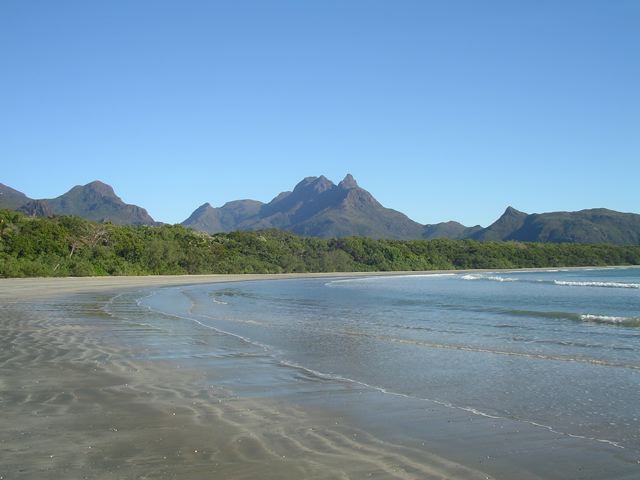
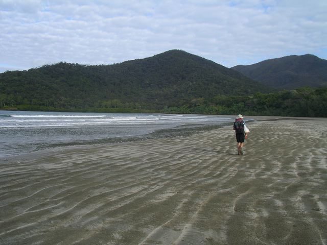
Loping along the beach at Ramsey Bay, near the northern terminus of the Thorsborne Trail.
Getting There & Away:
- Access to the Thorsborne Trail is either by private vessel, launched from Cardwell or Lucinda (Dungeness), or by the commercial ferries which transport bushwalkers to both ends of the trail. Services may vary according to weather, tidal conditions and time of year.
- Boat services to and from the island need to be booked in advance. For all information in regard to company options, prices, and timetables, see the excellent Queensland Government Parks & Forests website.
Season:
- All-year-round. The cooler months between April and September are ideal. Summer means stifling heat and humidity, as well as the possibility of monsoonal rains.
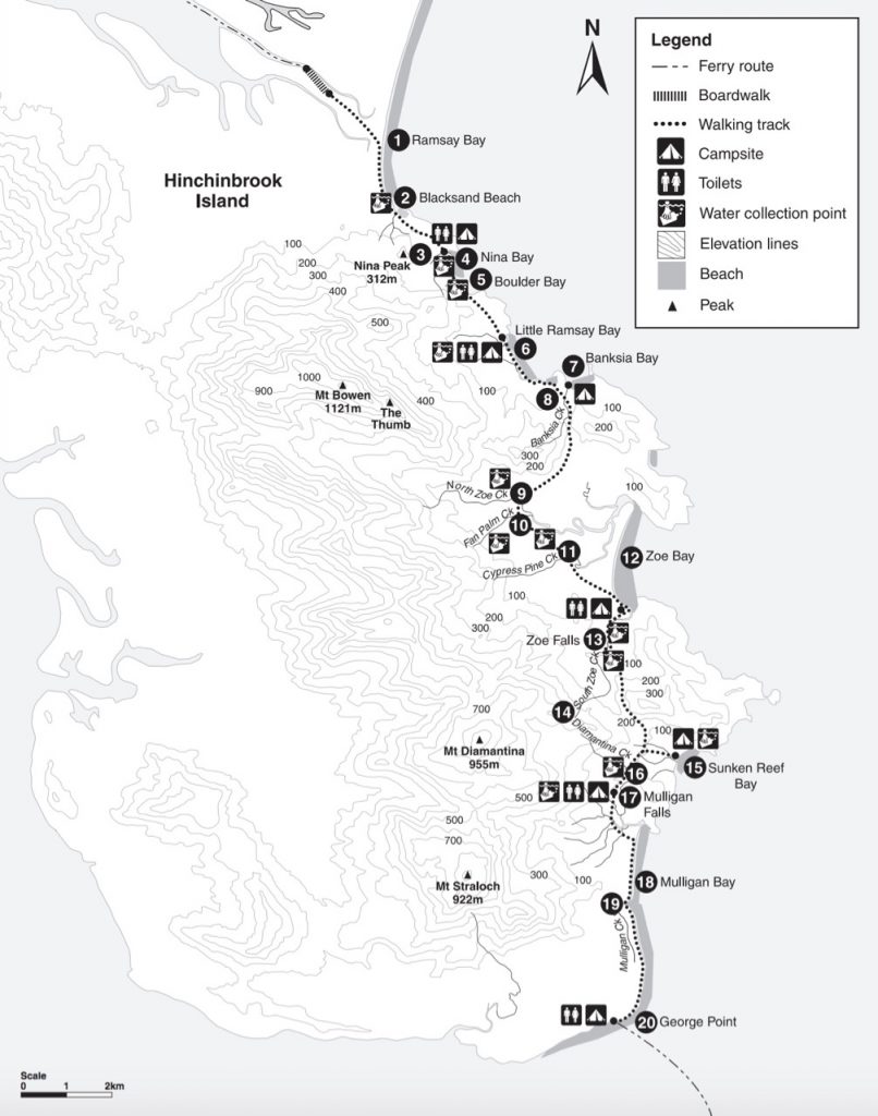
Thorsborne Trail Overview Map (free and downloadable from the QLD Govt. Parks & Forest website)

Maps / Information
- Background: Established in the early 1990s, the Thorsborne Trail takes place on Hinchinbrook Island, one of Australia’s largest island national parks. Part of the Great Barrier Reef World Heritage Area, the island is 37.4 km long, 10 km wide, and is separated from mainland Queensland by the scenic Hinchinbrook Channel.
- Permits: In addition to ferry/boat services mentioned above, camping permits for the Thorsborne Trail also need to be organised in advance. There is a maximum of 40 people allowed on the entire trail at any one time.
- Supplies: Bring everything you need from the mainland. There are supermarkets in both Cardwell and Lucinda.
- Water: Available in most of the island’s creeks, but can become scarce during the dry season. Note that if you can’t find H2O at the trail crossings, you may have better luck further upstream. It is recommended that all water be filtered or treated.
- Map & Trekking Notes: The free and downloadable map on the QLD Government Parks and Forest website is all you need for navigation purposes on this very well marked and maintained track. The trekking notes on the same site provide a good overview of the trail. Note: If you are thinking of doing the excellent side trip to the summit of Mount Bowen (see below for details), it’s advisable to take a topo map and compass, and/or GPS. In regard to the latter, the best option is ABC Maps, 1:50,000 Hillock Point sheet.
- GPS: See Aussiebushwalking.com and Alltrails.com a GPX track for the Thorsborne Trail.
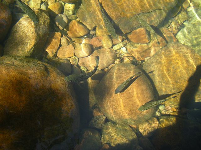
- Flora & Fauna: Hinchinbrook is home to a variety of animals including scrub fowls, skinks, dugongs, white-lipped tree frogs, green turtles, and the one that everyone both wants to see and doesn’t want to see…………..crocodiles.
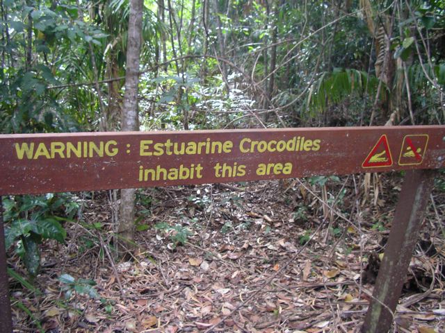
You need to be a little selective about where you go swimming on Hinchinbrook.
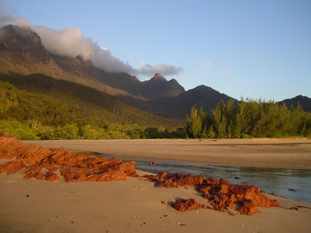
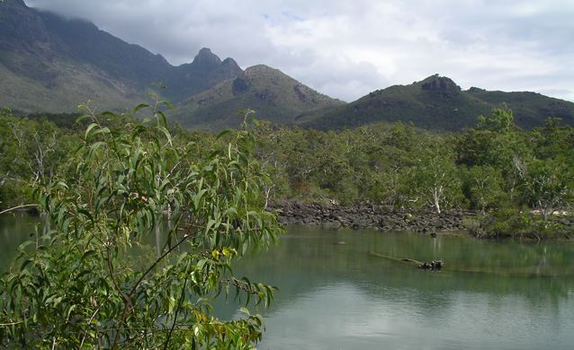
Early morning clouds creep through the island’s mountainous interior.
Route / Conditions
- Signage: The trek is well marked by orange trail markers from north to south, and yellow trail markers from south to north. Rock cairns are also used in areas where trail markers are absent.
- Stages: The QLD government website breaks the trail down into the following stages. At the end of each segment is a campsite and water source: 1. Ramsay Bay to Nina Bay (4 km); 2. Nina Bay to Little Ramsay Bay (2.5 km); 3. Little Ramsay Bay to Zoe Bay (10.5 km ); 4. Zoe Bay to Diamantina Creek (6.5 km); 5. Diamantina Creek to Mulligan Falls Camp (1 km), and; 6. Mulligan Falls Camp to George Point (7.5 km).
Black Sand Beach
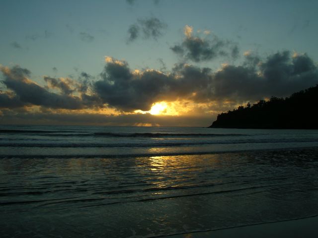
Hinchinbrook sunrise
- Swimming: The beaches along the trail are gorgeous, however, be sure to take heed of any saltwater crocodile warning signs. If you are chomping at the bit for a swim, there are some great, prehistoric reptile-free opportunities to be had at both Zoe and Mulligan Falls.
- Side Trip to Mount Bowen: (Note: I did this worthy out-and-back excursion in 1998, but regrettably skipped it in 2006 due to time restrictions) From Little Ramsey Bay Campsite it’s approximately 13 km (8.1 mi) return to the summit of Mount Bowen, the highest point on Hinchinbrook Island. Departing the camping area, a cairned route makes its way up the rocky Warrawilla Creek bed before eventually ascending to the small North Saddle, where there is space for two tents (you’ll require a special camping permit). From this scenic point, follow the ridge south through scrubby forest, negotiating granite bluffs and some large boulders. When you eventually reach the summit you’ll be greeted by a large cairn, a summit logbook, and a gorgeous 360-degree panorama of Hinchinbrook Island, the largest island on the Great Barrier Reef.
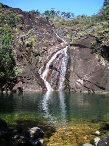
Swimming heaven at Zoe Falls.
Sleeping
- Bring your own shelter. There are seven designated camping areas on the Thorsborne Trail. A maximum of two nights is permitted at any campsite, with the exception of Mulligan Falls, where hikers are only permitted to stay for a single night.
- Due to rats, steel boxes are present at all the main campsites. Be sure to store your food in them at night, lest you wake up in the morning with a hole in your tent and/or pack.
- See the Thorsborne Trail Camping page on the QLD Parks & Forests website for details on each of the respective campsites.
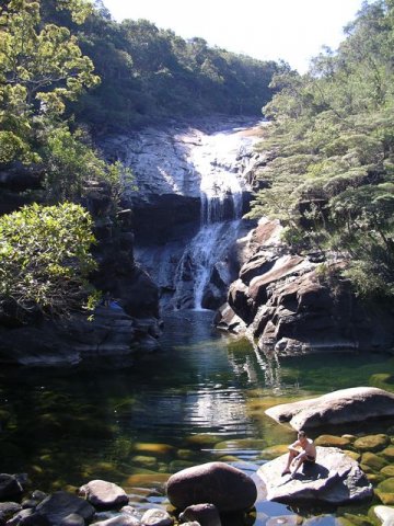
Mulligan Falls
Overview
- The Thorsborne Trail is one of the world’s finest coastal walks.
- Mangroves, pristine beaches, towering Eucalypt forests, rocky headlands, lush rainforest and two of the world’s best swimming holes – there is a lot to like about this trail
- Due to its short length (32km / 20 mi), mellow nature and the logistics of actually getting to and from the island itself, I would definitely recommend taking your time on the Thorsborne Trail. Bring a book and do as much swimming as possible.
Crystal clear water at the base of Mulligan Falls.
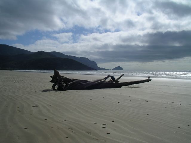
Hiking along the final stretch of beach towards George Point.