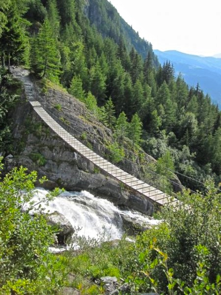
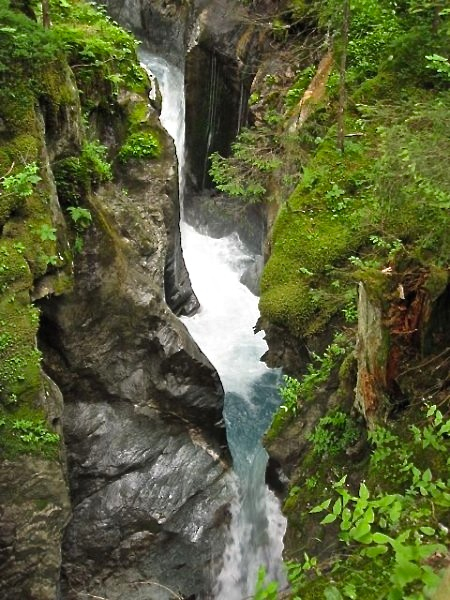
The Tour du Mont Blanc (TMB) is a spectacular multi-day trek around Western Europe’s highest peak (4807 m / 15,771 ft). Passing through France, Italy and Switzerland, it takes the hiker on an alpine tour de force of snow-capped peaks, glacial valleys and beautiful mountain lakes.
I hiked the TMB in 2009. All logistical details have been updated as of January, 2018. Please note that the information below is largely directed towards independent hikers, rather than folks going as part of an organised trekking group (Note: As always, a shout out to pmags.com for the loan of the “Quick & Dirty” heading!).

TMB Overview Map (Cicerone Press)
Details
Distance : 106 miles (170 km) approx.
Avg. Time : 8 – 10 days
Start / Finish :
- The trailhead in Les Houches is located 6 km from Chamonix. Regular bus service available. See Chamonix.net for details.
- Chamonix is one of the world’s biggest outdoor hubs. It’s easily accessed by either bus, shuttle or train. The closest major airport is Geneva. Check out Chamonix.com for a detailed rundown of regional transportation options.


Season :
- The ideal time to hike the Tour du Mont Blanc is late June to September. If possible, try to avoid August, when the trail can be crowded due to the French school holidays.
- Afternoon thunderstorms are common during the summer months.
- Late June/early July is best for mountain flowers and September is traditionally the driest month of the year. Late September brings with it cooler nights and the beginning of the fall foliage season.

Maps & Information :
- Online: To get things started on the TMB planning front, take a look at the following websites: Besthike.com, Autour du Mont Blanc, Alpine Exploratory and Chamonix.net.
- Guidebook: During my 2009 hike, I used the Tour du Mont Blanc guide book by Trailblazer Publications. For such a well marked and easy to follow route, I found its sketch maps and trekking notes to be sufficient for navigational purposes. It also provided a good source of information on accommodation, flora, fauna and the general history of the area.
- Guidebook: For a more up-to-date guidebook option (2015), try The Tour of Mont Blanc, by Cicerone Press. Its author is the prolific outdoors writer, Kev Reynolds, a man who has written dozens of hiking guidebooks since the 1970s.
- Topographic Maps: If you are thinking of doing some side trips, I recommend picking up the following two IGN 1:25,000 maps: 3630 OT Chamonix/Massif du Mont Blanc and 3531 ET St. Gervais-Les Bains / Massif du Mont Blanc.
- GPS: See GPSies – Hiking Trail Tour du Mont Blanc for free to download GPS information.
- Language: A basic knowledge of French comes in handy, however, most of the locals along the way know at least a little bit of English.

Route / Conditions :
- Signage: The trail is well marked with red and white blazes.
- Current Status: For online information about current trail conditions see Autour du Mont Blanc.
- Navigationally simple though it might be, the Tour du Mont Blanc is still a challenging hike due to the amount of ascent and descent involved. Over the course of the Tour, walkers will negotiate more than 11,000 m (36,089 ft) of combined altitude gain and loss.
- Resupply: Loads of options. Even if you are camping, there is no need to carry more than a day’s food at any stage of the hike. See the aforementioned guidebooks for all the details. If you’re a foodie, you’ve chosen the right hike!
- Water sources are plentiful throughout the walk. Treat any water taken downstream of human settlement, grazing animals or agriculture (see Intestinal Disorders in HEALTH & SAFETY).

- Tip: As with the Haute Route, more than 90% of Tour du Mont Blanc hikers seem to be part of organized trekking groups. From what I could tell, most of these parties seem to begin their hiking day around 8 am and finish about 2 to 4 pm. For the independent hiker this is a bit of a boon, as the trail is virtually people-free during what I consider to be the best times of the day (i.e. early morning and late afternoon). That being the case, my advice is to get out on the trail around dawn, enjoy a swim and/or a big lunch (in that order) in the middle of the day, and then hike until dusk.
Sleeping :
- A wide range of accommodation options are available throughout the walk. Huts, hotels, hostels & Bed & Breakfasts. See either the Trailblazer or Cicerone Guidebooks for details.
- For online accommodation information, check out Autour du Mont Blanc.

- Due to the wide range of options available, it seems as if 90 – 95% of hikers stay exclusively indoors on the Tour du Mont Blanc. The mountain huts in particular, are often packed during peak season. For that reason alone, I suggest carrying your own shelter (Note: It’s way cheaper as well ? ).
- Although officially discouraged, “wild” camping is tolerated as long as discretion and no trace principles are practiced. In other words, set up your shelter at dusk, head off early the next morning and avoid camping too close to huts, villages or towns.

Overview :
- My favourite sections of the TMB were the stretch between Refuge des Mottets and Col Checroui and the final stage from Argentiere to Les Houches, which affords the hiker sweeping views over Chamonix Valley. A wonderful finale.
- My least favourite part was the over-developed Col Checroui and the subsequent descent into the town of Courmayeur.
- Tip: If you have got the time and inclination, I highly recommend also hiking the Haute Route (i.e. Chamonix to Zermatt) while you’re in the area. Indeed, depending on route choices, the two classic trails largely coincide from Chamonix to the picturesque Swiss village of Champex.

