
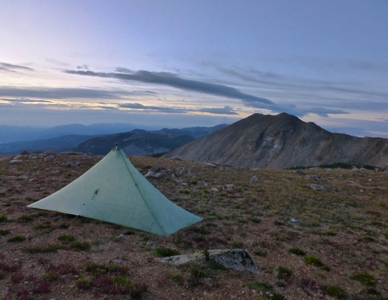
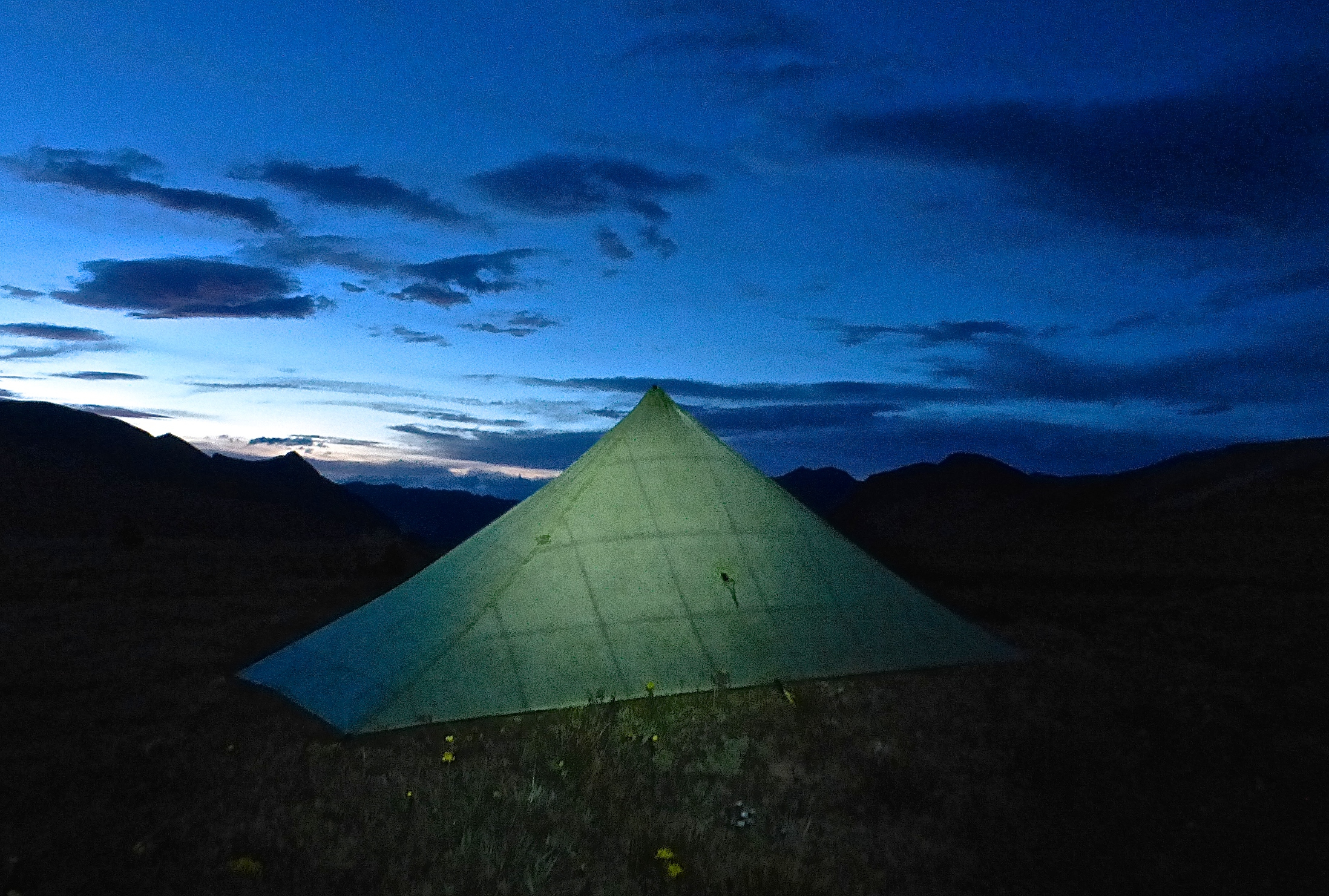
Striding out on the Colorado Trail.
I hiked the Colorado Trail (CT) during the first two weeks of September. No crowds, monsoon season practically over, the Aspens changing from green to flaming gold. A wonderful time to be outside in the Rockies.
Coming in at around 490 miles (789 km) in length, the CT represented the longest hike (in regards to distance, rather than time) that I had done since 2012. However, in many respects, it was also the easiest. Well maintained pathway, loads of resupply options, regular water sources and simple navigation. And you know what? It was just what I needed.
As much as I’ve always loved backpacking off-trail and/or in far-flung locales, there are times when it’s simply enough to grab a pack, follow a path and camp in the woods. The Colorado Trail was one of those times. And I enjoyed every moment.
Listed below are stats, logistical details, notes and observations from my journey.
Trip Summary
Distance: 490 miles approx. (789 km)
Time: 15 days
Start: Durango / Click here for transport options.
Finish: Denver / Click here for transport options.

www.coloradotrail.org
Maps / Information:
- In regards to logistics for the Colorado Trail, there isn’t much I can add to the plethora of information already available in guidebooks and on the internet.
- The best place to start your research is Paul “Mags” Magnanti’s, Colorado Trail End to End Guide. Practical and to-the-point with loads of up-to-date information on all things Colorado Trail.
- What did I use during my hike? A combination of the following sources: The Colorado Trail Map Book, Colorado Trail Data Book and Magnanti’s information on resupply options and alternate routes.

Resupply
My CT resupply points were as follows:
- Lake City: I sent a resupply box to Raven’s Rest Hostel.
- Monarch Crest Store: Resupply box sent via UPS.
- Twin Lakes Village: I purchased snacks at the general store for the final 33 miles to Tennessee Pass/Leadville.
- Leadville: Bought food at the Safeway supermarket for the 38 mile stretch into Breckenridge.
- Breckinridge: Resupply box sent to the Fireside Inn.

Climbing up from North Fork Chalk Creek.
Water
- No issues. Loads of water. If memory serves, the longest dry stretch was after Taylor Lake at the beginning of Day 2; approximately 22 miles in length.
- During the CT I rarely carried more than 1 litre and purified three times during the course of my hike.
- Note: I am not suggesting others follow my lead in regards to water treatment. My philosophy is simple: if in doubt purify……….otherwise drink the water as is. I haven’t had a waterborne illness since 1999.

Taylor Lake
Route / Conditions:
- I hiked in a north-east direction (i.e. Durango to Denver) and took the Collegiate West alternate, which begins just south of Monarch Crest and rejoins the Colorado Trail proper at Twin Lakes.
- Speaking of the Collegiate West, double thumbs up for the new 23 mile section of pathway between North Fork Chalk and Texas Creeks (via Cottonwood Pass). A beautiful stretch and a big upgrade over the old Continental Divide Trail (CDT) tread I traversed in 2012. Kudos to all the CDT and CT volunteers for their incredible trail building efforts (Note: According to PMags.com, the CT and CDT coincide for 234 miles; or more than 300 if you take the Collegiate West alternate).
- Despite being well maintained and relatively easy to follow, the Colorado trail is not without it’s challenges. There is a considerable amount of elevation gain and loss throughout its course.
- In regards to altitude, for folks thinking about hiking in a NE direction, it is worth noting that the trail climbs to over 10,000 ft above sea level within 18 miles of the Durango terminus. In other words, if you’re a lowlander, it may be worth spending a couple of days in the Durango area in order to acclimatise before beginning your CT hike.

Little Molas Lake

- In regards to weather, my hike was a tale of two halves. During the first week it was wetter than a mermaid’s pool party. In the second half of the hike, I encountered little except for brilliant sunshine and didn’t have a single drop of rain.
- Temperatures throughout the hike were mild, with the barometer dropping below freezing on no more than one or two occasions.
Notes & Musings
A Tribute to Sly & the Family Stone: It’s a Family Affair
During the course of the CT, I ran into nine people that I had either met on previous trails or knew as a result of my involvement in the US long distance hiking community. At times it almost felt like a family reunion!
All of these meetings were completely random, and when coupled with the collection of new friends I made during my 15 days on the the CT, it would definitely rank as the most social solo long distance hike I have ever done!

Eric & yours truly | I first met Eric in April of 2012 whilst hiking on the AZT; we met again in August of the same year on the CDT. This time around I met him on the second day of my Colorado Trail hike.

Jason “Bluejay” Reamy | Hiking the AT & CDT back to back in 2015 (Note: He just finished five days ago on October 23).

The one and only “Guy on a Buffalo” | Triple Crowner at the ripe old age of 21!
The Joys of Stormy Weather
One of the more memorable afternoons on the CT occurred whilst hiking NE of Spring Creek Pass. A big storm rolled in; heavy rain, winds and mostly exposed terrain.
This may sound strange, but I’ve always enjoyed hiking in such inclement conditions.
The increased level of focus. The opportunity of seeing just how good (or not) my wet weather gear really is. And most of all? The gift of being up close and personal when Mother Nature really turns it on.
Sometimes this means slogging through the elements. Other times it equates to adapting on the fly and making a B-line for sheltered confines and/or taking an alternate route. Each situation is different and a fluid mindset is essential. Staying positive and maintaining your sense of humour are also worth their weight in Snickers Bars (i.e. the hiking equivalent of gold).
Looking back over the years, these have often the times that I’ve learnt the most whilst out in the wilderness. Backcountry stepping stones cunningly disguised by Mother Nature as meteorological stumbling blocks.

Sunset on the Continental Divide
I arrived at the Monarch Crest store around 2.30 pm.
After picking up my resupply box, I proceeded to spend a couple of hours packing, chatting to CDT hikers (MeHap, NomNom & Grim) and inhaling three bowls of chilli and one generously proportioned double scoop ice cream.
When I eventually returned to the trail, my timing could not have been better. As I waddled along the Divide, the sun began to set and the sky was painted with dream-like hues of crimson, red and orange.
Mother Nature’s afternoon kaleidoscope.
It was windy and cold, but I didn’t care. My waddle turned into a glide as I digested both my sublime surroundings as well as the ridiculous amount that of food that I had managed to consume a mere two hours before.
I smiled, rubbed my belly and felt thankful.

Sunset just south of Bald Mountain.
Colours of Kenosha Pass
One of the biggest reason for hiking the CT in early September was the opportunity to experience the Fall colours. I had vivid memories of hiking through Colorado at this same time of year in 2012, whilst heading south on the Continental Divide Trail.
This year the colours arrived a little later than usual thanks to warmer summer days. Nonetheless, I was fortunate to catch the incredible transformation during the final seventy miles of my hike from Kenosha Pass to Denver.


Escape from Waterton Canyon
The Denver terminus of the Colorado Trail is situated at Waterton Canyon.
During my journey I heard through the hiker grapevine that the popular recreation area had been closed indefinitely due to bear activity. The story went that some genius hikers were trying to take selfies with local bruins. The bears took umbrage and as a result the park was closed to the public.
Upon making further inquiries with trail officials, I was informed that people finishing up their CT thru hikes would still be permitted to walk through the canyon, as long as they didn’t camp or linger. Sounded good to me. (Note: The aforementioned information was later confirmed by an on-site official).
After 15 days of hiking, I eventually reached the Waterton terminus at 4.30 pm on September 14; no bear sightings or selfie opportunities to report 😉 .
A friend of mine by the name of Felicia (aka. The Princess of Darkness from The Trail Show) had come to pick me up. There was just one problem; my exit was blocked by an 8ft high barb wire fence and a padlocked gate.
The aforementioned Waterton official had forgotten to tell me about this part!
With POD holding the gate for me, there was nothing for it but to climb over. Unfortunately this part of the barrier was still pretty shakey and I ended up cutting my right shin on the barbed wire.
Take 2 was much more successful. We spotted a nearby corner of the fence that was completely stable, and within a few seconds I had managed to climb over without further incident.
An amusing ending to a great couple of weeks hiking.


Related Articles
Discover more from The Hiking Life
Subscribe to get the latest posts sent to your email.
nice report, congrads
Thanks for the kind words! I plan up updating this doc early next month with some great info from fellow CTers.
Fall is my favorite time to hike in Colorado as well.
No worries. It’s a great resource. As I mentioned in the article, the new section of trail before Cottonwood Pass was one of the highlights.
By the way, I like the updated “season-appropriate” mug shot!
And there was a lot less blowdowns when this mug shot was taken!!! 🙂
Great photos! Makes me want to add it to the list…