In August, 2017, I hiked an approximately 600 km (373 mi) route across Bolivia’s Altiplano region. An otherworldly landscape of salt flats, volcanoes, fantastical rock formations and coloured lakes, it was a trip that had been bouncing around my noggin for twenty years, ever since my first visit to the area in February, 1997.
Click here for a full rundown of the second and final stage of the traverse.
Day 1 – Salar de Coipasa
The traverse was a combination cross country, 4WD tracks and volcano scrambles. To the best of my knowledge, it was the first time that such a route had been undertaken on foot. The journey began at the tiny village of Coipasa, and finished 16 days later on the summit of Volcan Licancabur (5920 m / 19,423 ft), which is located on the Boliva/Chile border.
What follows is a summary of the first stage from Coipasa to the sleepy town of San Agustin.
Stage 1 – At a Glance
Distance: 300 km (186 mi)
Duration: 8 days
Start: Coipasa village
Finish: San Agustin village
Highest Elevation: Volcan Tunupa – 5220 m (17,126 ft)
Lowest Elevation: Salar de Coipasa – 3657 m (11,998 ft)
Temperatures: The highest temperature was 15°C (59°F) and the lowest was -18°C (-0.4F).
Highlights – (In no particular order): 1. Salar de Coipasa; 2. Volcan Tunupa; 3. Salar de Uyuni; 4. Quinoa farming on the outskirts of San Agustin; 5. Friendliness and curiosity of the Bolivians I met along the way (i.e. “What are you doing out here on foot? Can’t you afford a tour?”)
Challenges – (In no particular order): 1. Dearth of beta in regards to viable water sources; 2. The climb up Tunupa; 3. In a treeless environment that is regularly buffeted by high winds, finding places to camp at day’s end was not always easy.
Gear: Gear: Click here for my full gear list from the Altiplano Traverse. My base weight for the journey was 4.75 kg (10.5 lb), and total weight was 6.5 kg (14.4 lb).
Resupply & Water Information: See the second stage summary for the full rundown on food and H2O options for the Altiplano Traverse.
Dirtmonger
Before I get started with the first stage summary, I need to give a shout-out to my friend, Ryan “Dirtmonger” Sylva.
The Altiplano Traverse was the fourth and final hike of the Central Andes trip of 2017. On the first few treks of the journey (Salkantay, Ausangate, Cordillera Real) I was joined by DM, who was all set to do the Altiplano hike with me as well. Unfortunately some back issues I’d been dealing with over the previous month, had gotten to the point where I had no choice but to postpone the start of the Altiplano hike. DM couldn’t have been more supportive, however, due to work commitments up in the States he wasn’t able to wait around until my health improved. As bad as my back was feeling, I felt worse about letting down a good mate.
Postscript: Being the persistent bloke that he is, DM returned to Bolivia the following year to do a variation of the route across the Altiplano. Here is a link to his trip report.
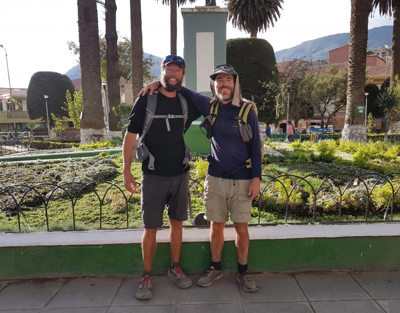
DM and I in the village of Sorata, the finishing point of our full length traverse of Bolivia’s Cordillera Real.
Trip Report – Stage 1 – Altiplano Traverse
A. Coipasa to Salinas de Garci Mendoza – (approx. 88 km / 55 mi) – 2 days
- I overnighted in the salt mining village of Coipasa before beginning the traverse. There were no hotels/hostels, but the family that ran the small shop on the plaza were kind enough to rent me out a room at the back of the store.
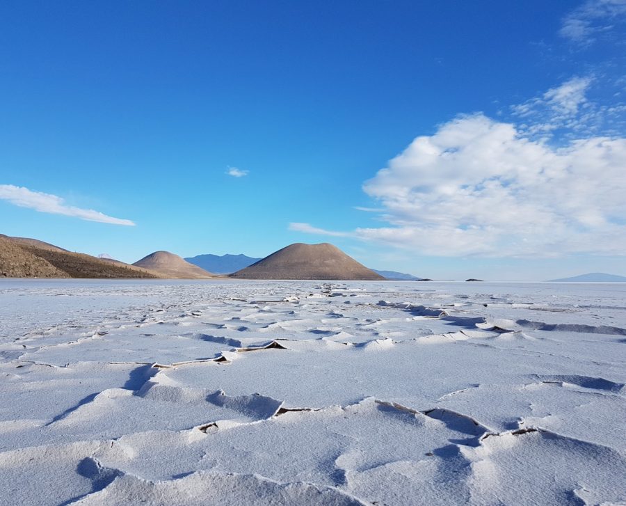
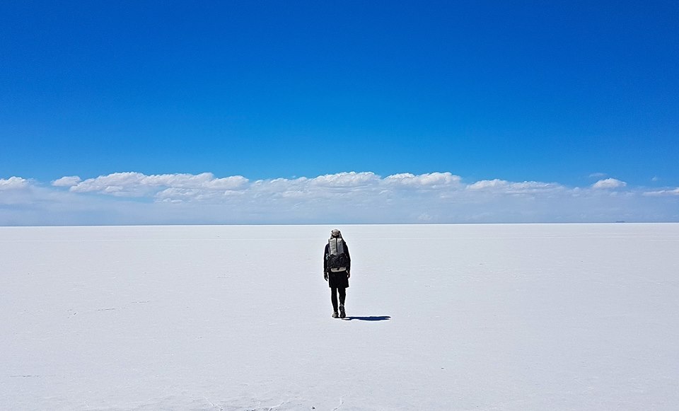
- The initial 43 km of this section crossed the Salar de Coipasa, the fifth largest salt flat in the world. Think the Salar de Uyuni, but with no tourist traffic at all. Great way to begin the traverse.
- I began the hike carrying enough water to get me through to the end of the section at Salinas de Garci Mendoza (88 km / 55 m). Fortunately I was able to obtain H2O after only 60 km (37 mi), at the bigger-than-expected village of Luca. As an added bonus it also had a small shop which sold crisps, chocolate, nuts and eggs (I ordered six of the hard boiled variety).
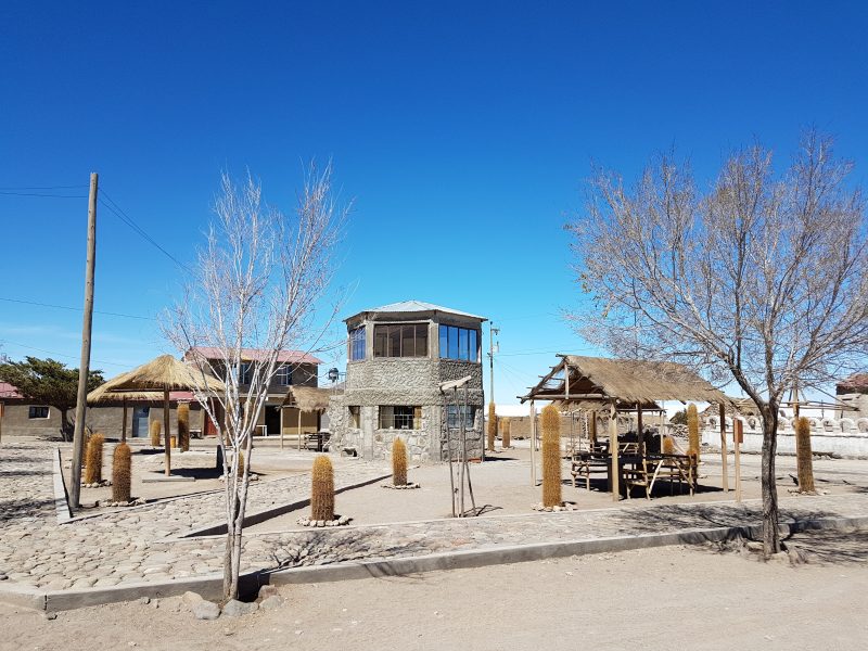
- From Luca to Salinas I mainly followed little used 4WD roads (I didn’t see a single vehicle) up and over a lowish pass (3961 m / 12,995 ft). Salinas was the largest town (population 11,705) I encountered on the Altiplano Route. It had a few simple hotels, restaurants and shops. I stayed at the Albergue Sukarini which is located a few blocks up the hill from the plaza.
Early morning day 1 – Sun rising over the Salar de Coipasa.
Day 1 – Looking back towards the village of Coipasa, which is situated on the other side of the mini volcano.
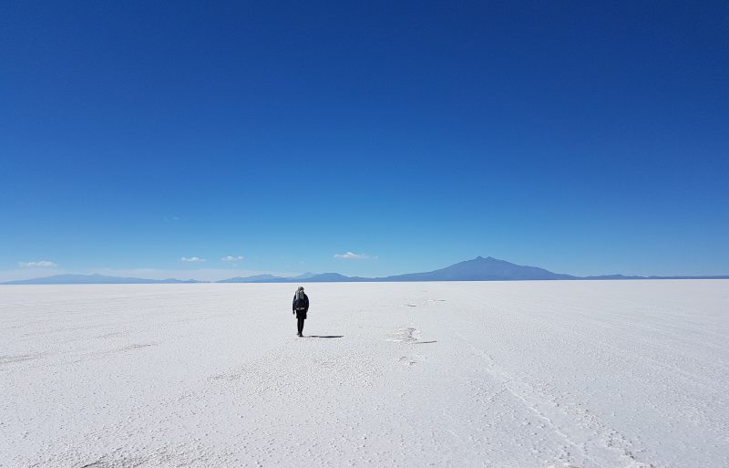
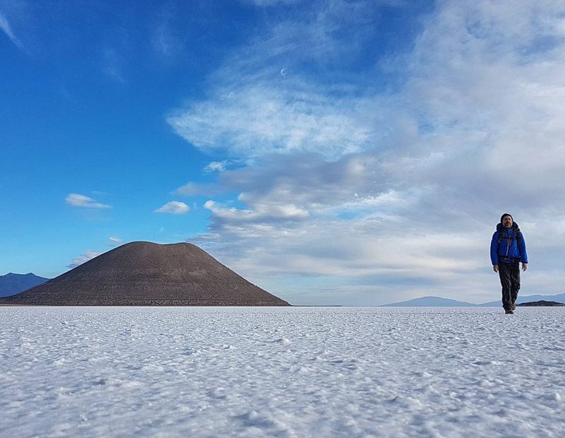
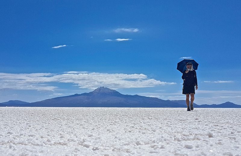
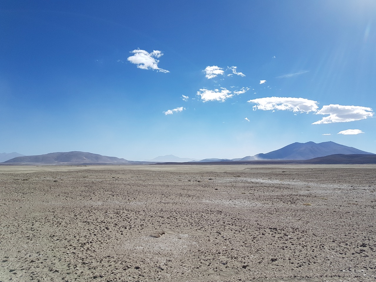
Day 1 – Salar de Coipasa. The prominent peak on the horizon is Volcan Tunupa (5321 m / 17,457 ft), which I would go up and over on day 3 and 4 of the traverse.
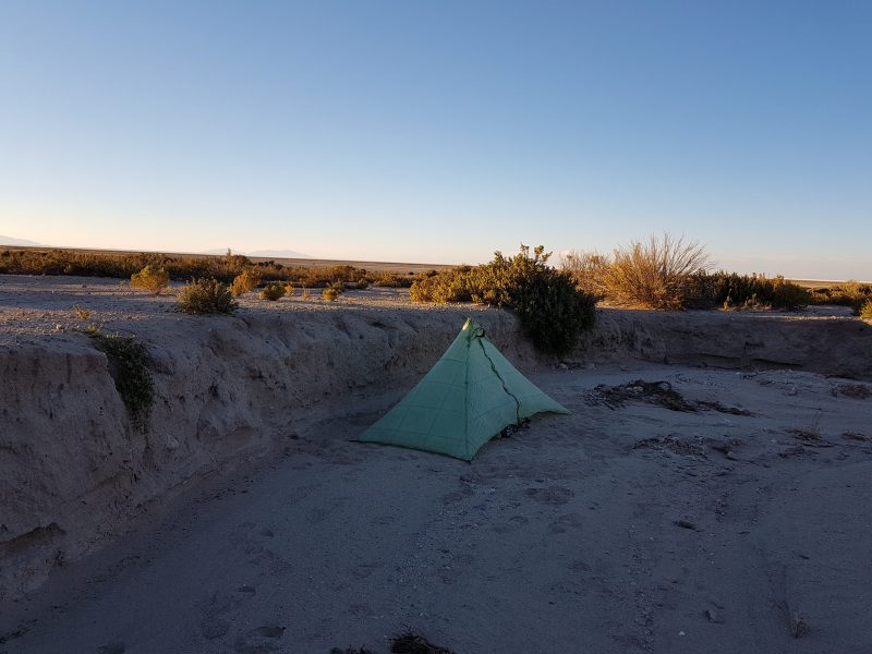
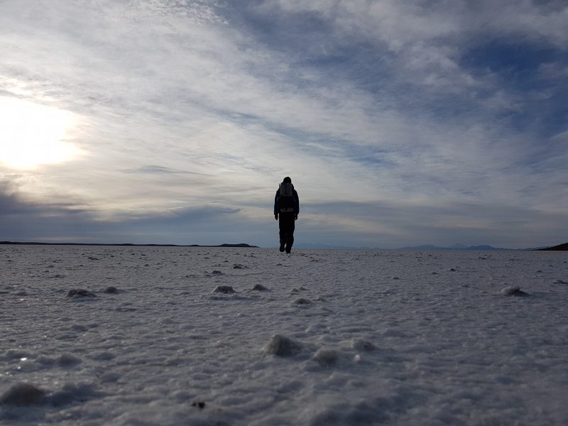
End of Day 1 – After hiking for about 46 km (29 mi), I found a semi-sheltered wash to set up camp. No small thing as the winds were blowing up to 70 kmph (43 mph).
Day 2 – The village of Luca. The little shop there had food and water. A much appreciated bonus.
Day 2 – The lonely dirt road leading to Salinas de Garci Mendoza.
Day 2 – Sunset from the plaza of Salinas de Garci Mendoza
B. Salinas de Garci Mendoza to Coquesa – (approx. 48 km / 30 m) – 2 days
- Leaving Salinas after a huge breakfast, I followed the dirt road south of town towards my next objective, the Volcan Tunupa 5,321 m (17,457 ft).
- After approximately 19 km, I left the dirt road at Colcaya (3670 m / 12,040 ft), a small collection of seemingly deserted dwellings. From there I headed SSW up Tunupa, at first following little used 4WD tracks and then cross country.
- About 10 km of switchbacking later I attained the eastern ridge (4630 m / 15,190 ft) of the volcano, where I met up with a 4WD track that ascended from the Salar-side village of Jirira.
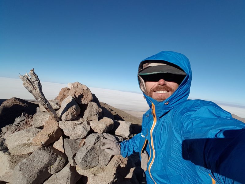
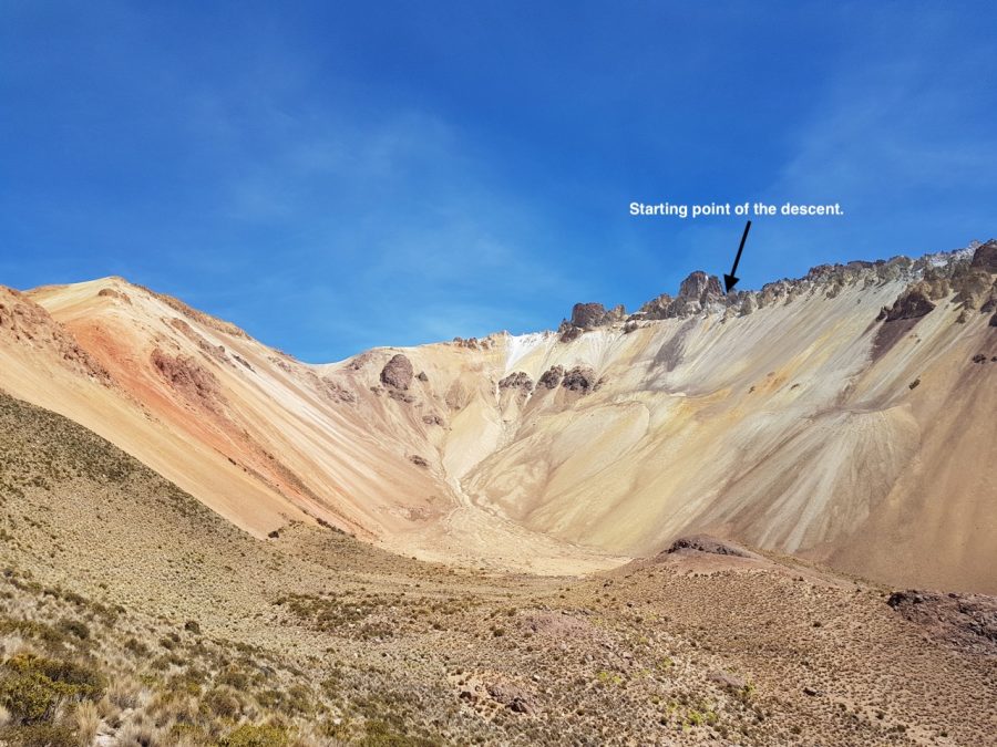
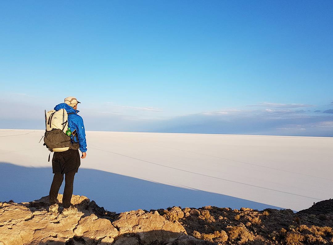
- A short climb west of there was a lookout point with a large cairn on top (see photo below). By this time it was late afternoon, and the winds were getting stronger. With zero chance of finding somewhere to camp higher up, I made the easy decision to drop down into an adjacent rocky basin, where I found a relatively sheltered spot to hunker down. This was the highest campsite of the traverse and not surprisingly the coldest night (-18°C / 0°F).
Day 3 – Windy lookout over Salar de Uyuni from the slopes of Volcan Tunupa
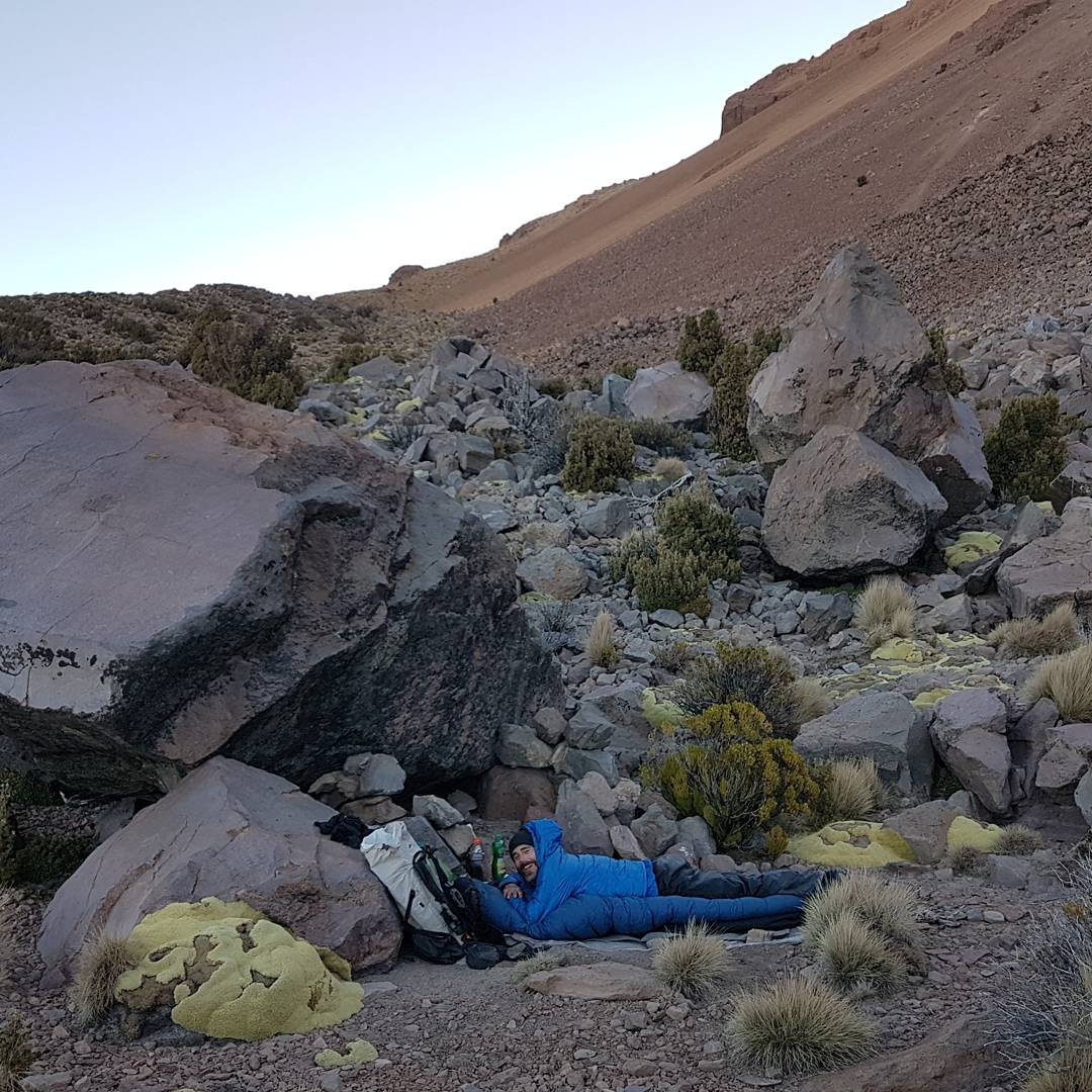
Day 3 – Flat and sheltered campsite at 4692 m (15,394 ft) on the flanks of Volcan Tunupa. All things considered, I couldn’t have asked for a better spot.
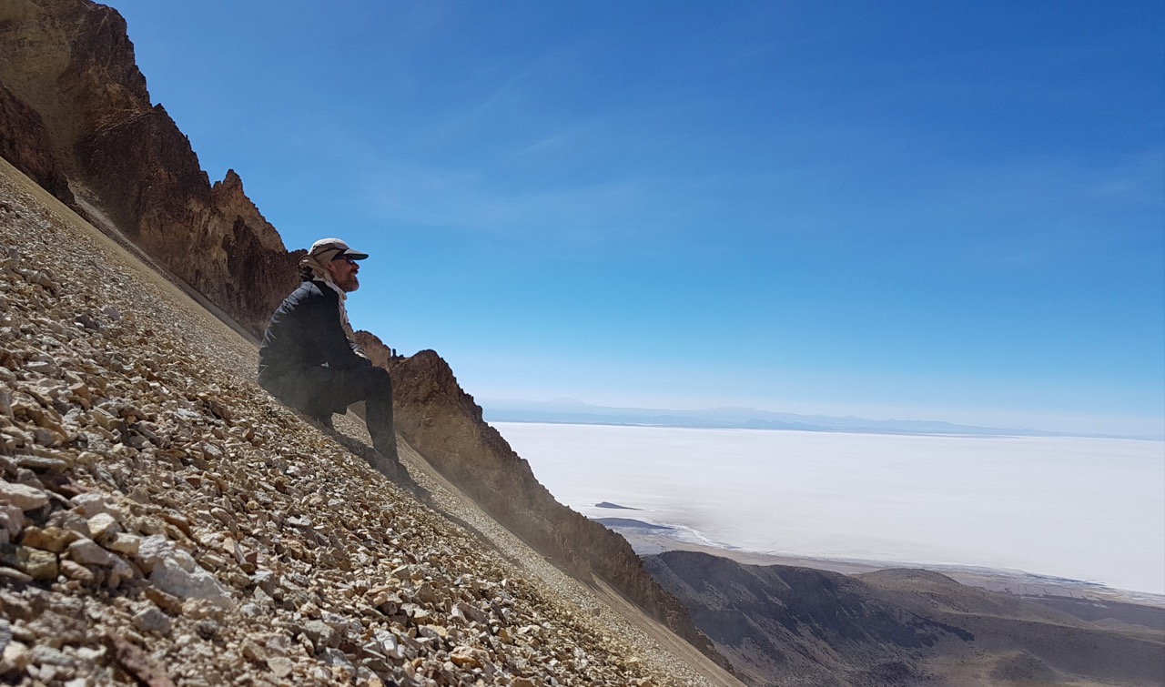
- The following morning I made slow progress up the loose volcanic terrain of the eastern ridge of Tunupa. A few hours of slogging later, I had ascended as high as I could (approx. 5220 m / 17,126 ft), at which point climbing equipment would have been necessary to scale the final 100 m to the summit. The bird’s eye view over the Salar de Uyuni was breathtaking – though in the spirit of full disclosure, I had very little breath to give at this point in time.
- From here I dropped 1700 ft (518 m) down the scree slope (see photo below). The initial section was a little technical, but after that it was relatively clear sailing. The final 1400 ft (427 m) of the descent to the basin was done in about 15 minutes. The equivalent in elevation had taken me all morning to ascend.
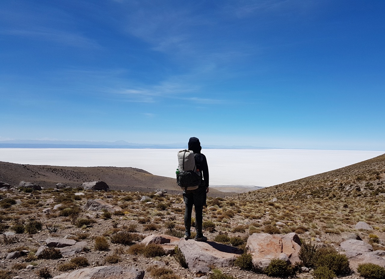
- From the basin I continued cross country towards the village of Coquesa, meeting up with the main Tunupa trail about 1.5 km north of town.
- In Coquesa I stayed at the Hospedaje Chatahuana, across the road from the Maya Hostal de Sal. The ladies that ran the establishment included lunch, dinner and breakfast in the overall price. I purchased four days worth of food at the well-stocked shop on the plaza.
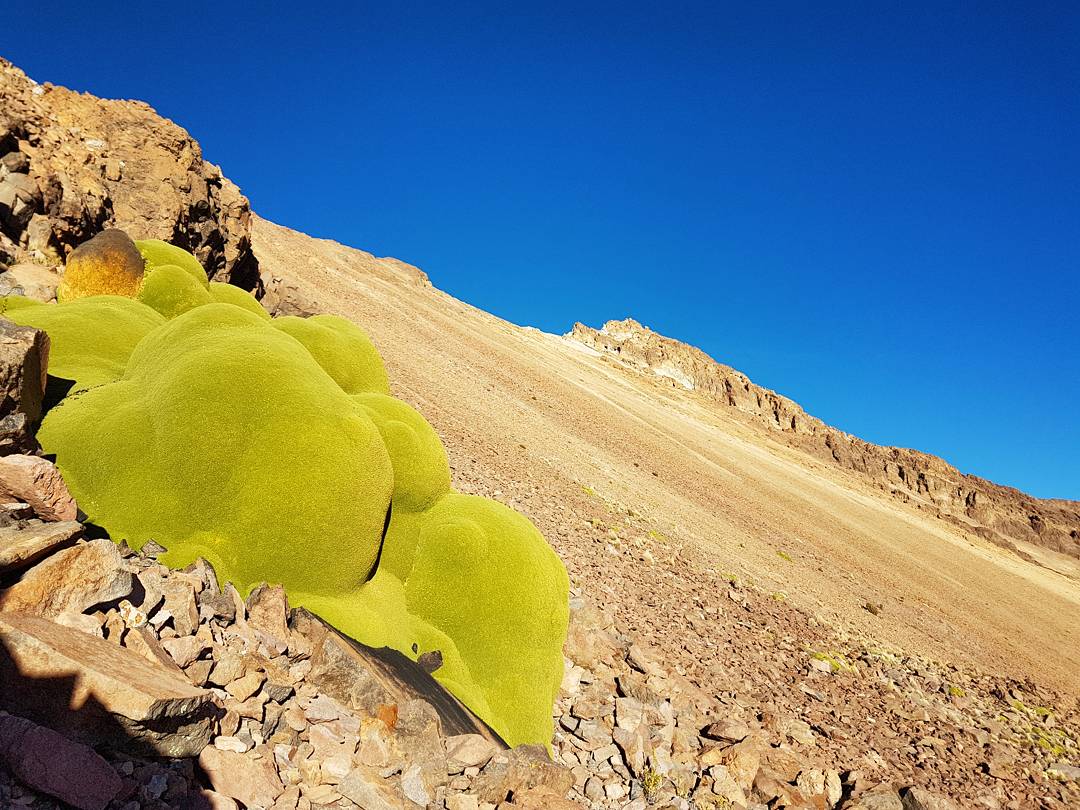
Day 4 – The loose volcanic terrain made the initial hours of the day very slow going. One of the highlights was encountering these Azorella Compacta (“llareta”), a high altitude plant endemic to the Andes, which is found at elevations ranging between 3200 and 5000 m (16,404 ft) above sea level.
Day 4 – Looking out over the Salar de Uyuni during the descent of Volcan Tunupa.

Day 4 – Descending Tunupa.
Day 4 – Scree slope amphitheatre, Volcan Tunupa.
Day 4 – Descending X-Country to the village of Coquesa.
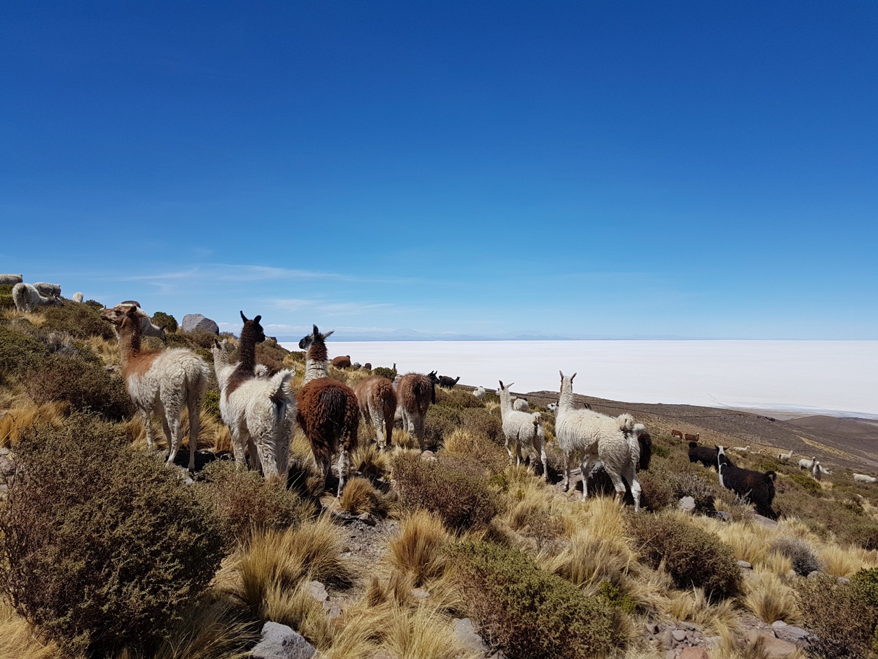
Day 4 – A herd of llamas and a big salt lake.
Downtown Coquesa. I arrived early afternoon on Day 4.
C. Coquesa to Chuvica – (approx. 81 km / 50 mi)
This section was covered in detail in my post Hiking across the Salar de Uyuni. A few quick factoids about the Salar de Uyuni:
- It is the world’s biggest salt flat (12,106 sq km / 4674 sq mi). Approximately 20 times bigger than Death Valley’s in the States.
- Situated at an altitude of 3663 m (12,018 ft), the Salar de Uyuni is the world’s flattest region, with an altitudinal variation of less than one meter.
- According to estimates, the Salar de Uyuni holds between 50 and 70% of the world’s lithium supplies underneath its glistening white surface.
- The cactus-laden Incahuasi island is the only place you can obtain potable water in the salar. There is also a tiny store that sells snacks and meals.
- Upon arriving in Chuvica I stayed at the Hotel de los Cactus, in which the floor, walls and furniture were all made of salt.
Day 5 – Heading to the Isla Incahuasi on the Salar de Uyuni. That’s Volcan Tunupa in the background.
Day 5 – Crossing the Salar de Uyuni.
End of Day 5 – Gazing out from the Isla Incahuasi.
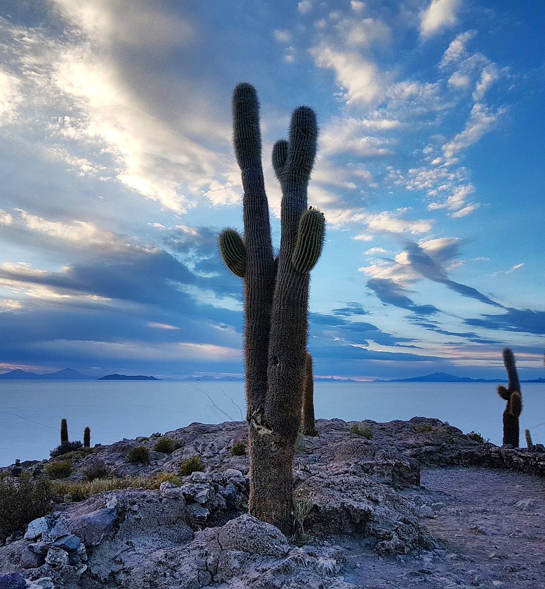
Sunrise Day 6 – The giant cacti (Trichocereus pasacana) of the Isla Incahuasi. These plants can be found at altitudes between 2,000 m (6,562 ft) and 4,000 m (13,123 ft). They, grow up to 10 m (33 ft) in height, and are endemic to the Andean regions of Bolivia, Argentina, and Chile.
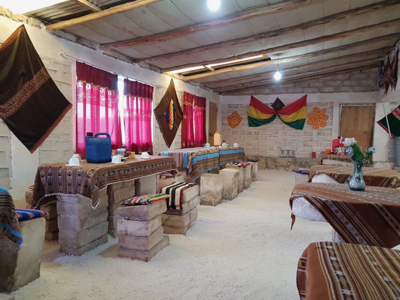
End of Day 6 – Dining room of the Hotel de los Cactus, Chuvica.
D. Chuvica to San Agustin (via Julaca) (approx. 83 km / 52 mi) – 2 days
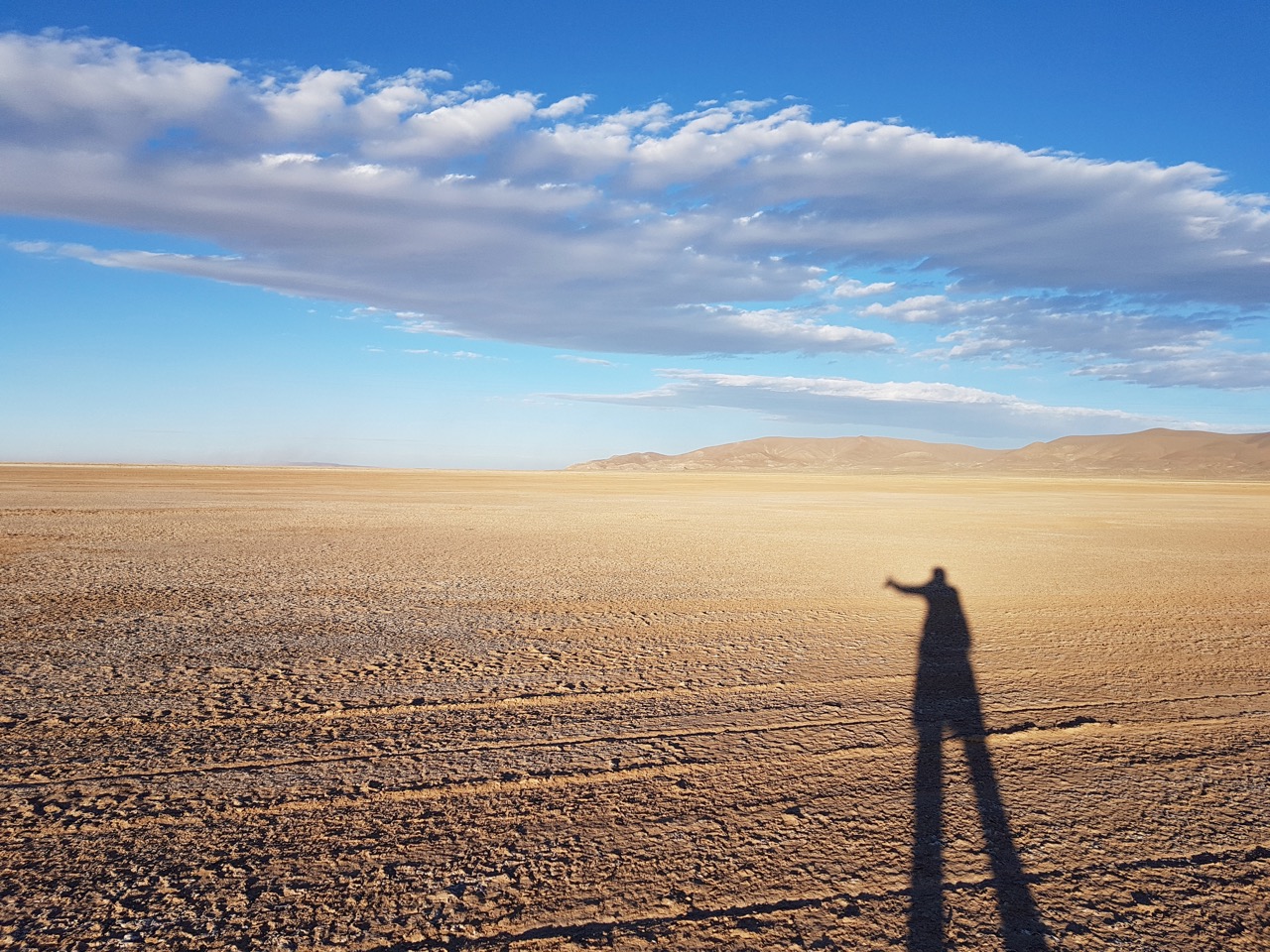
- In regards to the terrain, this was the least interesting stretch of the entire hike. A combination of dirt roads and mostly featureless landscape. The winds were unrelenting. However, from a people perspective, the hospitality I received in both Julaca and San Agustin was one of the highlights of the entire trip.
- Day 7 involved approximately 45 km (28 mi) of hiking between Chuvica and Junaca.
- Approximately 2 km after leaving Chuvica I passed through the outpost of Tamil Vinto, which had a couple of guest houses and a small shop.
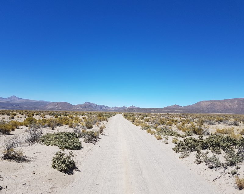
- I stayed on the main dirt road heading south for a further 20 km (12 mi), before heading SW on the track less travelled towards Julaca. After being blown around like a rag doll for the next 25 km (15.6 mi) I eventually reached the semi-deserted town of Julaca.
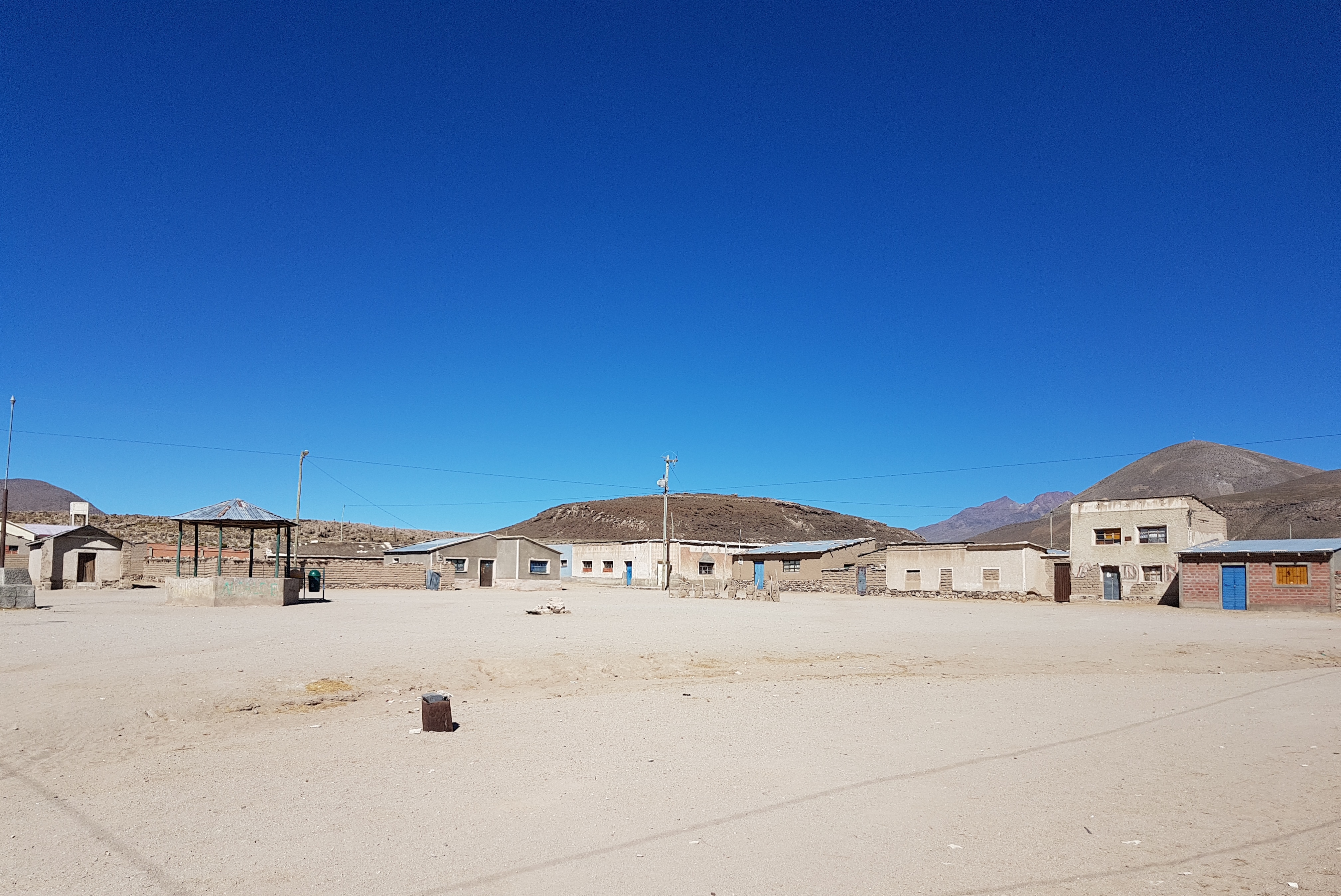
- In decades past, Julaca had been the location of a large fabrica de cal (quicklime factory), and was also a train stop between Uyuni and the Chilean border. Its heyday long past, it is now home to just seven families, one school (with nine students) and a surprisingly well-stocked shop.
- The store’s friendly proprietors not only opened it for me, but also invited me to eat dinner with the family and camp on their back porch. I gladly agreed. The father’s name was Alberto, and his favourite hobby was wood carving (see photo below); which struck me as a little unusual in a region almost completely devoid of trees.
Day 7 – Chuvica’s official name is Puerto (Port) Chuvica. This gave me a bit of a chuckle, as the maximum depth of the salt lake during rainy season is around 50 cm (20 in).
Day 7 – Salt flats to high desert.
Day 7 – X-country to Julaca.
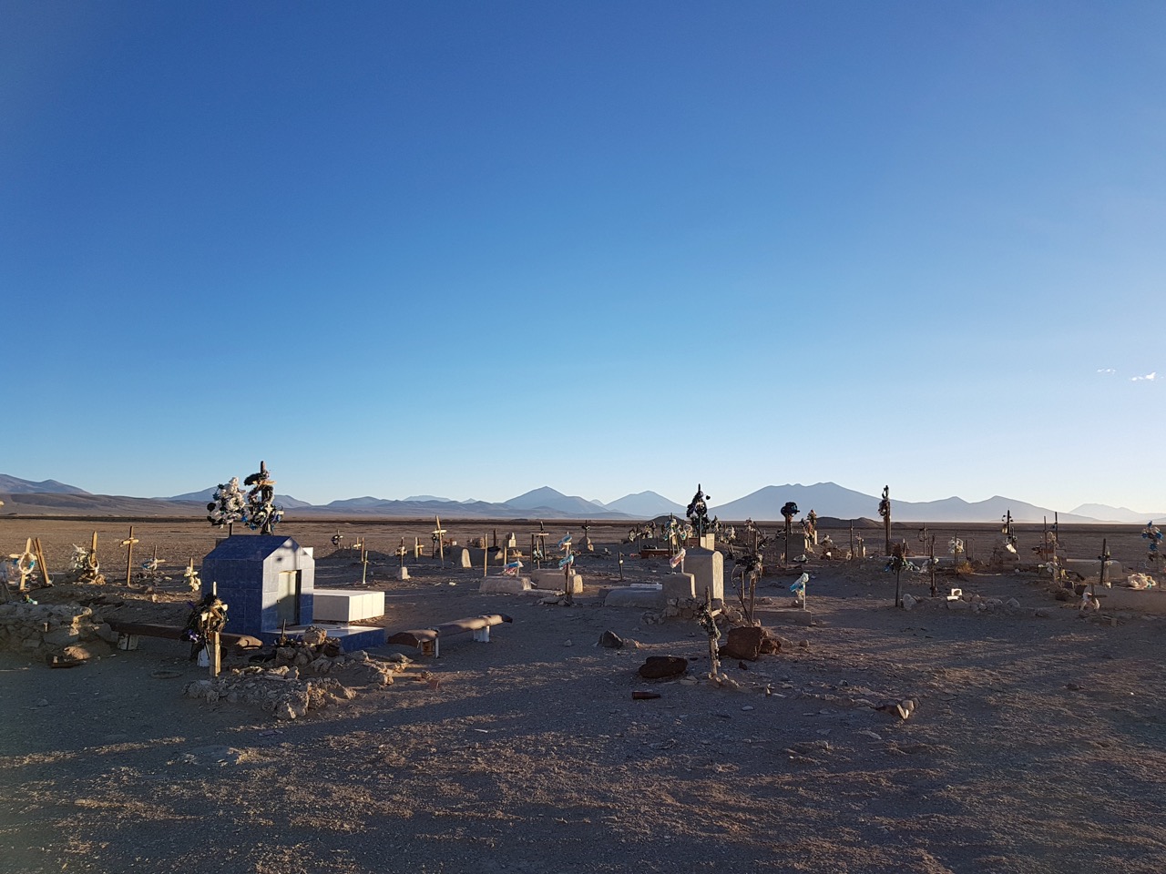
Day 7 – Julaca Cemetery
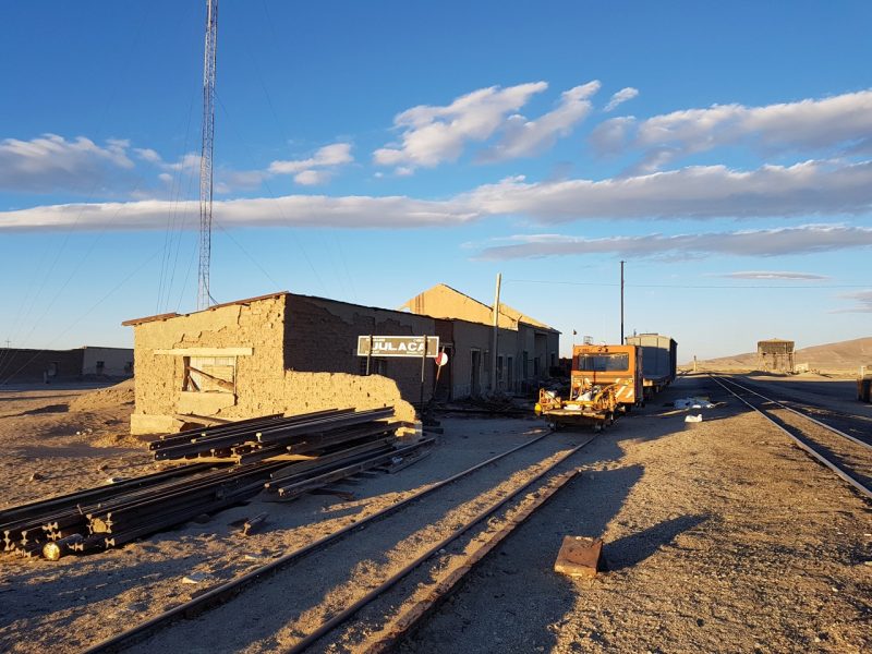
End of Day 7 – Downtown Julaca.
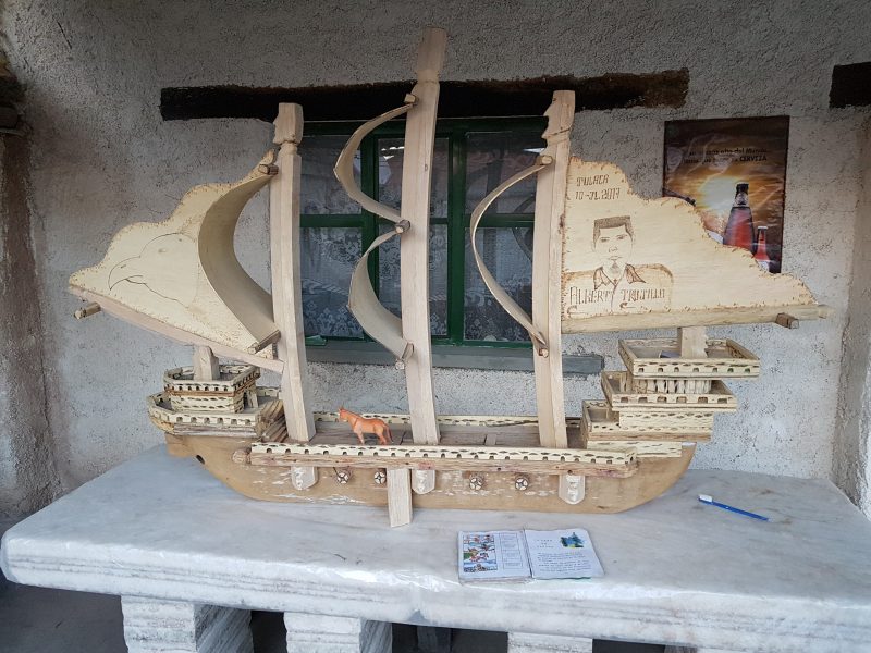
Day 7 – One of Alberto’s wood carvings.
- On the eighth and final day of the first stage, I hiked for 38 km (23.6 mi) from Julaca to the village of San Agustin.
- The initial 3.5 km (2.2 mi) was on a dirt road heading SSE from Julaca. After that I ventured X-Country in a SSW direction for approximately the next 18 km (11 mi). During this segment I tried to stay high on the ridges whenever possible, in order to minimise the amount of soft sand walking in the lower areas.
- My route eventually rejoined the dirt road to San Agustin at a large cairn. From this point it was a further three hours to my destination. The scenic highlights during this mellow final stretch were the saline Laguna Turuncha, and an impressive line of red rock cliffs which extended for kilometers south of the lonely lake.
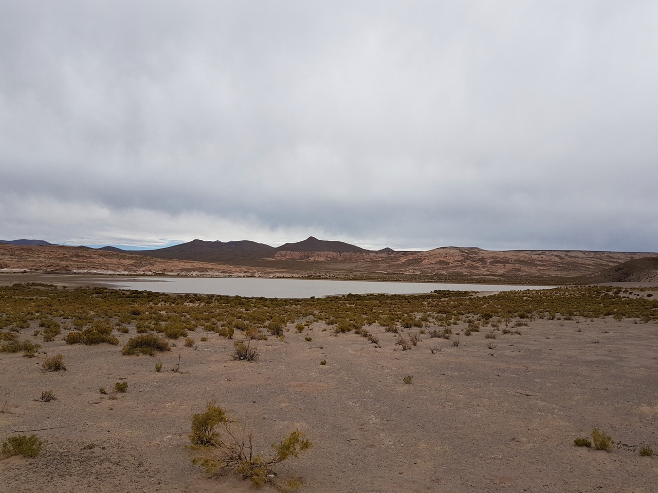
Day 8 – Laguna Turuncha
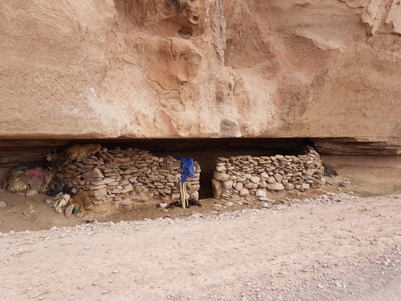
Day 8 – Shady shelter for local livestock.
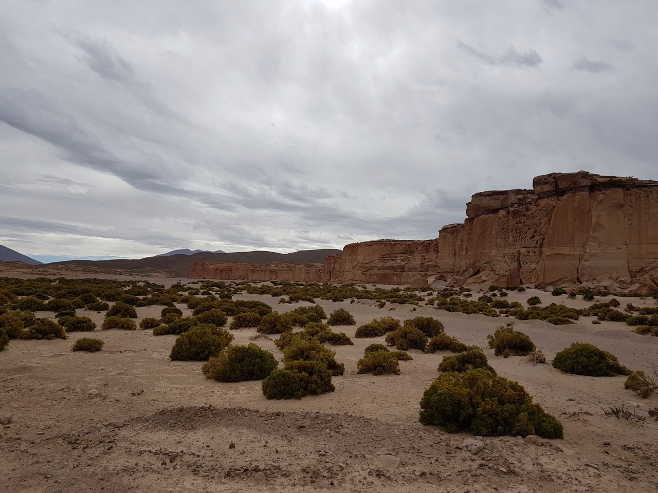
Day 8 – Impressive red rock cliffs south of Laguna Turuncha
- San Agustin (population 1640) doesn’t see many outsiders. It is off the Altiplano’s tourist route. That said, I quickly found accommodation in the form of an under-construction guest house (the town’s first), which was run by Eugenio and family.
- In addition to being a budding hotelier, Eugenio is a quinoa farmer. Quinoa is the region’s principal crop, grows well in sandy soils, and is amazingly resilient to the elements (drought, frost, wind, etc). The morning after my arrival, Eugenio invited me out to his family’s property to learn about the ins and outs of quinoa farming. After spending a couple of hours watching as well as trying my hand at some planting, I bid my farewells and continued southwest towards Volcan Licancabur.
Related Articles
- Stage 2 – Altiplano Traverse – Coloured Lakes, Geothermal Fields and a Towering Finale
- Gear List: Altiplano Traverse
- Hiking Across Bolivia’s Salar de Uyuni
Discover more from The Hiking Life
Subscribe to get the latest posts to your email.
The altiplano is magical. What an amazing place to explore on a long walk. And what cool folks, and wonderful hospitality. Bravo on a truly neat undertaking!
Thanks for the kind words. It’s definitely a unique part of the planet, and the hospitality and curiosity of the folks I met along the way is one of my fondest memories of the journey.
Unreal trip!
Do you prefer to use diamox, or acclimatize over time Cam?
Acclimatize. I’ve never used Diamox on any of my high altitude trips.
I really enjoyed your descriptions, and it’s refreshing to see outside-the-box adventures like yours. Inspiring!
Great undertaking Cam,those “endless” water less vistas require courage and would give one a thirst for more than a cerveza or two!Thanks for the pics and write up. That is scenery for the true explorer, I prefer more greenery
Hey Cam,
600km is one hell of a hike!
May I ask what backpack did you rely on on this trip?
Hyperlite Mountain Gear Southwest 2400. See the Altiplano Traverse Gear List for more details: https://www.thehikinglife.com/2019/05/gear-list-the-altiplano-traverse/
Reminds me of Death Valley! WOW!!! Thanks for sharing!
To answer your questions: 1. No, most folks don’t speak English, but I am fluent in Spanish so the language wasn’t an issue; 2. I put together the route on both Gaia and Google Earth before departure. Because I was very familiar with the conditions, I didn’t have to do any special planning in regards to gear or physical preparations; 3. I never have a budget for my trips, so I’m not sure how much it would cost you. Depends on a bunch of factors (e.g. gear, accommodation, travel costs). I can tell you that Bolivia is one of, if not the cheapest country in South America.
Best of luck,
Cam
Very interesting, definitely not a normal trek