Sandwiched between Switzerland and Austria, Liechtenstein is the sixth smallest country in the world. Famous for its private banks and castles, this tiny Alpine principality is also home to a classic hiking trail by the name of the Liechtenstein Panoramaweg (LP). Stretching across the nation’s rugged rooftop, the LP affords spectacular views of the Vorarlberg, Rhine Valley, and Swiss Alps, and is most commonly tackled over two or three days. I hiked the Liechtenstein Panoramaweg in late August 2019.

Hiking along the backbone of Liechtenstein.
At a Glance
Distance: 46 km (28.6 mi)**
Average Time: 2 or 3 days
Start: Malbun
Finish: Ruggell
**Officially speaking, the Liechtenstein Panoramaweg is 46 km long and split over three stages. However, the majority of the third stage between Gafadura Hut and Ruggell takes place in built-up areas along the Rhine Valley floor. I decided to give the urban finale a miss and instead finish my hike in the village of Nendeln (see map below). The total distance was approximately 32 km (20 mi).
Difficulty: Moderate
Season: June to October

Overview Map of the Liechtenstein Panoramaweg / Click here for an elevation profile of the trail.
Getting There & Away:
- Malbun: A picturesque mountain village popular with skiers and snowboarders during the colder months. It’s located 30 minutes by bus #21 from the capital of Vaduz.
- Nendeln: Located just north of Vaduz, I took bus #13 to Schaan, and then transferred to bus #11 for the remaining stretch back to Vaduz.
- The Gateway of Sargans: I arrived in Liechtenstein via the Swiss border village of Sargans. There are regular bus connections between there and Vaduz (32 minutes). Sargans also offers easy access to the impressive Pizol Five Lake Trail and for those interested in something longer, it represents the eastern terminus of the Alpine Pass Route across Switzerland (See “Why the Liechtenstein Panoramaweg?” below).
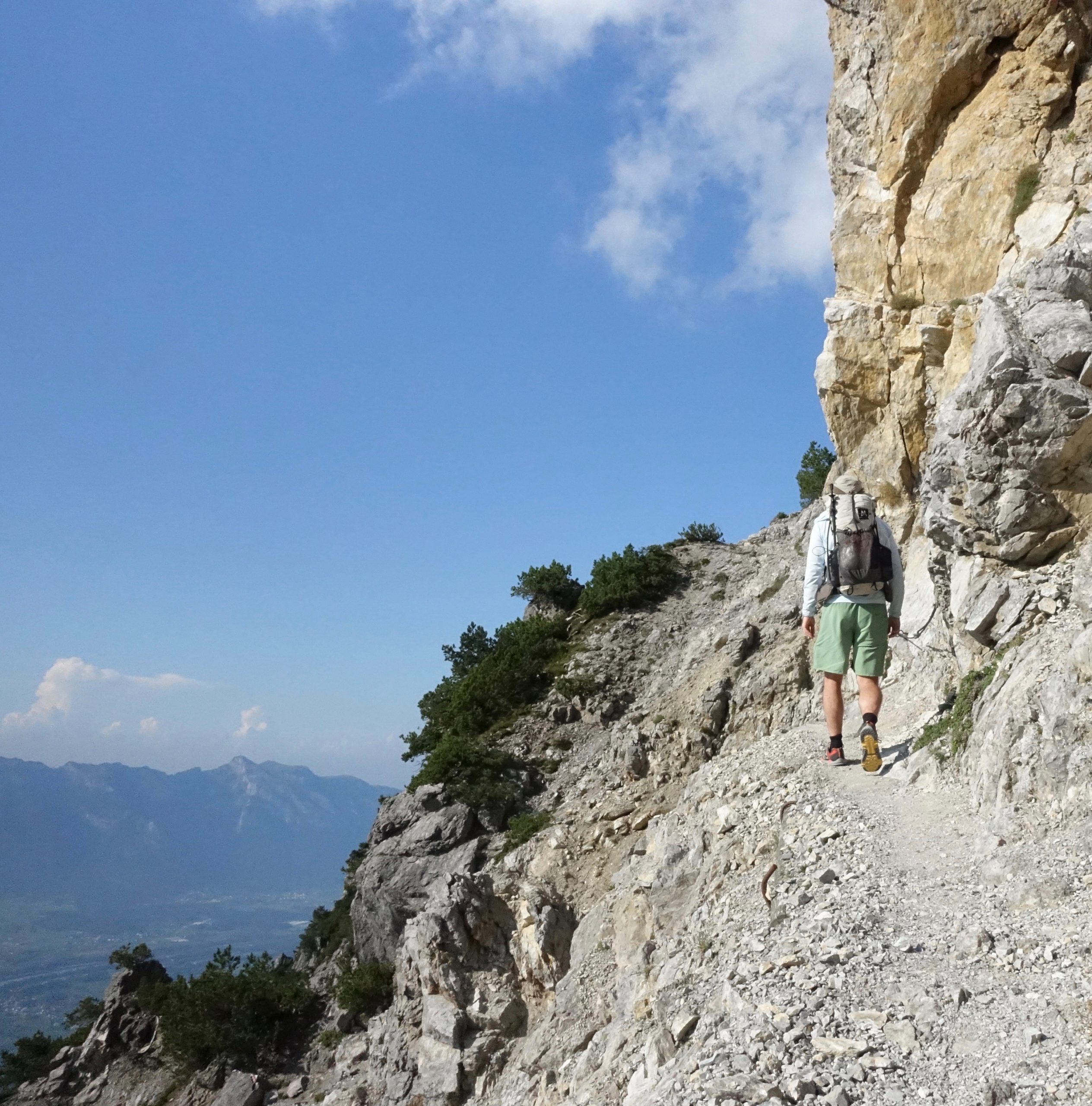
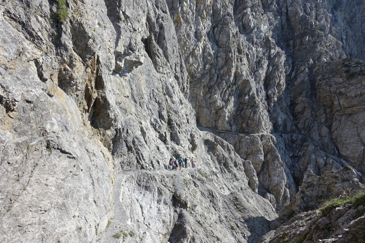
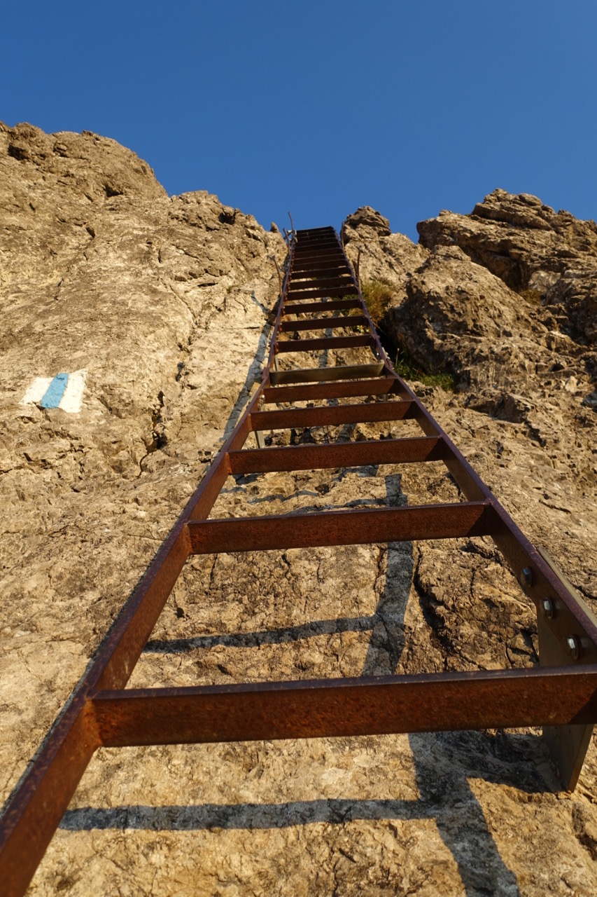
The cliff-hugging Fürstensteig section.
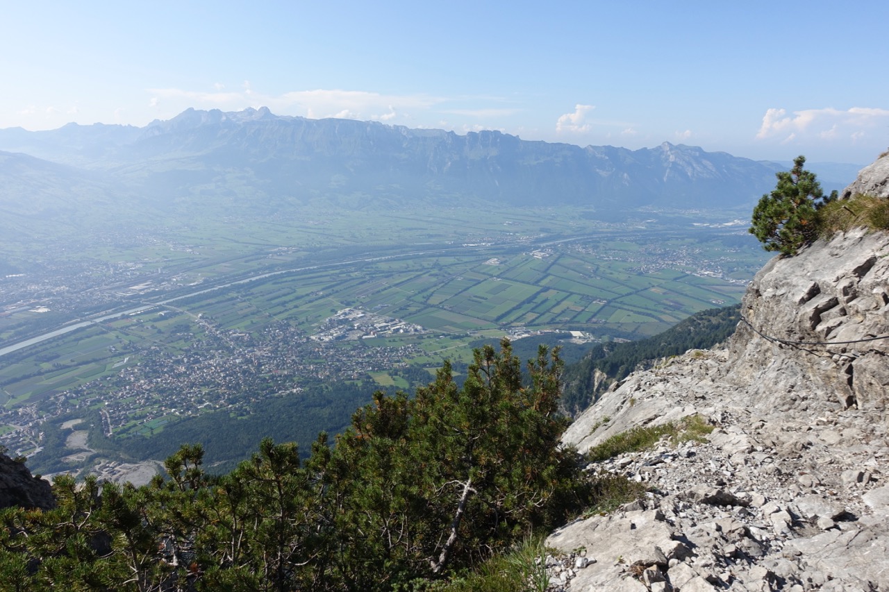
The Fürstensteig affords gorgeous views over the Rhine Valley into Switzerland.
Three generations of a Liechtenstein family out for a day hike.
Maps / Information
- Online Information: The Official Tourism website for Liechtenstein (tourismus.li) is the go-to resource for the Panoramaweg. It contains a basic overview of the trail, GPX/KML files, transport beta, and food and accommodation recommendations. Click on the following links for specific information on each of the LP’s three official stages: Stage 1 – Malbun to Steg; Stage 2 – Steg to the Gafadura hut, and; Stage 3 – Gafadura Hut to Ruggell.
- Other Online Sources: 1. Activity Workshop – This excellent website has a map, Kmz files, and trekking notes; 2. Wanderland.ch – Comprehensive resource for hiking in Switzerland, also has information for the Liechtenstein Panoramaweg including elevation profile, transport details, and an overview map.
- Topographic Map – Hiking map 1:25’000: Fürstentum Liechtenstein. You can pick up this sheet at the tourism office in Vaduz.
- Food: You can purchase all that you need at one of the supermarkets in Vaduz or Sargans. Additionally, you can also purchase meals and snacks at the various accommodation options along the trail (see below).
Route / Conditions
The Liechtenstein Panoramaweg is an undulating high route across the rooftop of the world’s sixth smallest country. The trail is well maintained and clearly signed with “Route 66” markings throughout its course. It is suitable for hikers of all ages and levels of experience, though a reasonable level of fitness and a good head for heights are recommended.
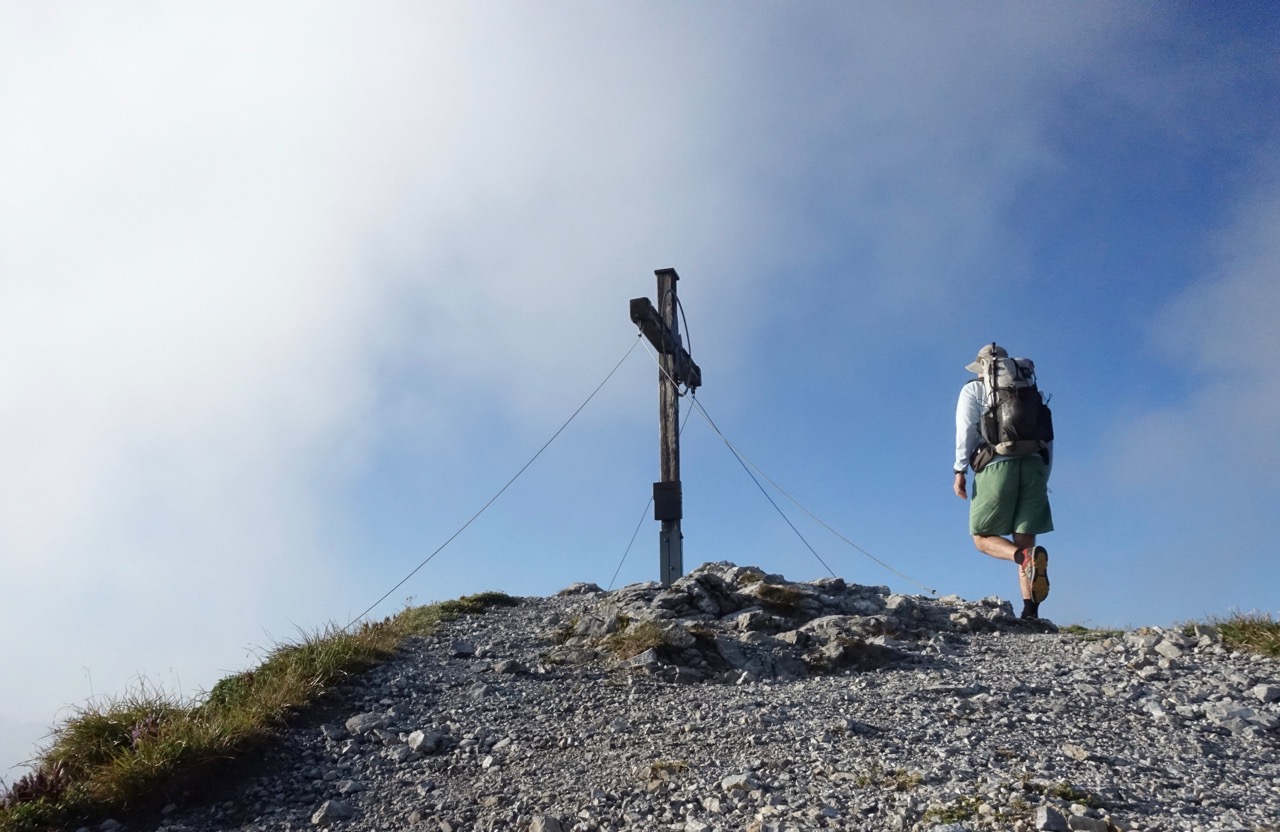
Stage 1 – From downtown Malbun, the trail climbs more than 700 m (2297 ft) to the summit of Augstenberg, which affords an impressive 360-degree panorama. It soon passes the scenically located Pfälzerhütte (a good overnight option if you make a late start), before descending northward toward the signposted junctions for the village of Steg. As an alternative, hikers can stay on the trail for a short time longer and overnight at the reasonably priced Sücka Berggasthaus.
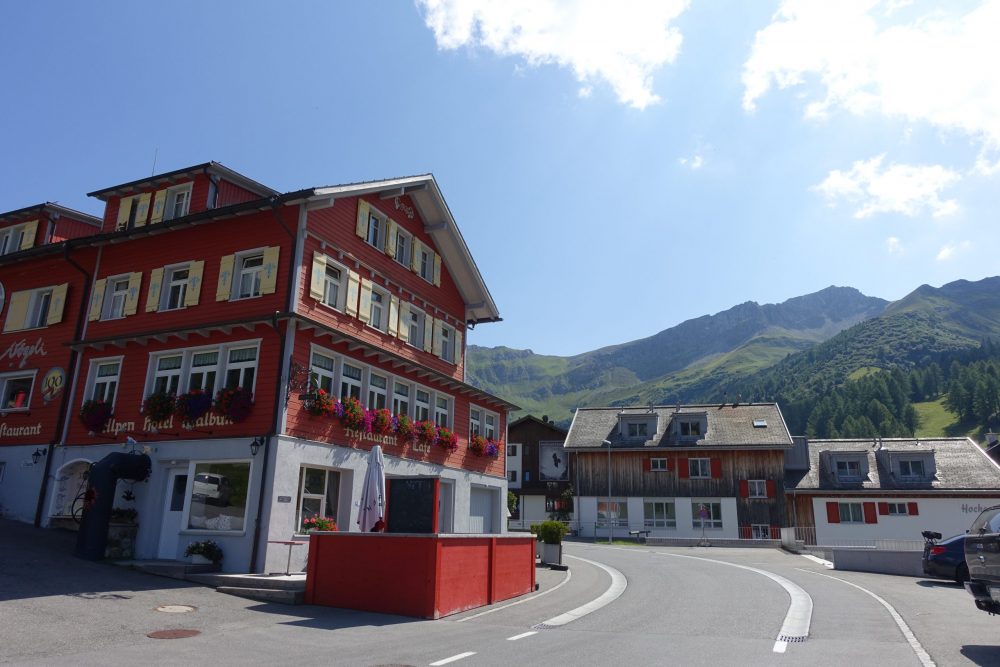
Downtown Malbun – Starting point of the Liechtenstein Panoramaweg.
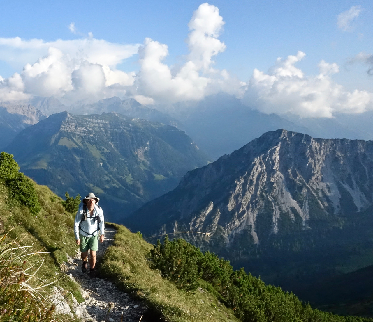
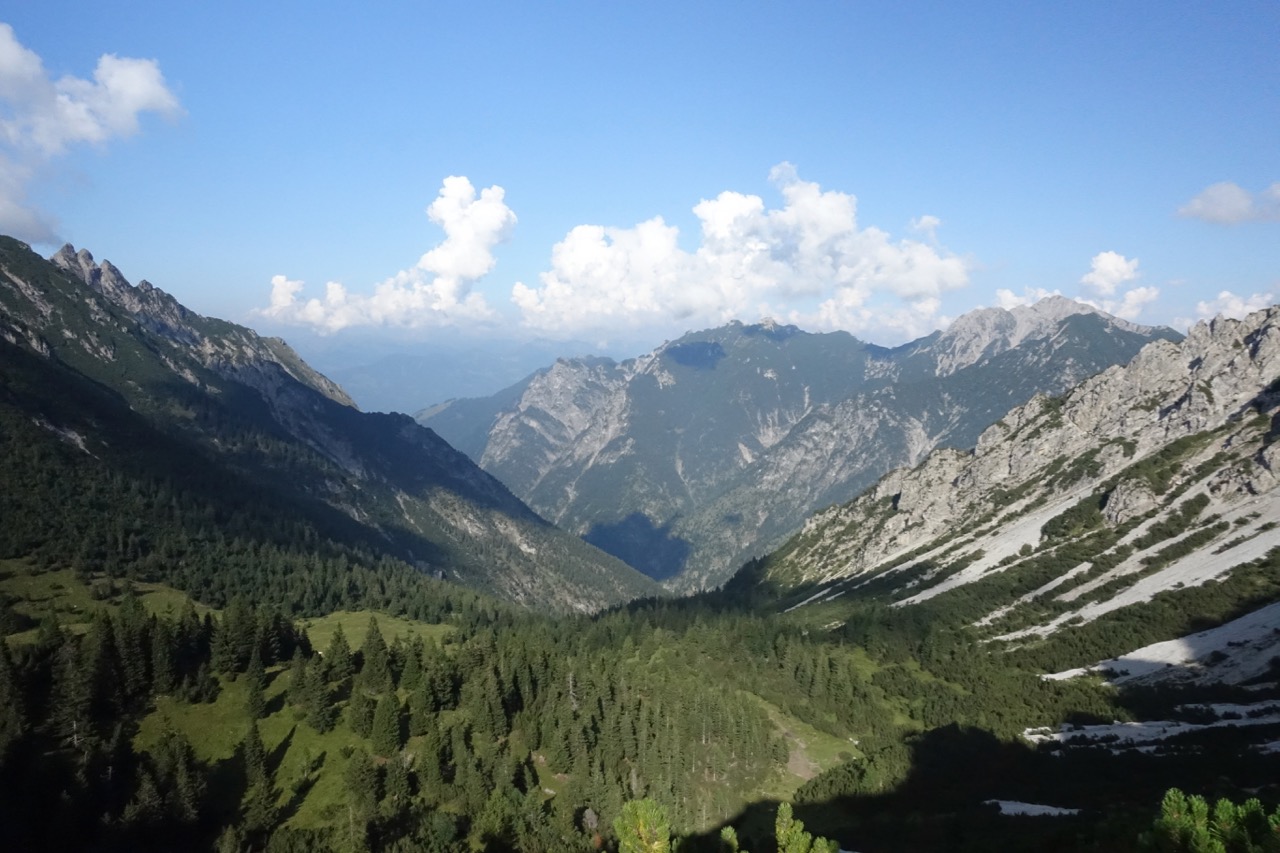
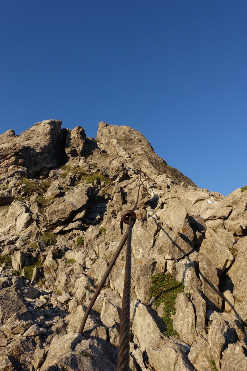
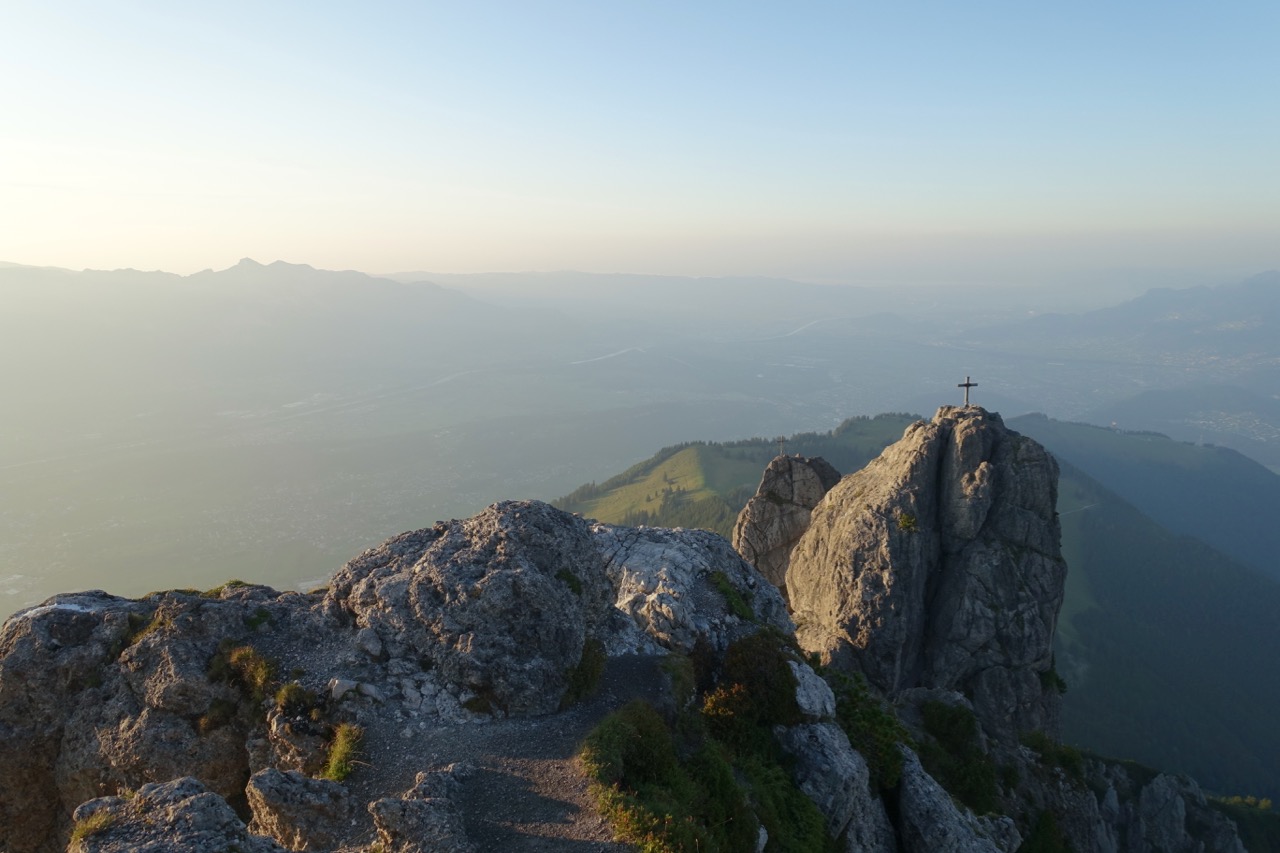
Stage 2 – Includes the highlight sections of the Panoramaweg – the cliff-hugging Fürstensteig and the spine-tracing Drei Schwestern (“Three Sisters”). Although by no means technical, care should be taken on these exposed stretches, which include metal cables and ladders. In between the Fürstensteig and the Three Sisters, the trail stays mostly on the eastern side of the ridge, affording gorgeous mountain views into Vorarlberg, Austria.
Stage 3 – The final stage begins with a steep drop through the forest to the villages of Planken and Nendeln. As mentioned above, I decided to end my hike at the latter, which is serviced by regular buses back to Vaduz.
Accommodation
- Accommodation: Multiple options along the route. These include Pfälzerhütte (6 km mark), Steg / Sücka (13 to 14 km mark), Gafadurahütte (25 km mark), Planken (29 km mark), and Nendeln (32 km mark).
- Is camping allowed?: Officially speaking, wild camping is illegal in Liechtenstein. Unofficially speaking, there are a handful of areas along the route where a Leave No Trace devotee could discreetly bivouac for the evening without causing too much fuss (i.e. set up at dark and leave at dawn the following morning).
Final Notes
Five Fun Facts about Liechtenstein
1. It’s the world’s leading producer of false teeth.
2. It has the second-highest per capita income in the world after Monaco.
3. With an area of 160 km² (61.78 mi²), it’s nearly seventeen times smaller than Rhode Island, America’s smallest state.
4. After San Marino, it’s the second-least-visited country in Europe.
5. Along with Uzbekistan, it’s one of only two double landlocked nations on earth (i.e. surrounded by countries that are also landlocked).
Why the Liechtenstein Panoramaweg?
I undertook my first hiking trip to the Alps in 1997. It was a 340 km (211 mi) east to west crossing of Switzerland on the Alpine Pass Route. The journey began in the village of Sargans, located on the border between Switzerland and Liechtenstein. Before commencing I distinctly recall gazing at the rugged peaks located northeast of the train station and thinking to myself, “Hmm, Liechtenstein. I bet there are some cool places to hike in those mountains.”
I never forgot that moment. And thanks to a personality which is in equal parts inquisitive, sentimental, and peculiarly adamant when it comes to fulfilling random train station musings, I decided to begin my most recent Alpine hiking journey at the very same place some 22 years later. It turned out my hunch was 100 percent correct; the mountains of Liechtenstein are indeed a wonderful place to experience on foot. And of the more than 120 trails that dot its bucolic Alpine landscape, it’s hard to imagine there are many (if any) to surpass the grandeur and beauty of the appropriately named Liechtenstein Panoramaweg.
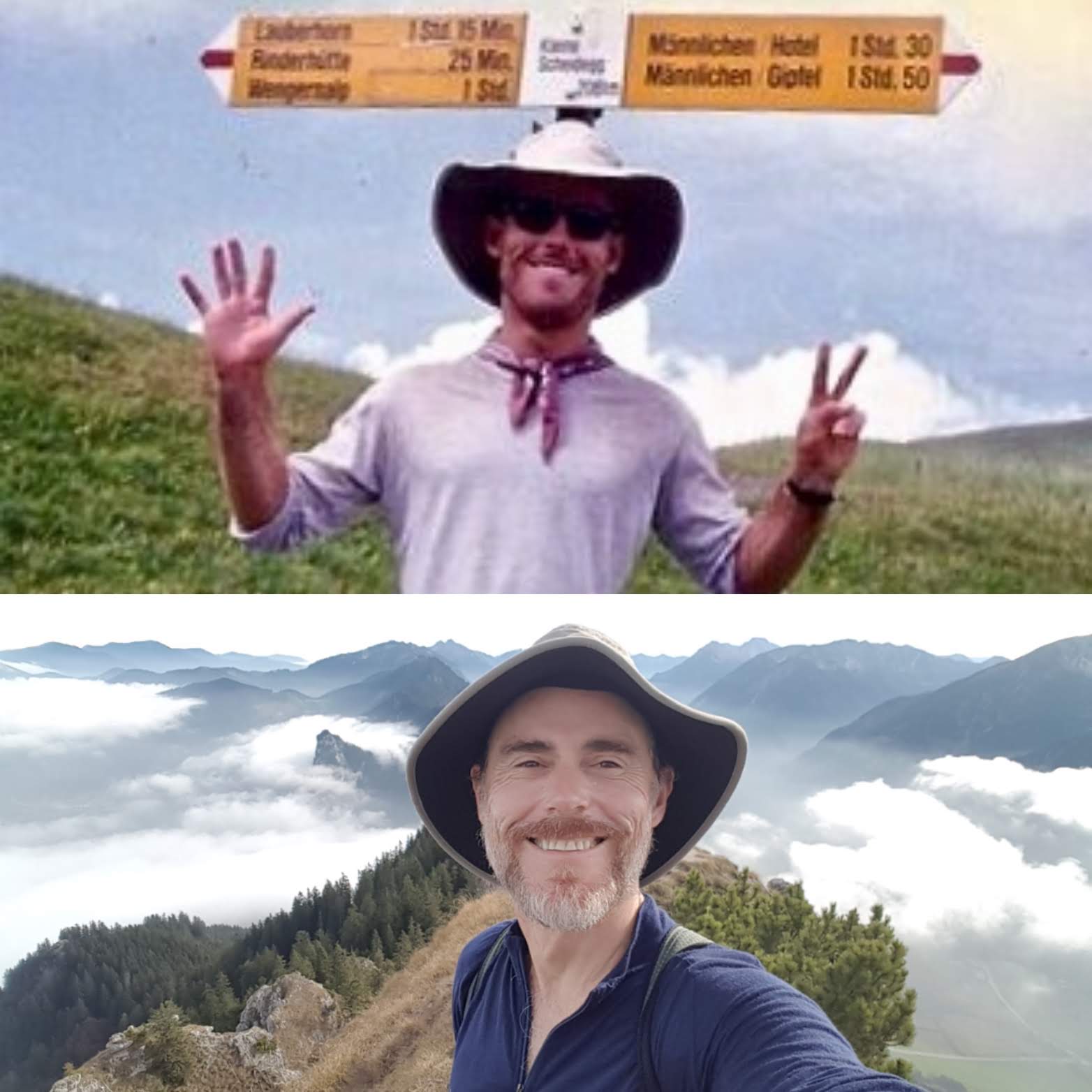
(Above) Yours truly on the Alpine Pass Route in 1997. (Below) Back in the same neighbourhood some 22 years later. Similar hats, similar smile, one or two more grey distinguished silver hairs in my beard.
Discover more from The Hiking Life
Subscribe to get the latest posts sent to your email.
Absolutely breathtaking! Definitely a hike for my “bucket list”! Thank you for sharing!
Cam, this looks a definite long weekend prospect from the UK. Thanks Peter
Hi Peter,
Absolutely. I suspect your best option might be a fight to Zurich, which is just over an hour by train to Sargans.
Cheers,
Cam
I stayed in Liechtenstein for 2 years in early 2000 which was 20 years ago for me. I worked for Hilti and stayed in an apt just below the Vaduz Schloss. I loved it. There were so many hiking trails around Liechtenstein and the Sargans Valley. I don’t know if you paid attention but at the top of the mountains especially near Sargans there are doors where back in the 40’s when Europe was defending Hitler, they were also worried about Russia invading so they built all these hidden doors up in the mountains in Sargans valley to store guns and stuff. They were ready to flood the Sargans Valley to drown the Russians. I have been meaning to go back an hike all the hidden hikes only the locals told me about… like the hike up to the hunting cabin where you can start it at Planken . I used to eat at the Sucka restaurant in Steg and in the winter you go up to the guest house, have fondue and schnapps and they they give you sleds to slide down the path to your car. It was awesome. Oh the memories.. I need to go back and like yourself hike my old haunts.
Hi Karen,
Thanks for sharing those great memories! Yes, I did know about Switzerland’s secret WW2 tunneled bunkers.
Cheers,
Cam
Thank you! We are always looking for new hikes while vanning around Europe and this one looks beautiful. We’re planning to do it later this year.
Sounds awesome. Will be doing my first trek in Europe this year on the high route, and hope to do more including this one in the future.
Regards
Hey, I went up there to the 3-sisters several times when I was young. I had the chance to grow up in Liechtenstein but left the paradise for sun and sea. Now I realize even more the beauty of this place.
Thanks for the heads-up.
Hi Cam!
Thanks to sharing this!
We are looking to do the trail the next June..could you please share the time needed to do each stages?
thanks!
Tommaso
Hi Tommaso,
Stage times can vary a lot from hiker to hiker. See the Liechtenstein Tourism website for general estimates, plus a lot of other useful information on the trail (https://tourismus.li/en/lie/tour/Liechtenstein%20Panoramaweg%2C%20stage%201/).
Cheers,
Cam
Thank you for an article. Look like an amazing trail. Can you please advice if this trail is manageable for children ( 10 and 14). They have walked up Snowdon in UK, but my biggest concern is Three Sisters.
Thank you in advance.
Thank you for the message. Regarding your question, the official Liechtenstein Tourism website suggests, “Secure children by a rope on the Fürstensteig track. Descend narrow passages on the trail carefully.” https://tourismus.li/en/lie/tour/F%C3%BCrstensteig-Drei%20Schwestern/).